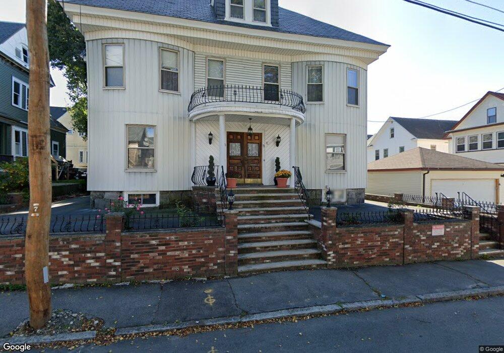
79 Sherman St Lowell, MA 01852
Belvidere NeighborhoodEstimated Value: $568,000 - $925,546
6
Beds
3
Baths
4,728
Sq Ft
$168/Sq Ft
Est. Value
About This Home
This home is located at 79 Sherman St, Lowell, MA 01852 and is currently estimated at $796,137, approximately $168 per square foot. 79 Sherman St is a home located in Middlesex County with nearby schools including Moody Elementary School, Abraham Lincoln Elementary School, and Greenhalge Elementary School.
Ownership History
Date
Name
Owned For
Owner Type
Purchase Details
Closed on
Jan 27, 2020
Sold by
Silva Eduarda B
Bought by
Eduarda B Silva 2020 Irt and Silva
Current Estimated Value
Purchase Details
Closed on
Jan 19, 2010
Sold by
Silva John M and Silva Joao M
Bought by
Silva Eduarda B
Create a Home Valuation Report for This Property
The Home Valuation Report is an in-depth analysis detailing your home's value as well as a comparison with similar homes in the area
Home Values in the Area
Average Home Value in this Area
Purchase History
| Date | Buyer | Sale Price | Title Company |
|---|---|---|---|
| Eduarda B Silva 2020 Irt | -- | None Available | |
| Eduarda B Silva 2020 Irt | -- | None Available | |
| Silva Eduarda B | -- | -- | |
| Silva Eduarda B | -- | -- |
Source: Public Records
Mortgage History
| Date | Status | Borrower | Loan Amount |
|---|---|---|---|
| Previous Owner | Silva Eduarda B | $97,000 |
Source: Public Records
Tax History Compared to Growth
Tax History
| Year | Tax Paid | Tax Assessment Tax Assessment Total Assessment is a certain percentage of the fair market value that is determined by local assessors to be the total taxable value of land and additions on the property. | Land | Improvement |
|---|---|---|---|---|
| 2025 | $10,913 | $950,600 | $144,700 | $805,900 |
| 2024 | $9,942 | $834,800 | $147,700 | $687,100 |
| 2023 | $9,462 | $761,800 | $123,600 | $638,200 |
| 2022 | $8,240 | $649,300 | $112,400 | $536,900 |
| 2021 | $7,884 | $585,700 | $97,800 | $487,900 |
| 2020 | $7,265 | $543,800 | $97,800 | $446,000 |
| 2019 | $6,307 | $449,200 | $85,300 | $363,900 |
| 2018 | $5,940 | $412,800 | $81,200 | $331,600 |
| 2017 | $5,964 | $399,700 | $77,700 | $322,000 |
| 2016 | $5,647 | $372,500 | $66,700 | $305,800 |
| 2015 | $5,268 | $340,300 | $66,700 | $273,600 |
| 2013 | $5,130 | $341,800 | $84,800 | $257,000 |
Source: Public Records
Map
Nearby Homes
- 44 Hanks St
- 220 Concord St
- 64 Hanks St
- 250 Nesmith St Unit 10
- 158 Concord St
- 53 Fairmount St
- 15 Alton St Unit 10
- 228 Lawrence St
- 540 Lawrence St
- 24 Richmond Ave
- 96 Park Ave W Unit A4
- 17 Wamesit St
- 39 Groves Ave
- 17 Cady St
- 9 Watson St
- 318 Andover St
- 12 Chase St
- 67 Wellington Ave
- 14 Watson St Unit 4
- 355 Andover St
- 85 Sherman St
- 85 Sherman St Unit 2
- 85 Sherman St Unit 1
- 153 Fort Hill Ave
- 416 High St
- 416 High St Unit 1
- 420 High St
- 426 High St
- 157 Fort Hill Ave
- 80 Sherman St
- 74 Sherman St
- 74 Sherman St Unit 74
- 86 Sherman St
- 86 Sherman St Unit 2
- 76 Sherman St
- 148 Fort Hill Ave
- 150 Fort Hill Ave Unit 2
- 148 Fort Hill Ave Unit 1
- 150 Fort Hill Ave Unit 1
- 430 High St