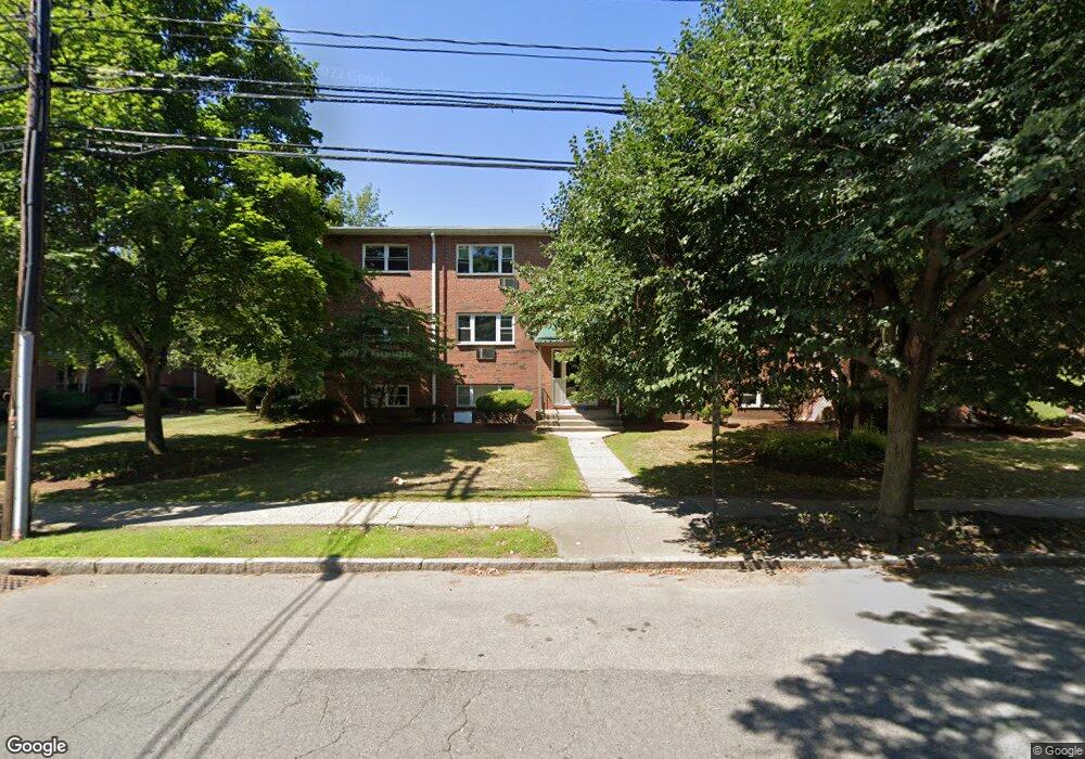
79 Walnut St Unit 6 Newtonville, MA 02460
Nonantum NeighborhoodEstimated Value: $394,000 - $494,000
2
Beds
1
Bath
734
Sq Ft
$608/Sq Ft
Est. Value
About This Home
This home is located at 79 Walnut St Unit 6, Newtonville, MA 02460 and is currently estimated at $446,274, approximately $608 per square foot. 79 Walnut St Unit 6 is a home located in Middlesex County with nearby schools including Horace Mann Elementary School, F.A. Day Middle School, and Newton North High School.
Ownership History
Date
Name
Owned For
Owner Type
Purchase Details
Closed on
Mar 22, 2023
Sold by
Fried Dorothy
Bought by
Rosenberg-Moyseev Ft
Current Estimated Value
Purchase Details
Closed on
Jul 1, 1982
Bought by
Fried Dorothy
Create a Home Valuation Report for This Property
The Home Valuation Report is an in-depth analysis detailing your home's value as well as a comparison with similar homes in the area
Home Values in the Area
Average Home Value in this Area
Purchase History
| Date | Buyer | Sale Price | Title Company |
|---|---|---|---|
| Rosenberg-Moyseev Ft | $420,000 | None Available | |
| Fried Dorothy | $59,000 | -- |
Source: Public Records
Mortgage History
| Date | Status | Borrower | Loan Amount |
|---|---|---|---|
| Previous Owner | Fried Dorothy | $25,000 |
Source: Public Records
Tax History Compared to Growth
Tax History
| Year | Tax Paid | Tax Assessment Tax Assessment Total Assessment is a certain percentage of the fair market value that is determined by local assessors to be the total taxable value of land and additions on the property. | Land | Improvement |
|---|---|---|---|---|
| 2025 | $3,483 | $355,400 | $0 | $355,400 |
| 2024 | $3,367 | $345,000 | $0 | $345,000 |
| 2023 | $3,290 | $323,200 | $0 | $323,200 |
| 2022 | $3,238 | $307,800 | $0 | $307,800 |
| 2021 | $3,125 | $290,400 | $0 | $290,400 |
| 2020 | $3,032 | $290,400 | $0 | $290,400 |
| 2019 | $2,946 | $281,900 | $0 | $281,900 |
| 2018 | $2,781 | $257,000 | $0 | $257,000 |
| 2017 | $2,858 | $257,000 | $0 | $257,000 |
| 2016 | $2,733 | $240,200 | $0 | $240,200 |
| 2015 | $2,656 | $228,800 | $0 | $228,800 |
Source: Public Records
Map
Nearby Homes
- 57 Walnut St
- 354 Linwood Ave Unit 1
- 611 Watertown St Unit 14
- 32-34 Rossmere St
- 321 Albemarle Rd
- 581 California St
- 299 Albemarle Rd
- 42-44 Judkins St
- 43 Walker St
- 286 Nevada St Unit 286
- 282 Nevada St Unit 282
- 177 Nevada St
- 911 Washington St
- 77 Court St Unit 205
- 935 Washington St (Rear Facing) Unit 11
- 935 Washington St Unit 8
- 40 Fairway Dr
- 3 Ashmont Ave
- 22-24 Emerald St
- 158 Adams St
- 79 Walnut St Unit 12
- 79 Walnut St Unit 11
- 79 Walnut St Unit 10
- 79 Walnut St Unit 9
- 79 Walnut St Unit 8
- 79 Walnut St Unit 7
- 79 Walnut St Unit 5
- 79 Walnut St Unit 4
- 79 Walnut St Unit 3
- 79 Walnut St Unit 2
- 79 Walnut St Unit 1
- 73 Walnut St Unit 12
- 73 Walnut St Unit 11
- 73 Walnut St Unit 10
- 73 Walnut St Unit 9
- 73 Walnut St Unit 8
- 73 Walnut St Unit 7
- 73 Walnut St Unit 6
- 73 Walnut St Unit 5
- 73 Walnut St Unit 4