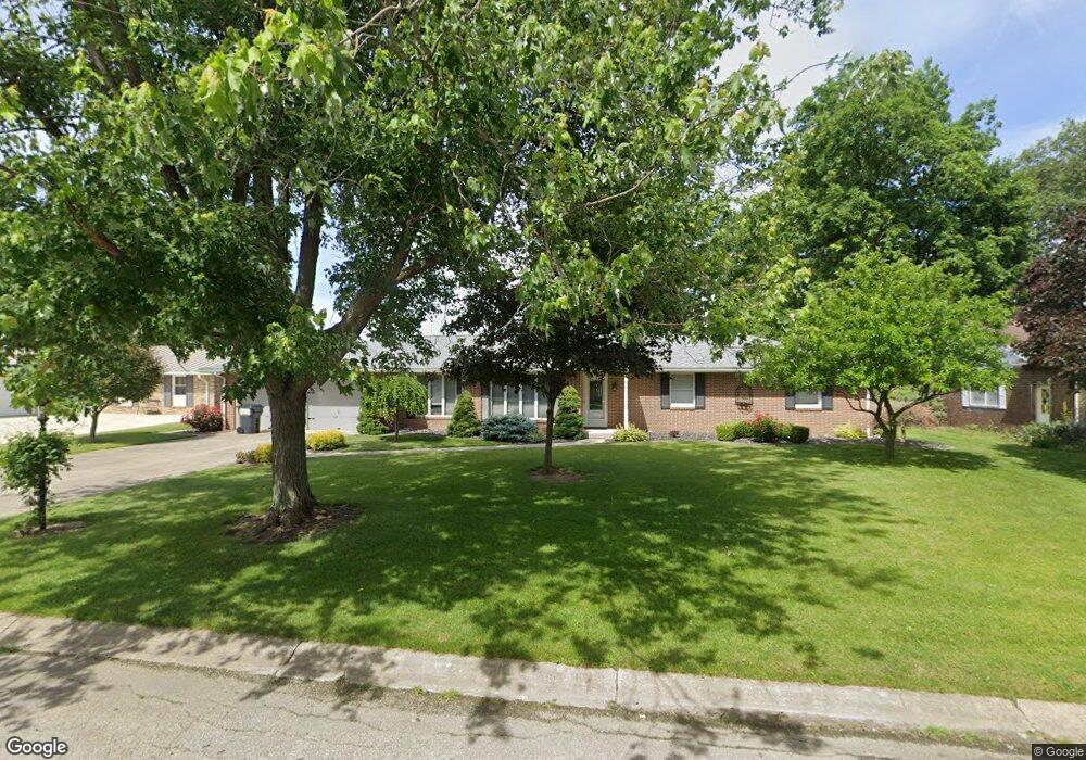
79 Westwood Dr Fremont, OH 43420
Estimated Value: $223,000 - $266,527
3
Beds
2
Baths
2,404
Sq Ft
$105/Sq Ft
Est. Value
About This Home
This home is located at 79 Westwood Dr, Fremont, OH 43420 and is currently estimated at $251,632, approximately $104 per square foot. 79 Westwood Dr is a home located in Sandusky County with nearby schools including Fremont Ross High School, Bishop Hoffman Catholic School - This is St Joe's School now, and St. Joseph School.
Ownership History
Date
Name
Owned For
Owner Type
Purchase Details
Closed on
Feb 17, 2006
Sold by
Prudential Relocation Inc
Bought by
Dove Deborah
Current Estimated Value
Purchase Details
Closed on
Nov 5, 2005
Sold by
Wells John A and Wells Virginia M
Bought by
Prudential Relocation Inc
Purchase Details
Closed on
May 30, 2001
Sold by
Miller Virginia M
Bought by
Wells John A and Wells Virginia M
Home Financials for this Owner
Home Financials are based on the most recent Mortgage that was taken out on this home.
Original Mortgage
$142,400
Interest Rate
7.23%
Mortgage Type
New Conventional
Purchase Details
Closed on
Oct 1, 1985
Sold by
Wells John A and Wells Virginia
Bought by
Dove Deborah
Purchase Details
Closed on
Jun 1, 1983
Bought by
Dove Deborah
Create a Home Valuation Report for This Property
The Home Valuation Report is an in-depth analysis detailing your home's value as well as a comparison with similar homes in the area
Home Values in the Area
Average Home Value in this Area
Purchase History
| Date | Buyer | Sale Price | Title Company |
|---|---|---|---|
| Dove Deborah | -- | Chicago Title | |
| Prudential Relocation Inc | -- | Chicago Title | |
| Wells John A | $149,900 | -- | |
| Dove Deborah | $85,000 | -- | |
| Dove Deborah | $78,000 | -- |
Source: Public Records
Mortgage History
| Date | Status | Borrower | Loan Amount |
|---|---|---|---|
| Previous Owner | Wells John A | $142,400 |
Source: Public Records
Tax History Compared to Growth
Tax History
| Year | Tax Paid | Tax Assessment Tax Assessment Total Assessment is a certain percentage of the fair market value that is determined by local assessors to be the total taxable value of land and additions on the property. | Land | Improvement |
|---|---|---|---|---|
| 2024 | $2,614 | $67,270 | $12,110 | $55,160 |
| 2023 | $2,614 | $54,680 | $9,840 | $44,840 |
| 2022 | $2,270 | $54,680 | $9,840 | $44,840 |
| 2021 | $2,338 | $54,680 | $9,840 | $44,840 |
| 2020 | $2,218 | $50,860 | $9,840 | $41,020 |
| 2019 | $2,216 | $50,860 | $9,840 | $41,020 |
| 2018 | $2,105 | $50,860 | $9,840 | $41,020 |
| 2017 | $2,053 | $48,170 | $9,840 | $38,330 |
| 2016 | $1,800 | $48,170 | $9,840 | $38,330 |
| 2015 | $1,771 | $48,170 | $9,840 | $38,330 |
| 2014 | $1,860 | $48,480 | $9,630 | $38,850 |
| 2013 | $1,821 | $48,480 | $9,630 | $38,850 |
Source: Public Records
Map
Nearby Homes
- 17 Adams Dr
- 2484 Buckland Ave
- 2020 Elm Dr
- 822 Upton Rd
- 1719 Buckland Ave
- 614 3rd Ave
- 2242 Napoleon Rd
- 855 Rambo Ln
- 520 Everett Rd
- 515 Everett Rd
- 880 Cleveland Ave
- 43 Sun Valley Dr Unit 43
- 1485 Autumn Woods Dr
- 115 N Taft Ave
- 2119 Lake St
- 1611 Mcpherson Blvd
- 10 Meadowbrook Dr
- 10 Meadowbrook Ln
- 816 Lime St
- 1342 Mcpherson Blvd