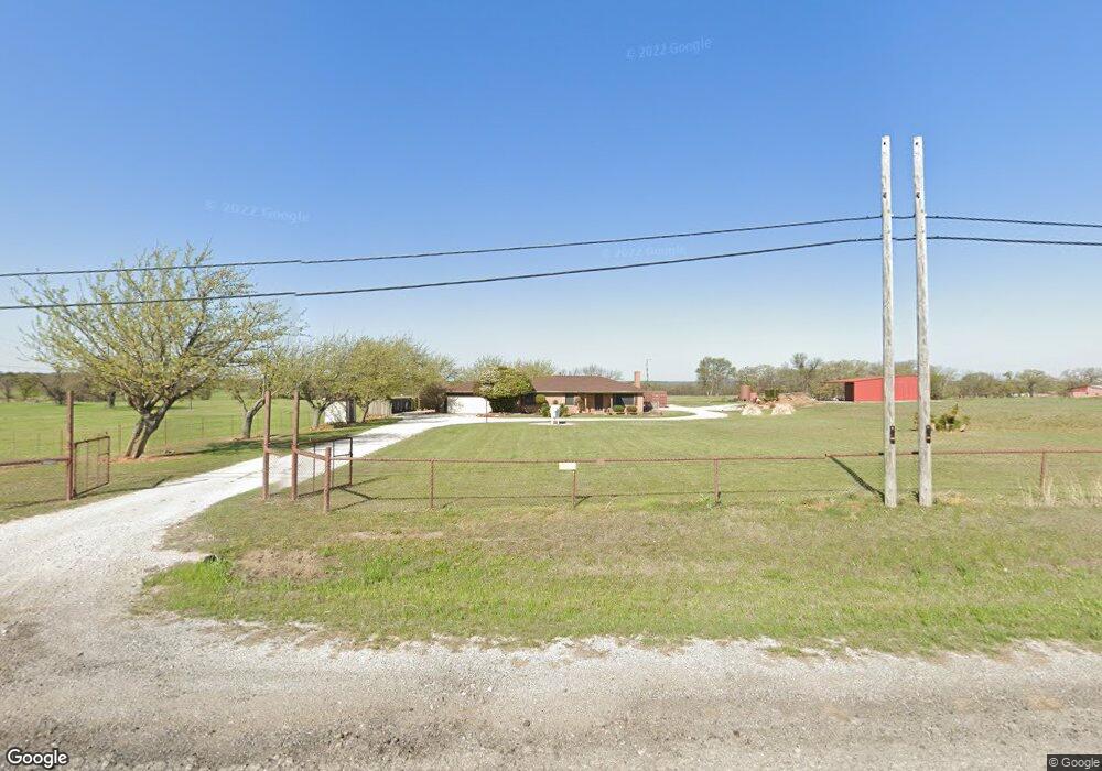
790 Fannin St Millsap, TX 76066
Estimated Value: $581,000
--
Bed
--
Bath
1,603
Sq Ft
$362/Sq Ft
Est. Value
About This Home
This home is located at 790 Fannin St, Millsap, TX 76066 and is currently estimated at $581,000, approximately $362 per square foot. 790 Fannin St is a home with nearby schools including Millsap Elementary School, Millsap Middle School, and Millsap High School.
Ownership History
Date
Name
Owned For
Owner Type
Purchase Details
Closed on
Feb 26, 2014
Sold by
Houston Barbara J
Bought by
Hill Leslie E Houston and Houston John A
Current Estimated Value
Purchase Details
Closed on
Nov 18, 2011
Sold by
Houston Barbara J and Houston Parks G
Bought by
Hill Leslie E Houston and Houston John A
Purchase Details
Closed on
Jan 8, 2002
Sold by
Parks Graydon B
Bought by
Hill Leslie E Houston and Houston John A
Create a Home Valuation Report for This Property
The Home Valuation Report is an in-depth analysis detailing your home's value as well as a comparison with similar homes in the area
Home Values in the Area
Average Home Value in this Area
Purchase History
| Date | Buyer | Sale Price | Title Company |
|---|---|---|---|
| Hill Leslie E Houston | -- | -- | |
| Hill Leslie E Houston | -- | -- | |
| Houston Barbara J | -- | None Available | |
| Hill Leslie E Houston | -- | -- |
Source: Public Records
Tax History Compared to Growth
Tax History
| Year | Tax Paid | Tax Assessment Tax Assessment Total Assessment is a certain percentage of the fair market value that is determined by local assessors to be the total taxable value of land and additions on the property. | Land | Improvement |
|---|---|---|---|---|
| 2025 | $4,518 | $223,280 | $19,560 | $203,720 |
| 2024 | $4,518 | $271,450 | $15,260 | $256,190 |
| 2023 | $4,518 | $271,450 | $15,260 | $256,190 |
| 2022 | $4,683 | $205,650 | $12,000 | $193,650 |
| 2021 | $5,060 | $205,650 | $12,000 | $193,650 |
| 2020 | $4,386 | $173,240 | $8,060 | $165,180 |
| 2019 | $4,655 | $173,240 | $8,060 | $165,180 |
| 2018 | $4,456 | $164,250 | $5,390 | $158,860 |
| 2017 | $4,592 | $164,250 | $5,390 | $158,860 |
| 2016 | $2,489 | $103,020 | $4,520 | $98,500 |
| 2015 | $2,458 | $103,020 | $4,520 | $98,500 |
| 2014 | $1,442 | $60,210 | $4,920 | $55,290 |
Source: Public Records
Map
Nearby Homes
- 3499 S Fm 113
- Farm To Market 113
- 106 S Houston St
- 207 NE Front St
- 211 N Cherry St
- 1950 Consolation Dr
- 811 NE Front St
- 9999 Trails End Cir
- 250 Young Rd
- 1923 Wilson Bend Rd
- 417 Wood River Rd
- 555 Sunset Trail
- 1350 Stephens Rd
- 4962 S Fm 113
- 2500 Cool Jct Unit Tract 2
- 000a Wilson Bend Rd
- 000b Wilson Bend Rd
- 320 Wilson Bend Rd
- 2710 Fairview Rd
- TBD Consolation
- 00 White Bull Ln
- 713 Fannin St
- 710 Fannin St
- 610 Fannin St
- 210 White Bull Ln
- 602 Fannin St
- 107 W Lee St
- 600 Fannin St
- 207 White Bull Ln
- 115 W Lee St
- 510 Palo Pinto St
- 111 W Davis Cir
- 508 Fannin St
- 508 Palo Pinto St
- 110 W Davis Cir
- 304 Strain Rd
- 504 Fannin St
- 505 Palo Pinto St
- 505 Palo Pinto St Unit B
- 505 Palo Pinto Parcel B St