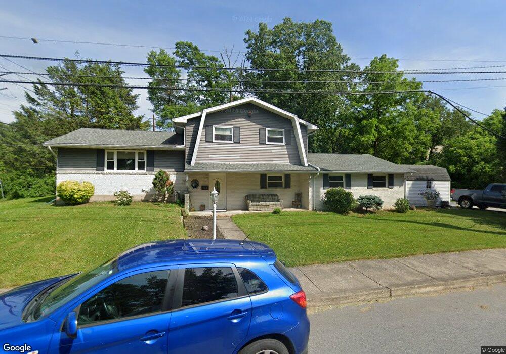
790 Furnace St Emmaus, PA 18049
Estimated Value: $364,000 - $454,000
3
Beds
2
Baths
1,986
Sq Ft
$205/Sq Ft
Est. Value
About This Home
This home is located at 790 Furnace St, Emmaus, PA 18049 and is currently estimated at $406,191, approximately $204 per square foot. 790 Furnace St is a home located in Lehigh County with nearby schools including Lincoln Elementary School, Lower Macungie Middle School, and Emmaus High School.
Ownership History
Date
Name
Owned For
Owner Type
Purchase Details
Closed on
Nov 25, 1992
Sold by
Kleckner Harry E and Kleckner Pearl
Bought by
Reynolds Michael A and Reynolds Robin
Current Estimated Value
Purchase Details
Closed on
May 14, 1975
Bought by
Kleckner Harry E and Kleckner Pearl
Create a Home Valuation Report for This Property
The Home Valuation Report is an in-depth analysis detailing your home's value as well as a comparison with similar homes in the area
Home Values in the Area
Average Home Value in this Area
Purchase History
| Date | Buyer | Sale Price | Title Company |
|---|---|---|---|
| Reynolds Michael A | $112,000 | -- | |
| Kleckner Harry E | -- | -- |
Source: Public Records
Tax History Compared to Growth
Tax History
| Year | Tax Paid | Tax Assessment Tax Assessment Total Assessment is a certain percentage of the fair market value that is determined by local assessors to be the total taxable value of land and additions on the property. | Land | Improvement |
|---|---|---|---|---|
| 2025 | $7,683 | $218,100 | $36,200 | $181,900 |
| 2024 | $7,037 | $218,100 | $36,200 | $181,900 |
| 2023 | $6,900 | $218,100 | $36,200 | $181,900 |
| 2022 | $6,673 | $218,100 | $181,900 | $36,200 |
| 2021 | $6,506 | $218,100 | $36,200 | $181,900 |
| 2020 | $6,450 | $218,100 | $36,200 | $181,900 |
| 2019 | $6,277 | $218,100 | $36,200 | $181,900 |
| 2018 | $6,041 | $218,100 | $36,200 | $181,900 |
| 2017 | $5,855 | $218,100 | $36,200 | $181,900 |
| 2016 | -- | $218,100 | $36,200 | $181,900 |
| 2015 | -- | $218,100 | $36,200 | $181,900 |
| 2014 | -- | $218,100 | $36,200 | $181,900 |
Source: Public Records
Map
Nearby Homes
- 339 Delong Ave Unit 343
- 659 Broad St
- 97 Chestnut Hill Rd
- 618 Broad St
- 521 Wood St
- 657 Walnut St
- 569 Chestnut St Unit 571
- 4109 Eveningstar Rd
- 3430 Gentlewind Way Unit IC 109
- 543 Long St
- 4088 Eveningstar Rd
- 120 N 2nd St
- 118 N 2nd St
- 4160 Newport Dr
- 3623 Daylily Dr
- 3810 Allen St
- 3989 Mink Rd
- 3703 Samantha Ln Unit Lot 70
- 3736 Samantha Ln Unit Lot 7
- 3748 Samantha Ln
- 505 S 10th St
- 507 S 10th St
- 515 S 10th St
- 517 S 10th St
- 525 S 10th St
- 1040 S 10th St
- 527 S 10th St
- 750 Furnace St
- 754 Furnace St
- 748 Furnace St
- 748 1/2 Furnace St
- 746 Furnace St
- 1018 S 10th St
- 734 Furnace St
- 728 Furnace St Unit 730
- 726 Furnace St
- 724 Furnace St
- 1034 S 10th St
- 1044 S 10th St
- 722 Furnace St