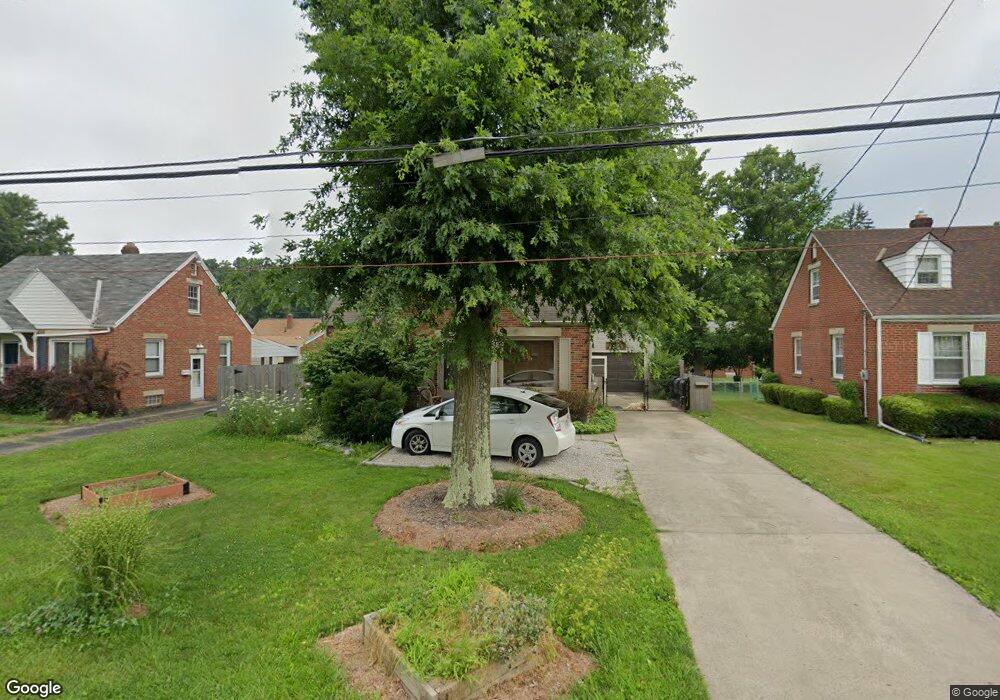
790 Maple St Mansfield, OH 44906
Estimated Value: $117,000 - $127,000
2
Beds
1
Bath
1,092
Sq Ft
$112/Sq Ft
Est. Value
About This Home
This home is located at 790 Maple St, Mansfield, OH 44906 and is currently estimated at $122,350, approximately $112 per square foot. 790 Maple St is a home located in Richland County with nearby schools including Goal Digital Academy, Mansfield Elective Academy, and Discovery School.
Ownership History
Date
Name
Owned For
Owner Type
Purchase Details
Closed on
Nov 6, 2015
Sold by
Stransky Matthew J
Bought by
Russell Sasrah P and Russell Stephen N
Current Estimated Value
Purchase Details
Closed on
Jun 23, 2015
Sold by
Estate Of Carol K Pierce
Bought by
Russell Sarah and Stransky Matthew J
Purchase Details
Closed on
Mar 15, 1993
Sold by
Snyder Rosamond B
Bought by
Pierce Carol K
Purchase Details
Closed on
Mar 1, 1987
Purchase Details
Closed on
Oct 1, 1985
Create a Home Valuation Report for This Property
The Home Valuation Report is an in-depth analysis detailing your home's value as well as a comparison with similar homes in the area
Home Values in the Area
Average Home Value in this Area
Purchase History
| Date | Buyer | Sale Price | Title Company |
|---|---|---|---|
| Russell Sasrah P | $31,700 | Attorney | |
| Russell Sarah | -- | Attorney | |
| Pierce Carol K | $52,000 | -- | |
| -- | $45,000 | -- | |
| -- | $44,200 | -- |
Source: Public Records
Tax History
| Year | Tax Paid | Tax Assessment Tax Assessment Total Assessment is a certain percentage of the fair market value that is determined by local assessors to be the total taxable value of land and additions on the property. | Land | Improvement |
|---|---|---|---|---|
| 2024 | $1,390 | $30,360 | $4,240 | $26,120 |
| 2023 | $1,422 | $30,360 | $4,240 | $26,120 |
| 2022 | $1,210 | $21,660 | $3,630 | $18,030 |
| 2021 | $1,219 | $21,660 | $3,630 | $18,030 |
| 2020 | $1,246 | $21,660 | $3,630 | $18,030 |
| 2019 | $1,381 | $21,660 | $3,630 | $18,030 |
| 2018 | $1,362 | $21,660 | $3,630 | $18,030 |
| 2017 | $1,325 | $21,660 | $3,630 | $18,030 |
| 2016 | $1,400 | $22,190 | $4,690 | $17,500 |
| 2015 | $1,400 | $22,190 | $4,690 | $17,500 |
| 2014 | $800 | $22,190 | $4,690 | $17,500 |
| 2012 | $1,216 | $22,200 | $4,940 | $17,260 |
Source: Public Records
Map
Nearby Homes
- 143 Fairlawn Ave
- 135 Fairlawn Ave
- 129 Fairlawn Ave
- 679 Coleman Rd
- 116 Stewart Ave S
- 108 Stewart Ave S
- 686 Barnard Ave
- 189 Westwood Ave
- 133 Stewart Ave S
- 988 Kentland Dr
- 126 Dawson Ave
- 24 Stewart Ave S
- 356 S Linden Rd
- 71 Dawson Ave
- 232 S Trimble Rd Unit 234
- 216 S Trimble Rd Unit 218
- 244 S Trimble Rd Unit 246
- 960 W Linden Cir
- 455 Marion Ave
- 616 Cline Ave
- 796 Maple St
- 784 Maple St
- 802 Maple St
- 791 Marlow Place
- 778 Maple St Unit 780
- 785 Marlow Place
- 795 Marlow Place
- 803 Marlow Place
- 808 Maple St
- 791 Maple St
- 142 Fairlawn Ave
- 809 Marlow Place
- 772 Fairlawn Ave
- 793 Maple St
- 779 Maple St
- 790 Marlow Place
- 799 Maple St
- 809 Maple St
- 176 Fairlawn Ave
- 771 Maple St Unit 773
Your Personal Tour Guide
Ask me questions while you tour the home.