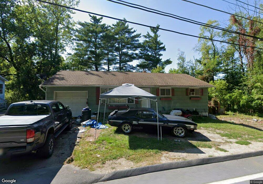
790 Mohawk Trail North Adams, MA 01247
Estimated Value: $218,598 - $253,000
3
Beds
1
Bath
1,210
Sq Ft
$190/Sq Ft
Est. Value
About This Home
This home is located at 790 Mohawk Trail, North Adams, MA 01247 and is currently estimated at $229,650, approximately $189 per square foot. 790 Mohawk Trail is a home located in Berkshire County with nearby schools including Colegrove Park Elementary School and Drury High School.
Ownership History
Date
Name
Owned For
Owner Type
Purchase Details
Closed on
Aug 23, 2011
Sold by
Hernandez Maria J
Bought by
Hamelin Scott F
Current Estimated Value
Home Financials for this Owner
Home Financials are based on the most recent Mortgage that was taken out on this home.
Original Mortgage
$86,500
Outstanding Balance
$60,031
Interest Rate
4.62%
Mortgage Type
Purchase Money Mortgage
Estimated Equity
$169,619
Purchase Details
Closed on
Aug 16, 2001
Sold by
Mundy Laurie F and Mundy M
Bought by
Hernandez Maria J
Home Financials for this Owner
Home Financials are based on the most recent Mortgage that was taken out on this home.
Original Mortgage
$64,000
Interest Rate
7.16%
Mortgage Type
Purchase Money Mortgage
Create a Home Valuation Report for This Property
The Home Valuation Report is an in-depth analysis detailing your home's value as well as a comparison with similar homes in the area
Home Values in the Area
Average Home Value in this Area
Purchase History
| Date | Buyer | Sale Price | Title Company |
|---|---|---|---|
| Hamelin Scott F | $83,500 | -- | |
| Hernandez Maria J | $80,000 | -- | |
| Hamelin Scott F | $83,500 | -- | |
| Hernandez Maria J | $80,000 | -- |
Source: Public Records
Mortgage History
| Date | Status | Borrower | Loan Amount |
|---|---|---|---|
| Open | Hernandez Maria J | $86,500 | |
| Closed | Hernandez Maria J | $86,500 | |
| Previous Owner | Hernandez Maria J | $64,000 |
Source: Public Records
Tax History
| Year | Tax Paid | Tax Assessment Tax Assessment Total Assessment is a certain percentage of the fair market value that is determined by local assessors to be the total taxable value of land and additions on the property. | Land | Improvement |
|---|---|---|---|---|
| 2025 | $2,834 | $169,600 | $33,700 | $135,900 |
| 2024 | $2,660 | $155,200 | $30,800 | $124,400 |
| 2023 | $2,566 | $145,200 | $30,800 | $114,400 |
| 2022 | $2,338 | $126,200 | $30,800 | $95,400 |
| 2021 | $2,174 | $116,800 | $28,500 | $88,300 |
| 2020 | $2,067 | $111,000 | $28,400 | $82,600 |
| 2019 | $1,984 | $103,800 | $28,400 | $75,400 |
| 2018 | $1,910 | $103,900 | $29,900 | $74,000 |
| 2017 | $1,818 | $102,900 | $29,600 | $73,300 |
| 2016 | $1,758 | $101,100 | $29,600 | $71,500 |
| 2015 | $1,704 | $102,100 | $30,600 | $71,500 |
Source: Public Records
Map
Nearby Homes
- 100 Autumn Dr
- 0 Oak Hill Unit 237953
- 350 Mohawk Trail
- 0 Mohawk Trail
- 516-518 Union St
- 376 Union St
- 0 Beaver St
- 6 Overlook Terrace
- 30 Dover St
- 306 Union St
- 67-69 E Quincy St
- 77 Front St
- 11-15 Perry St
- 74 Washington Ave
- 138 Church St
- 24 Spring St
- 32-38 Spring St
- 188 E Main St
- 41 Prospect St
- 35 Jackson St
- 798 Mohawk Trail
- 36 Autumn Dr
- 801 Mohawk Trail
- 812 Mohawk Trail
- 56 Autumn Dr
- 43 Autumn Dr
- 480 Mohawk Trail
- 394 Mohawk Trail
- 819 Mohawk Trail
- 53 Autumn Dr
- 80 Autumn Dr
- 7 Birchwood Terrace
- 88 Autumn Dr
- 19 Birchwood Terrace
- 4 Birchwood Terrace
- 991 W Shaft Rd
- 16 Birchwood Terrace
- 27 Birchwood Terrace
- 9 Pine Hill Terrace
- 9 Pinehill Terrace
Your Personal Tour Guide
Ask me questions while you tour the home.