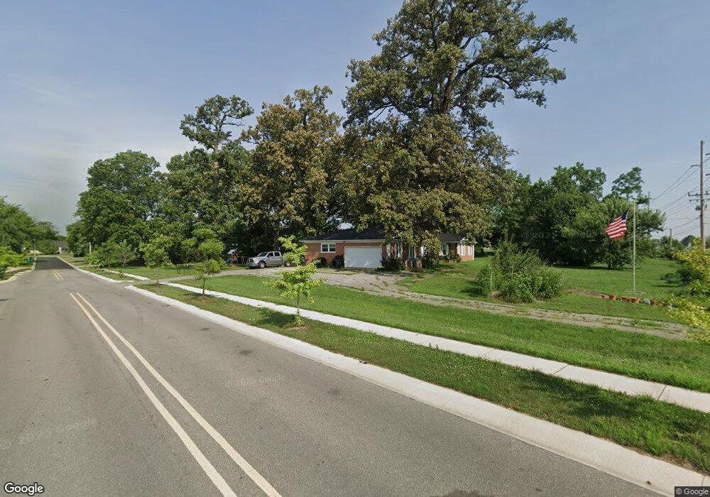
790 Us 31 S Franklin, IN 46131
Estimated Value: $323,000 - $360,592
4
Beds
3
Baths
2,292
Sq Ft
$148/Sq Ft
Est. Value
About This Home
This home is located at 790 Us 31 S, Franklin, IN 46131 and is currently estimated at $339,148, approximately $147 per square foot. 790 Us 31 S is a home located in Johnson County with nearby schools including Creekside Elementary School, Franklin Community Middle School, and Custer Baker Intermediate School.
Ownership History
Date
Name
Owned For
Owner Type
Purchase Details
Closed on
Feb 13, 2025
Sold by
Stall Justin Ross
Bought by
Stall Justin Ross and Stall Jessica Ann
Current Estimated Value
Purchase Details
Closed on
Mar 25, 2024
Sold by
Stall Justin
Bought by
State Of Indiana
Purchase Details
Closed on
May 31, 2017
Sold by
Hudson Gary S
Bought by
Stall Justin
Home Financials for this Owner
Home Financials are based on the most recent Mortgage that was taken out on this home.
Original Mortgage
$202,185
Interest Rate
5.25%
Mortgage Type
FHA
Purchase Details
Closed on
Jun 30, 2006
Sold by
Hudson Gary S
Bought by
Hudson Gary S
Create a Home Valuation Report for This Property
The Home Valuation Report is an in-depth analysis detailing your home's value as well as a comparison with similar homes in the area
Home Values in the Area
Average Home Value in this Area
Purchase History
| Date | Buyer | Sale Price | Title Company |
|---|---|---|---|
| Stall Justin Ross | -- | None Listed On Document | |
| State Of Indiana | $30,400 | None Listed On Document | |
| Stall Justin | -- | None Available | |
| Hudson Gary S | -- | None Available |
Source: Public Records
Mortgage History
| Date | Status | Borrower | Loan Amount |
|---|---|---|---|
| Previous Owner | Stall Justin | $202,185 |
Source: Public Records
Tax History Compared to Growth
Tax History
| Year | Tax Paid | Tax Assessment Tax Assessment Total Assessment is a certain percentage of the fair market value that is determined by local assessors to be the total taxable value of land and additions on the property. | Land | Improvement |
|---|---|---|---|---|
| 2025 | $2,690 | $372,000 | $44,200 | $327,800 |
| 2024 | $2,690 | $295,200 | $45,000 | $250,200 |
| 2023 | $2,769 | $286,400 | $45,000 | $241,400 |
| 2022 | $2,899 | $276,400 | $35,000 | $241,400 |
| 2021 | $2,385 | $226,300 | $35,000 | $191,300 |
| 2020 | $2,069 | $199,200 | $32,000 | $167,200 |
| 2019 | $1,858 | $181,100 | $30,000 | $151,100 |
| 2018 | $1,865 | $183,000 | $30,000 | $153,000 |
| 2017 | $1,793 | $175,300 | $30,000 | $145,300 |
| 2016 | $3,344 | $174,900 | $30,000 | $144,900 |
| 2014 | $3,083 | $158,000 | $30,000 | $128,000 |
| 2013 | $3,083 | $153,600 | $30,000 | $123,600 |
Source: Public Records
Map
Nearby Homes
- 0 Us 31 Unit MBR22038423
- 1410 Michigan Rd
- 3643 Hanford Rd
- Broadmoor Plan at Kingsbridge - SM Venture
- 3701 Jason Ave
- Alan Plan at Kingsbridge - SM Venture
- Paddington Plan at Kingsbridge - 3-Car Venture
- 3743 Jason Ave
- Kingston Plan at Kingsbridge - Venture
- 3673 Jason Ave
- 3771 Jason Ave
- Aspen Plan at Kingsbridge - SM Venture
- 3690 Jason Ave
- 3723 Hanford Rd
- Hampshire Plan at Kingsbridge - Venture
- Jasper Plan at Kingsbridge - 3-Car Venture
- Alan Plan at Kingsbridge - Venture
- Wentworth Plan at Kingsbridge - 3-Car Venture
- 3667 Hanford Rd
- Ironwood Plan at Kingsbridge - SM Venture
- 2630 S U S 31
- 2264 S U S 31
- 2138 S U S 31
- 3468 S U S 31
- 2540 S U S 31
- 2550 S U S 31
- 3716 S U S 31
- 2654 S U S 31
- 2600 S U S 31
- 2622 S U S 31
- 2246 S U S 31
- 2248 S U S 31
- 2250 S U S 31
- 2252 S U S 31
- 3480 S U S 31
- 1414 Nicole Dr
- 0 Us 31 Unit 21447130
- 0 Us 31 Unit Lot 2 MBR21744474
- 0 Us 31 Unit MBR2048065
- 0 Us 31 Unit MBR2107018