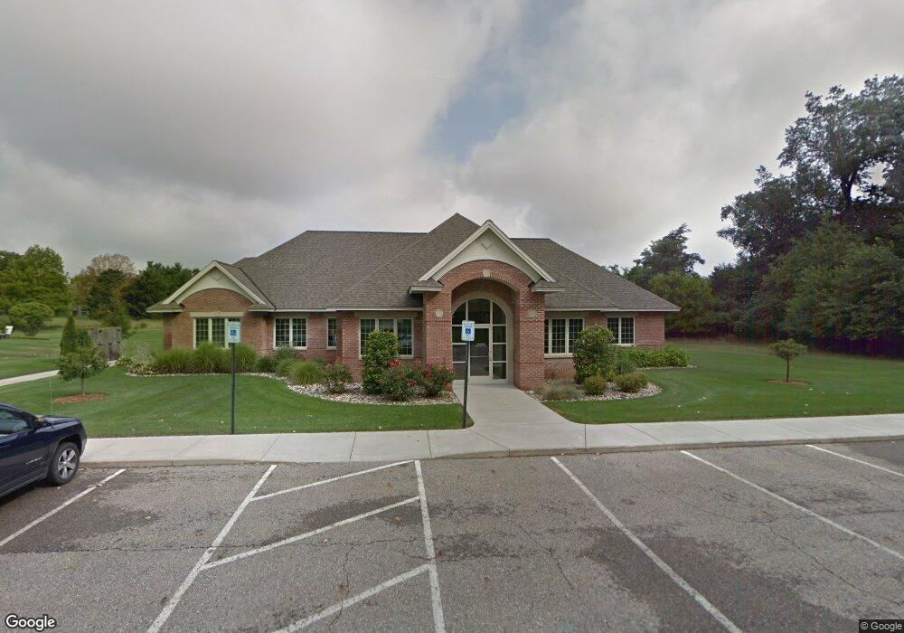
7900 Kirkland Ct Unit 1 Portage, MI 49024
--
Bed
--
Bath
3,609
Sq Ft
1.22
Acres
About This Home
This home is located at 7900 Kirkland Ct Unit 1, Portage, MI 49024. 7900 Kirkland Ct Unit 1 is a home located in Kalamazoo County with nearby schools including Moorsbridge Elementary School, Portage West Middle School, and Portage Central High School.
Ownership History
Date
Name
Owned For
Owner Type
Purchase Details
Closed on
Jun 22, 2012
Sold by
Alkhamis Financial Group Inc
Bought by
Alkhamis Llc
Home Financials for this Owner
Home Financials are based on the most recent Mortgage that was taken out on this home.
Original Mortgage
$420,000
Outstanding Balance
$291,075
Interest Rate
3.83%
Mortgage Type
Construction
Purchase Details
Closed on
Jun 30, 2008
Sold by
Hyland Holdings Llc
Bought by
Alkhamis Financial Group Inc
Home Financials for this Owner
Home Financials are based on the most recent Mortgage that was taken out on this home.
Original Mortgage
$150,880
Interest Rate
5.96%
Mortgage Type
Commercial
Create a Home Valuation Report for This Property
The Home Valuation Report is an in-depth analysis detailing your home's value as well as a comparison with similar homes in the area
Home Values in the Area
Average Home Value in this Area
Purchase History
| Date | Buyer | Sale Price | Title Company |
|---|---|---|---|
| Alkhamis Llc | -- | Devon Title | |
| Alkhamis Financial Group Inc | $188,600 | Michigan Bankers |
Source: Public Records
Mortgage History
| Date | Status | Borrower | Loan Amount |
|---|---|---|---|
| Open | Alkhamis Llc | $420,000 | |
| Previous Owner | Alkhamis Financial Group Inc | $150,880 |
Source: Public Records
Tax History Compared to Growth
Tax History
| Year | Tax Paid | Tax Assessment Tax Assessment Total Assessment is a certain percentage of the fair market value that is determined by local assessors to be the total taxable value of land and additions on the property. | Land | Improvement |
|---|---|---|---|---|
| 2025 | $15,588 | $449,600 | $0 | $0 |
| 2024 | $14,247 | $465,300 | $0 | $0 |
| 2023 | $13,577 | $399,800 | $0 | $0 |
| 2022 | $14,136 | $323,400 | $0 | $0 |
| 2021 | $13,668 | $393,200 | $0 | $0 |
| 2020 | $13,401 | $380,200 | $0 | $0 |
| 2019 | $865 | $326,300 | $0 | $0 |
| 2018 | $0 | $289,300 | $0 | $0 |
| 2017 | $0 | $258,800 | $0 | $0 |
| 2016 | -- | $229,500 | $0 | $0 |
| 2015 | -- | $198,300 | $0 | $0 |
| 2014 | -- | $197,200 | $0 | $0 |
Source: Public Records
Map
Nearby Homes
- 2076 Lion Gate Dr
- 1902 W Centre Ave
- 2600 W Centre Ave Unit +/- 1 Acre
- 2351 W Centre Ave
- 7639 Dunross Dr
- 7464 Saint George Cir
- 7922 Kilmory Cir
- 7481 Turnberry Ct
- 7784 Primrose Ln
- 8030 Wimbledon Dr Unit 35
- 7961 Kilmory Cir
- 7337 Starbrook St
- 1318 Ashton Woods Ct
- 7160 Crown Pointe Cir
- 7403 Rockford St
- 1531 Redstock Ave
- 1828 Woodland Dr
- 8660 Oakland Hills Cir Unit 13
- 3653 Tartan Cir
- 8603 Oakland Dr
- 7900 Kirkland Ct Unit B
- 7900 Kirkland Ct Unit A
- 7900 Kirkland Ct Unit 2
- 7900 Kirkland Ct Unit AB
- 2472 Deep Forest Ct
- 7878 Chippewa St
- 2446 Deep Forest Ct
- 7862 Chippewa St
- 2492 Deep Forest Ct
- 2416 Deep Forest Ct
- 7848 Chippewa St
- 2060 Lion Gate Dr
- 2088 Lion Gate Dr
- 2090 Black Bear Dr
- 7832 Chippewa St
- 2471 Deep Forest Ct
- 2699 Glenalmond Dr
- 7869 Chippewa St
- 2415 Deep Forest Ct
- 2687 Glenalmond Dr