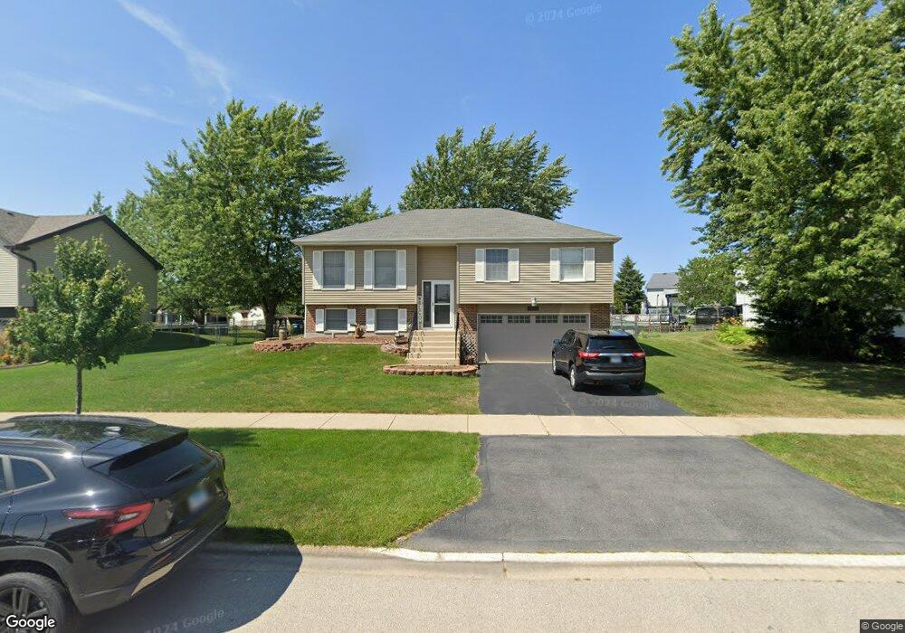
7900 W Carrie Ct Frankfort, IL 60423
Frankfort Square NeighborhoodEstimated Value: $314,000 - $368,000
3
Beds
2
Baths
1,140
Sq Ft
$296/Sq Ft
Est. Value
About This Home
This home is located at 7900 W Carrie Ct, Frankfort, IL 60423 and is currently estimated at $337,946, approximately $296 per square foot. 7900 W Carrie Ct is a home located in Will County with nearby schools including Frankfort Square Elementary School, Summit Hill Junior High School, and Lincoln-Way East High School.
Ownership History
Date
Name
Owned For
Owner Type
Purchase Details
Closed on
Jul 2, 2003
Sold by
Ewell Lia S and Ewell Timothy A
Bought by
Ewell Timothy A and Ewell Lia S
Current Estimated Value
Home Financials for this Owner
Home Financials are based on the most recent Mortgage that was taken out on this home.
Original Mortgage
$160,000
Outstanding Balance
$68,536
Interest Rate
5.36%
Mortgage Type
Purchase Money Mortgage
Estimated Equity
$269,410
Purchase Details
Closed on
Apr 29, 2002
Sold by
Bulow John N and Bulow Teri R
Bought by
Willett Lia S and Ewell Timothy A
Home Financials for this Owner
Home Financials are based on the most recent Mortgage that was taken out on this home.
Original Mortgage
$160,000
Interest Rate
7.24%
Create a Home Valuation Report for This Property
The Home Valuation Report is an in-depth analysis detailing your home's value as well as a comparison with similar homes in the area
Home Values in the Area
Average Home Value in this Area
Purchase History
| Date | Buyer | Sale Price | Title Company |
|---|---|---|---|
| Ewell Timothy A | -- | First American Title | |
| Willett Lia S | $180,000 | Ticor Title |
Source: Public Records
Mortgage History
| Date | Status | Borrower | Loan Amount |
|---|---|---|---|
| Open | Ewell Timothy A | $160,000 | |
| Closed | Willett Lia S | $160,000 |
Source: Public Records
Tax History Compared to Growth
Tax History
| Year | Tax Paid | Tax Assessment Tax Assessment Total Assessment is a certain percentage of the fair market value that is determined by local assessors to be the total taxable value of land and additions on the property. | Land | Improvement |
|---|---|---|---|---|
| 2024 | $6,521 | $85,316 | $18,216 | $67,100 |
| 2023 | $6,521 | $76,196 | $16,269 | $59,927 |
| 2022 | $5,789 | $69,401 | $14,818 | $54,583 |
| 2021 | $5,413 | $64,928 | $13,863 | $51,065 |
| 2020 | $5,324 | $63,098 | $13,472 | $49,626 |
| 2019 | $5,140 | $61,409 | $13,111 | $48,298 |
| 2018 | $4,946 | $59,643 | $12,734 | $46,909 |
| 2017 | $4,836 | $58,251 | $12,437 | $45,814 |
| 2016 | $4,679 | $56,254 | $12,011 | $44,243 |
| 2015 | $4,501 | $54,273 | $11,588 | $42,685 |
| 2014 | $4,501 | $53,895 | $11,507 | $42,388 |
| 2013 | $4,501 | $54,594 | $11,656 | $42,938 |
Source: Public Records
Map
Nearby Homes
- 8025 Stonegate Dr
- 20027 S Jessica Ln
- 8131 W Evergreen Dr
- 7959 Brookside Glen Dr Unit VI
- 7800 W Kingston Dr
- 7758 W Kingston Dr
- 8124 Glenbrook Place Unit 1
- 7905 Richardson Ln
- 20137 S Hampton Ct Unit A
- 20130 S Frankfort Square Rd
- 19708 S Skye Dr
- 7752 W Almond Ct Unit 135
- 7928 Trinity Cir Unit 2SW
- 7928 Trinity Cir Unit 3NW
- 20158 S Rosewood Dr
- 20206 S Frankfort Square Rd Unit A
- 8026 Bradley Dr
- 8500 Brookside Glen Dr
- 7407 Ridgefield Ln
- 20301 S Pine Hill Rd Unit 1D
- 7908 W Carrie Ct
- 7860 W Carrie Ct
- 7909 W Frankfort Square Rd
- 7861 W Frankfort Square Rd
- 7920 W Carrie Ct
- 7901 W Carrie Ct Unit 1
- 7917 W Frankfort Square Rd
- 7863 W Carrie Ct Unit 1
- 7930 W Carrie Ct
- 7905 W Carrie Ct Unit 1
- 7859 W Carrie Ct
- 7909 W Carrie Ct
- 7936 W Carrie Ct
- 7851 W Frankfort Square Rd
- 7913 W Carrie Ct
- 7851 W Carrie Ct
- 7940 W Carrie Ct
- 7917 W Carrie Ct
- 7860 W Frankfort Square Rd
- 7855 W Carrie Ct