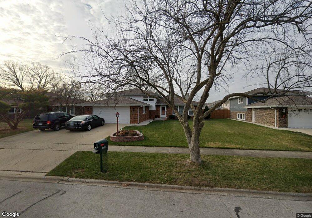
7900 W Tiffany Ct Palos Hills, IL 60465
Estimated Value: $289,000 - $315,000
2
Beds
2
Baths
1,814
Sq Ft
$166/Sq Ft
Est. Value
About This Home
This home is located at 7900 W Tiffany Ct, Palos Hills, IL 60465 and is currently estimated at $300,680, approximately $165 per square foot. 7900 W Tiffany Ct is a home located in Cook County with nearby schools including Sorrick Elementary School, Oak Ridge Elementary School, and H H Conrady Jr High School.
Ownership History
Date
Name
Owned For
Owner Type
Purchase Details
Closed on
Oct 30, 2006
Sold by
Buczek Helen
Bought by
Thoele Ruth A and The Ruth A Thoele Trust
Current Estimated Value
Home Financials for this Owner
Home Financials are based on the most recent Mortgage that was taken out on this home.
Original Mortgage
$212,000
Outstanding Balance
$122,125
Interest Rate
5.75%
Mortgage Type
Unknown
Estimated Equity
$178,555
Purchase Details
Closed on
Oct 7, 1996
Sold by
Buczek Helen
Bought by
Buczek Helen and Helen Buczek Trust
Create a Home Valuation Report for This Property
The Home Valuation Report is an in-depth analysis detailing your home's value as well as a comparison with similar homes in the area
Home Values in the Area
Average Home Value in this Area
Purchase History
| Date | Buyer | Sale Price | Title Company |
|---|---|---|---|
| Thoele Ruth A | $265,000 | Ticor Title | |
| Buczek Helen | -- | -- |
Source: Public Records
Mortgage History
| Date | Status | Borrower | Loan Amount |
|---|---|---|---|
| Open | Thoele Ruth A | $212,000 |
Source: Public Records
Tax History Compared to Growth
Tax History
| Year | Tax Paid | Tax Assessment Tax Assessment Total Assessment is a certain percentage of the fair market value that is determined by local assessors to be the total taxable value of land and additions on the property. | Land | Improvement |
|---|---|---|---|---|
| 2024 | $4,921 | $23,000 | $1,156 | $21,844 |
| 2023 | $4,447 | $23,000 | $1,156 | $21,844 |
| 2022 | $4,447 | $18,343 | $1,007 | $17,336 |
| 2021 | $4,366 | $18,343 | $1,007 | $17,336 |
| 2020 | $4,417 | $18,343 | $1,007 | $17,336 |
| 2019 | $5,418 | $21,889 | $932 | $20,957 |
| 2018 | $7,264 | $21,889 | $932 | $20,957 |
| 2017 | $1,570 | $21,889 | $932 | $20,957 |
| 2016 | $5,573 | $20,412 | $820 | $19,592 |
| 2015 | $6,952 | $20,412 | $820 | $19,592 |
| 2014 | $6,828 | $20,412 | $820 | $19,592 |
| 2013 | $2,417 | $20,758 | $820 | $19,938 |
Source: Public Records
Map
Nearby Homes
- 10531 S Roberts Rd Unit 2D
- 10820 Kathleen Ct Unit D
- 10926 Circle Ct
- 10927 Circle Dr
- 10324 S 81st Ave
- 8057 Valley Dr
- 10440 S 75th Ct
- 10300 S Kathy Ct
- 11050 S Roberts Rd
- 10441 S 83rd Ave
- 11001 Stony Creek Dr Unit 2C
- 7810 W 102nd St
- 10226 S 81st Ave
- 7801 W 111th St
- 3 Stony Creek Dr Unit A
- 10845 S 84th Ave Unit 2A
- 10845 S 84th Ave Unit 2B
- 10562 S 84th Ave
- 6 W Pebble Ct Unit A
- 8202 Gruener Ct
- 7901 W Tiffany Ct
- 7908 W Tiffany Ct
- 7909 W Tiffany Ct
- 7900 W Tameling Ct
- 7900 W Tameling Ct Unit 7900
- 7901 W Tameling Ct
- 10600 S Tod Dr
- 7917 W Tiffany Ct
- 7909 W Tameling Ct
- 7916 W Tiffany Ct Unit 7916
- 10548 S Tod Dr
- 7916 W Tameling Ct
- 10612 S Tod Dr
- 7917 W Tameling Ct
- 7924 W Tiffany Ct
- 7925 W Tiffany Ct
- 10542 S Tod Dr
- 10600 S Brooklodge Ln Unit 2C
- 10600 S Brooklodge Ln Unit 3