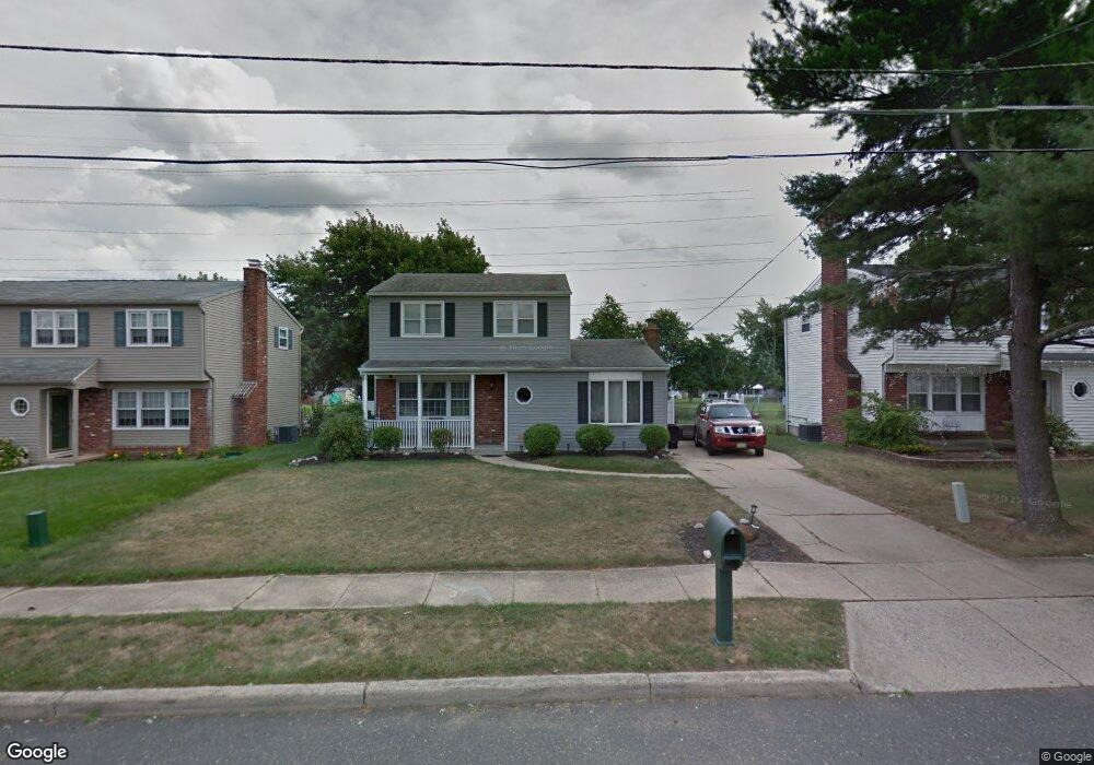
7900 Wyndam Rd Pennsauken, NJ 08109
Estimated Value: $276,524 - $386,000
--
Bed
--
Bath
1,559
Sq Ft
$221/Sq Ft
Est. Value
About This Home
This home is located at 7900 Wyndam Rd, Pennsauken, NJ 08109 and is currently estimated at $344,631, approximately $221 per square foot. 7900 Wyndam Rd is a home located in Camden County with nearby schools including Pennsauken High School and St. Cecilia School.
Ownership History
Date
Name
Owned For
Owner Type
Purchase Details
Closed on
Jun 26, 1998
Sold by
Deal Theodore C
Bought by
Jackson Glen Marshall and Gilliam Leona Yolanda
Current Estimated Value
Home Financials for this Owner
Home Financials are based on the most recent Mortgage that was taken out on this home.
Original Mortgage
$117,400
Outstanding Balance
$23,858
Interest Rate
6.92%
Mortgage Type
FHA
Estimated Equity
$320,773
Purchase Details
Closed on
Jun 23, 1995
Sold by
Klamo John A
Bought by
Deal Theodore C
Home Financials for this Owner
Home Financials are based on the most recent Mortgage that was taken out on this home.
Original Mortgage
$88,000
Interest Rate
7.8%
Create a Home Valuation Report for This Property
The Home Valuation Report is an in-depth analysis detailing your home's value as well as a comparison with similar homes in the area
Home Values in the Area
Average Home Value in this Area
Purchase History
| Date | Buyer | Sale Price | Title Company |
|---|---|---|---|
| Jackson Glen Marshall | $117,500 | -- | |
| Deal Theodore C | $110,000 | -- |
Source: Public Records
Mortgage History
| Date | Status | Borrower | Loan Amount |
|---|---|---|---|
| Open | Jackson Glen Marshall | $117,400 | |
| Previous Owner | Deal Theodore C | $88,000 |
Source: Public Records
Tax History Compared to Growth
Tax History
| Year | Tax Paid | Tax Assessment Tax Assessment Total Assessment is a certain percentage of the fair market value that is determined by local assessors to be the total taxable value of land and additions on the property. | Land | Improvement |
|---|---|---|---|---|
| 2025 | $7,660 | $309,100 | $57,600 | $251,500 |
| 2024 | $7,512 | $176,000 | $46,500 | $129,500 |
| 2023 | $7,512 | $176,000 | $46,500 | $129,500 |
| 2022 | $6,792 | $176,000 | $46,500 | $129,500 |
| 2021 | $6,975 | $176,000 | $46,500 | $129,500 |
| 2020 | $6,248 | $176,000 | $46,500 | $129,500 |
| 2019 | $6,320 | $176,000 | $46,500 | $129,500 |
| 2018 | $6,354 | $176,000 | $46,500 | $129,500 |
| 2017 | $6,366 | $176,000 | $46,500 | $129,500 |
| 2016 | $6,252 | $176,000 | $46,500 | $129,500 |
| 2015 | $6,438 | $176,000 | $46,500 | $129,500 |
| 2014 | $6,652 | $119,600 | $27,000 | $92,600 |
Source: Public Records
Map
Nearby Homes
- 2410 Shelley Ln
- 2561 Burning Tree Rd
- 8221 Corbett Rd
- 7406 Jackson Ave
- 3002 Gladwyn Ave
- 2603 Manall Ave
- 7750 Hesson Ln
- 2657 Rockafellow Ave
- 7487 Githens Ave
- 7418 Harvey Ave
- 8704 Park Ave
- 7218 Irving Ave
- 3423 New Jersey Ct
- 3422 Palace Ct
- 3412 Union Ave Unit C4
- 7775 Marion Ave
- 7812 Marion Ave
- 7028 Collins Ave
- 8331 Stockton Ave
- 3215 Cooper Ave
- 7880 Wyndam Rd
- 7920 Wyndam Rd
- 7860 Wyndam Rd
- 7940 Wyndam Rd
- 7881 Wyndam Rd
- 7901 Wyndam Rd
- 7861 Wyndam Rd
- 7840 Wyndam Rd
- 7921 Wyndam Rd
- 7841 Wyndam Rd
- 7960 Wyndam Rd
- 7820 Wyndam Rd
- 7821 Wyndam Rd
- 7817 Greenbrier Ct
- 7890 Greenbrier Rd
- 2500 Pettit Ct
- 2509 Pettit Ct
- 7980 Wyndam Rd
- 7882 Greenbrier Rd
- 7800 Wyndam Rd