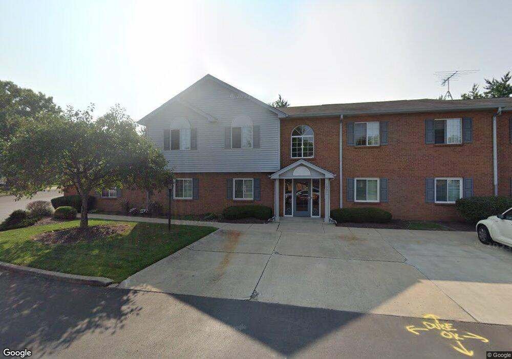
7901 Cheviot Rd Unit 1 Cincinnati, OH 45247
Estimated Value: $169,000 - $176,240
2
Beds
2
Baths
1,208
Sq Ft
$143/Sq Ft
Est. Value
About This Home
This home is located at 7901 Cheviot Rd Unit 1, Cincinnati, OH 45247 and is currently estimated at $172,310, approximately $142 per square foot. 7901 Cheviot Rd Unit 1 is a home located in Hamilton County with nearby schools including White Oak Middle School, Colerain High School, and St. James School.
Ownership History
Date
Name
Owned For
Owner Type
Purchase Details
Closed on
Apr 12, 2014
Sold by
Segrist Clara and Muldoon Jean F
Bought by
Storer Rebecca H
Current Estimated Value
Home Financials for this Owner
Home Financials are based on the most recent Mortgage that was taken out on this home.
Original Mortgage
$44,400
Outstanding Balance
$33,315
Interest Rate
4%
Mortgage Type
Adjustable Rate Mortgage/ARM
Estimated Equity
$138,995
Purchase Details
Closed on
May 20, 2003
Sold by
Ries Madeleine M
Bought by
Segrist Clara A and Segrist John W
Home Financials for this Owner
Home Financials are based on the most recent Mortgage that was taken out on this home.
Original Mortgage
$57,000
Interest Rate
5.88%
Mortgage Type
Purchase Money Mortgage
Purchase Details
Closed on
Apr 8, 1996
Sold by
Ries Madeleine M
Bought by
Ries Elmer L and Ries Madeleine M
Create a Home Valuation Report for This Property
The Home Valuation Report is an in-depth analysis detailing your home's value as well as a comparison with similar homes in the area
Home Values in the Area
Average Home Value in this Area
Purchase History
| Date | Buyer | Sale Price | Title Company |
|---|---|---|---|
| Storer Rebecca H | $55,000 | None Available | |
| Segrist Clara A | $107,500 | Advanced Land Title Agency L | |
| Ries Elmer L | -- | -- |
Source: Public Records
Mortgage History
| Date | Status | Borrower | Loan Amount |
|---|---|---|---|
| Open | Storer Rebecca H | $44,400 | |
| Previous Owner | Segrist Clara A | $57,000 |
Source: Public Records
Tax History Compared to Growth
Tax History
| Year | Tax Paid | Tax Assessment Tax Assessment Total Assessment is a certain percentage of the fair market value that is determined by local assessors to be the total taxable value of land and additions on the property. | Land | Improvement |
|---|---|---|---|---|
| 2024 | $2,361 | $44,139 | $6,650 | $37,489 |
| 2023 | $2,374 | $44,139 | $6,650 | $37,489 |
| 2022 | $2,026 | $30,702 | $7,168 | $23,534 |
| 2021 | $2,011 | $30,702 | $7,168 | $23,534 |
| 2020 | $2,029 | $30,702 | $7,168 | $23,534 |
| 2019 | $1,668 | $23,531 | $5,600 | $17,931 |
| 2018 | $1,497 | $23,531 | $5,600 | $17,931 |
| 2017 | $1,420 | $23,531 | $5,600 | $17,931 |
| 2016 | $1,189 | $19,425 | $3,976 | $15,449 |
| 2015 | $1,200 | $19,425 | $3,976 | $15,449 |
| 2014 | $1,255 | $19,425 | $3,976 | $15,449 |
| 2013 | $2,359 | $38,430 | $5,600 | $32,830 |
Source: Public Records
Map
Nearby Homes
- 7909 Cheviot Rd
- 3693 W Galbraith Rd
- 3691 W Galbraith Rd
- 3701 W Galbraith Rd
- 3397 Nandale Dr
- 3663 Sandralin Dr
- 7448 Locust View Ln
- 3927 Philnoll Dr
- 3950 Olde Savannah Dr
- 8344 Firshade Terrace
- 3960 Olde Savannah Dr
- 3369 W Galbraith Rd
- 4029 Appletree Ct
- 7320 Locust View Ln
- 3611 Benhill Dr
- 7030 King James Ct
- 3329 Alexis Rd
- 6715 Cheviot Rd
- 3474 Oakmeadow Ln
- 3277 Warfield Ave
- 7901 Cheviot Rd Unit 3
- 7901 Cheviot Rd Unit 4
- 7901 Cheviot Rd
- 7901 Cheviot Rd
- 7901 Cheviot Rd Unit 2
- 7909 Cheviot Rd Unit 18
- 7909 Cheviot Rd Unit 17
- 7909 Cheviot Rd
- 7911 Cheviot Rd
- 7911 Cheviot Rd
- 7911 Cheviot Rd
- 7909 Cheviot Rd
- 7911 Cheviot Rd
- 7911 Cheviot Rd Unit 22
- 7909 Cheviot Rd Unit 19
- 7911 Cheviot Rd Unit 23
- 7909 Cheviot Rd Unit 20
- 7911 Cheviot Rd Unit 21
- 7907 Cheviot Rd
- 7907 Cheviot Rd