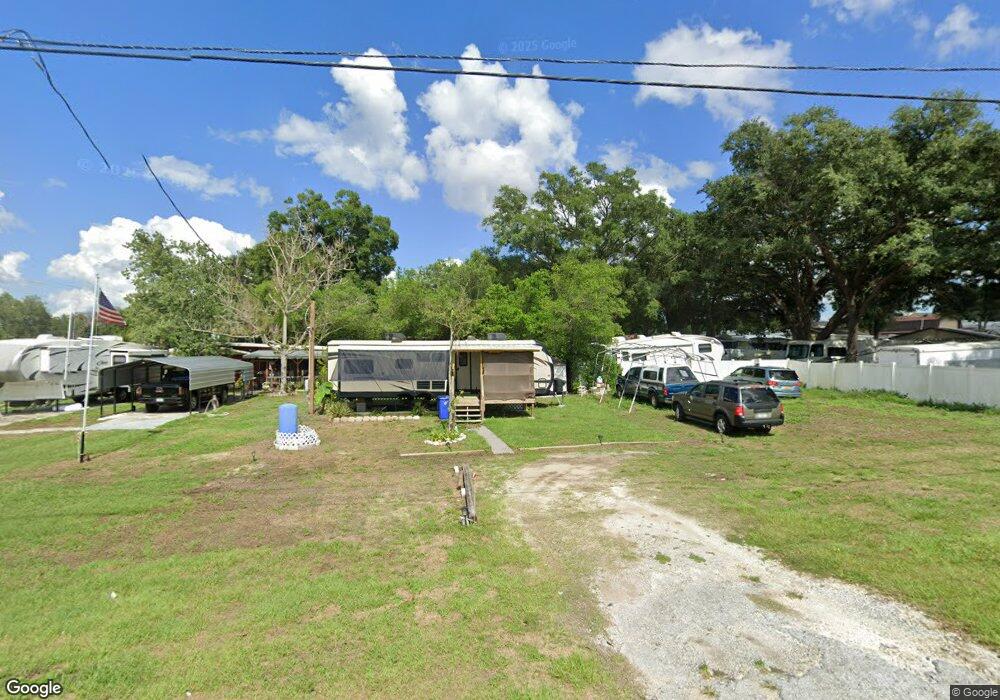
7902 Wire Rd Zephyrhills, FL 33540
Estimated Value: $216,000
--
Bed
1
Bath
600
Sq Ft
$360/Sq Ft
Est. Value
About This Home
This home is located at 7902 Wire Rd, Zephyrhills, FL 33540 and is currently estimated at $216,000, approximately $360 per square foot. 7902 Wire Rd is a home located in Pasco County with nearby schools including Woodland Elementary School, Centennial Middle School, and Zephyrhills High School.
Ownership History
Date
Name
Owned For
Owner Type
Purchase Details
Closed on
Mar 20, 2008
Sold by
Douglas Dwight S and Douglas Donna D
Bought by
Whelan Edouard R
Current Estimated Value
Home Financials for this Owner
Home Financials are based on the most recent Mortgage that was taken out on this home.
Original Mortgage
$55,500
Interest Rate
5.68%
Mortgage Type
Seller Take Back
Purchase Details
Closed on
Mar 16, 1999
Sold by
Living In Faith Fellowship
Bought by
Douglas Dwight S and Douglas Donna D
Create a Home Valuation Report for This Property
The Home Valuation Report is an in-depth analysis detailing your home's value as well as a comparison with similar homes in the area
Home Values in the Area
Average Home Value in this Area
Purchase History
| Date | Buyer | Sale Price | Title Company |
|---|---|---|---|
| Whelan Edouard R | $63,000 | Attorney | |
| Douglas Dwight S | $18,000 | -- |
Source: Public Records
Mortgage History
| Date | Status | Borrower | Loan Amount |
|---|---|---|---|
| Closed | Whelan Edouard R | $55,500 |
Source: Public Records
Tax History Compared to Growth
Tax History
| Year | Tax Paid | Tax Assessment Tax Assessment Total Assessment is a certain percentage of the fair market value that is determined by local assessors to be the total taxable value of land and additions on the property. | Land | Improvement |
|---|---|---|---|---|
| 2025 | $131 | $11,644 | $4,644 | $7,000 |
| 2024 | $131 | $11,771 | $4,644 | $7,127 |
| 2023 | $127 | $4,870 | $0 | $0 |
| 2022 | $111 | $12,023 | $4,644 | $7,379 |
| 2021 | $64 | $4,028 | $3,574 | $454 |
| 2020 | $59 | $3,717 | $3,249 | $468 |
| 2019 | $60 | $3,737 | $3,249 | $488 |
| 2018 | $61 | $3,757 | $3,249 | $508 |
| 2017 | $62 | $3,777 | $3,249 | $528 |
| 2016 | $64 | $3,798 | $3,249 | $549 |
| 2015 | $65 | $3,808 | $3,249 | $559 |
| 2014 | $64 | $3,828 | $3,249 | $579 |
Source: Public Records
Map
Nearby Homes
- 38533 Homestead Way
- 7820 Wire Rd
- 7938 Broad Pointe Dr
- 7855 Davie Ray Dr
- 38701 Wade Hampton Rd
- 7809 Jubal Early Rd
- 7974 Broad Pointe Dr
- 7804 Davie Ray Dr
- 7811 Davie Ray Dr
- 38648 Ferm Cir
- 38621 Ferm Cir
- 7771 Davie Ray Dr
- 8034 Broad Pointe Dr
- 38651 Ferm Cir
- 38378 Sonnet Landing Ave
- 8075 Broad Pointe Dr
- Aria Plan at Abbott Park
- Cali Plan at Abbott Park
- Hayden Plan at Abbott Park
- Elston II Plan at Abbott Park
- 7908 Wire Rd
- 36519 Olde Homestead Dr
- 7850 Wire Rd
- 36515 Olde Homestead Dr
- 36523 Olde Homestead Dr
- 36527 Olde Homestead Dr
- 36535 Olde Homestead Dr
- 36543 Olde Homestead Dr
- 36539 Olde Homestead Dr
- 36547 Olde Homestead Dr
- 38521 Homestead Way
- 7890 Broad Pointe Dr
- 7904 Broad Pointe Dr
- 7918 Broad Pointe Dr
- 38533 Homestead Way Unit 25
- 38509 Wade Hampton Rd
- 7930 Broad Pointe Dr
- 7882 Broad Pointe Dr
- 7864 Broad Pointe Dr
- 7914 Wire Rd