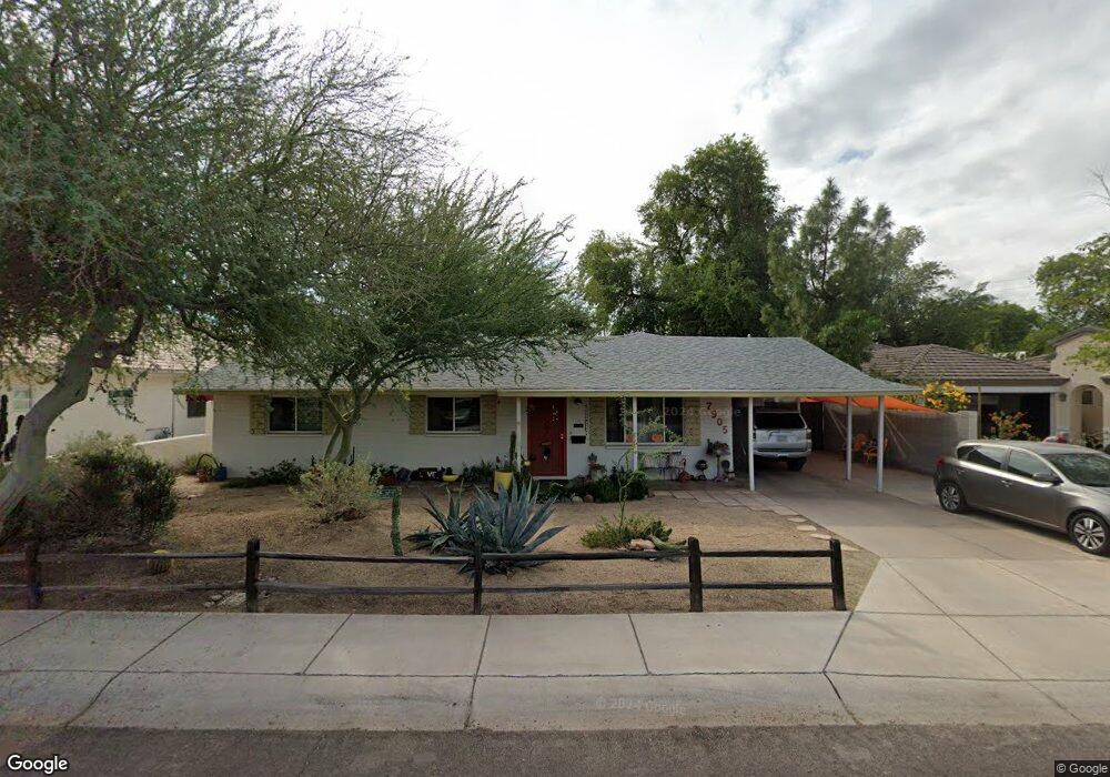
7905 E Wilshire Dr Scottsdale, AZ 85257
South Scottsdale NeighborhoodEstimated Value: $435,000 - $752,000
--
Bed
2
Baths
1,685
Sq Ft
$355/Sq Ft
Est. Value
About This Home
This home is located at 7905 E Wilshire Dr, Scottsdale, AZ 85257 and is currently estimated at $598,558, approximately $355 per square foot. 7905 E Wilshire Dr is a home located in Maricopa County with nearby schools including Pima Elementary School, Tonalea Middle School, and Coronado High School.
Ownership History
Date
Name
Owned For
Owner Type
Purchase Details
Closed on
Mar 24, 1997
Sold by
Bergal Philip and Bergal Mary M
Bought by
Megaw S Robert D and Megaw Twyla J
Current Estimated Value
Home Financials for this Owner
Home Financials are based on the most recent Mortgage that was taken out on this home.
Original Mortgage
$68,000
Interest Rate
7.63%
Mortgage Type
New Conventional
Create a Home Valuation Report for This Property
The Home Valuation Report is an in-depth analysis detailing your home's value as well as a comparison with similar homes in the area
Home Values in the Area
Average Home Value in this Area
Purchase History
| Date | Buyer | Sale Price | Title Company |
|---|---|---|---|
| Megaw S Robert D | $85,000 | Lawyers Title Of Arizona Inc |
Source: Public Records
Mortgage History
| Date | Status | Borrower | Loan Amount |
|---|---|---|---|
| Previous Owner | Megaw S Robert D | $68,000 |
Source: Public Records
Tax History Compared to Growth
Tax History
| Year | Tax Paid | Tax Assessment Tax Assessment Total Assessment is a certain percentage of the fair market value that is determined by local assessors to be the total taxable value of land and additions on the property. | Land | Improvement |
|---|---|---|---|---|
| 2025 | $1,264 | $21,260 | -- | -- |
| 2024 | $1,186 | $20,247 | -- | -- |
| 2023 | $1,186 | $47,670 | $9,530 | $38,140 |
| 2022 | $1,129 | $33,860 | $6,770 | $27,090 |
| 2021 | $1,225 | $30,970 | $6,190 | $24,780 |
| 2020 | $1,214 | $27,720 | $5,540 | $22,180 |
| 2019 | $1,177 | $25,970 | $5,190 | $20,780 |
| 2018 | $1,150 | $23,150 | $4,630 | $18,520 |
| 2017 | $1,085 | $21,800 | $4,360 | $17,440 |
| 2016 | $1,064 | $20,130 | $4,020 | $16,110 |
| 2015 | $1,022 | $19,870 | $3,970 | $15,900 |
Source: Public Records
Map
Nearby Homes
- 2500 N Hayden Rd Unit 15
- 7741 E Harvard St
- 8004 E Oak St
- 8054 E Oak St
- 7729 E Harvard St
- 2316 N 81st St
- 8060 E Lewis Ave
- 8055 E Thomas Rd Unit C104
- 8055 E Thomas Rd Unit H103
- 8055 E Thomas Rd Unit C211
- 8055 E Thomas Rd Unit A102
- 8055 E Thomas Rd Unit E110
- 8055 E Thomas Rd Unit A202
- 8055 E Thomas Rd Unit E117
- 8055 E Thomas Rd Unit D111
- 8055 E Thomas Rd Unit C203
- 8055 E Thomas Rd Unit E101
- 8102 E Cambridge Ave
- 2839 N 77th Place
- 2571 N Miller Rd
- 7901 E Wilshire Dr
- 7909 E Wilshire Dr
- 2500 N Hayden Rd
- 2500 N Hayden Rd Unit 14
- 2500 N Hayden Rd Unit 20
- 2500 N Hayden Rd Unit 27
- 2500 N Hayden Rd Unit 17
- 2500 N Hayden Rd Unit 22
- 2500 N Hayden Rd Unit 32
- 2500 N Hayden Rd Unit 5
- 2500 N Hayden Rd Unit 16
- 2500 N Hayden Rd Unit 1
- 2500 N Hayden Rd Unit 25
- 2500 N Hayden Rd Unit 18
- 2500 N Hayden Rd Unit 4
- 2500 N Hayden Rd Unit 33
- 2500 N Hayden Rd Unit 10
- 2500 N Hayden Rd Unit 29
- 2500 N Hayden Rd Unit 8
- 2500 N Hayden Rd Unit 7