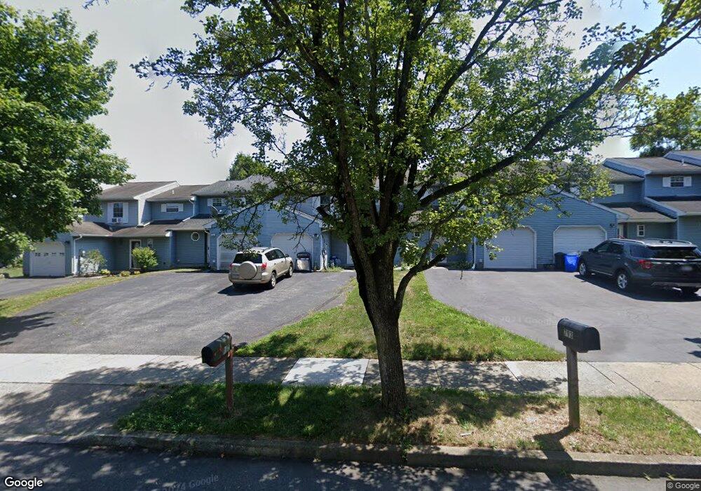
791 Briarstone Rd Bethlehem, PA 18017
Estimated Value: $276,000 - $319,000
3
Beds
2
Baths
1,366
Sq Ft
$218/Sq Ft
Est. Value
About This Home
This home is located at 791 Briarstone Rd, Bethlehem, PA 18017 and is currently estimated at $297,637, approximately $217 per square foot. 791 Briarstone Rd is a home located in Northampton County with nearby schools including Asa Packer Elementary School, Nitschmann Middle School, and Liberty High School.
Ownership History
Date
Name
Owned For
Owner Type
Purchase Details
Closed on
Jan 13, 2012
Sold by
Deutsch Karla M and Trumbauer Karla M
Bought by
Pavlo Michael G and Pavlo Megan G
Current Estimated Value
Home Financials for this Owner
Home Financials are based on the most recent Mortgage that was taken out on this home.
Original Mortgage
$110,000
Outstanding Balance
$75,485
Interest Rate
4%
Mortgage Type
New Conventional
Estimated Equity
$222,152
Purchase Details
Closed on
Mar 5, 2004
Sold by
Duplaga Richard E
Bought by
Deutsch Karla M
Home Financials for this Owner
Home Financials are based on the most recent Mortgage that was taken out on this home.
Original Mortgage
$122,916
Interest Rate
5.67%
Mortgage Type
FHA
Create a Home Valuation Report for This Property
The Home Valuation Report is an in-depth analysis detailing your home's value as well as a comparison with similar homes in the area
Home Values in the Area
Average Home Value in this Area
Purchase History
| Date | Buyer | Sale Price | Title Company |
|---|---|---|---|
| Pavlo Michael G | $140,000 | None Available | |
| Deutsch Karla M | $123,900 | -- |
Source: Public Records
Mortgage History
| Date | Status | Borrower | Loan Amount |
|---|---|---|---|
| Open | Pavlo Michael G | $110,000 | |
| Previous Owner | Deutsch Karla M | $122,916 |
Source: Public Records
Tax History Compared to Growth
Tax History
| Year | Tax Paid | Tax Assessment Tax Assessment Total Assessment is a certain percentage of the fair market value that is determined by local assessors to be the total taxable value of land and additions on the property. | Land | Improvement |
|---|---|---|---|---|
| 2025 | $494 | $45,700 | $9,500 | $36,200 |
| 2024 | $3,332 | $45,700 | $9,500 | $36,200 |
| 2023 | $3,343 | $45,700 | $9,500 | $36,200 |
| 2022 | $3,311 | $45,700 | $9,500 | $36,200 |
| 2021 | $3,284 | $45,700 | $9,500 | $36,200 |
| 2020 | $3,289 | $45,700 | $9,500 | $36,200 |
| 2019 | $3,275 | $45,700 | $9,500 | $36,200 |
| 2018 | $3,210 | $45,700 | $9,500 | $36,200 |
| 2017 | $3,188 | $45,700 | $9,500 | $36,200 |
| 2016 | -- | $45,700 | $9,500 | $36,200 |
| 2015 | -- | $45,700 | $9,500 | $36,200 |
| 2014 | -- | $45,700 | $9,500 | $36,200 |
Source: Public Records
Map
Nearby Homes
- 809 Overlook Dr
- 1215 Ciara Dr
- 1285 Stafore Dr
- 820 Yorkshire Rd
- 960 Yorkshire Rd
- 1215 W MacAda Rd
- 3760 Jacksonville Rd
- 5449 Hale Ave
- 460 Bridle Path Rd
- 105 Pine Top Trail
- 2616 Pioneer Rd
- 5531 Grace Ave
- 3450 Park Place
- 1225 Brentwood Ave
- 2860 Center St
- 2520 Winston Rd
- 4410 Greenfield Rd
- 2713 Center St
- 0 Rosewood Dr Unit 766427
- 1445 Westgate Dr
- 789 Briarstone Rd
- 793 Briarstone Rd
- 795 Briarstone Rd
- 787 Briarstone Rd
- 797 Briarstone Rd
- 689 Briarstone Rd
- 595 Stonepark Dr
- 799 Briarstone Rd
- 687 Briarstone Rd
- 685 Briarstone Rd
- 790 Briarstone Rd
- 788 Briarstone Rd
- 792 Briarstone Rd
- 786 Briarstone Rd
- 794 Briarstone Rd
- 796 Briarstone Rd
- 597 Stonepark Dr
- 683 Briarstone Rd
- 784 Briarstone Rd
- 798 Briarstone Rd