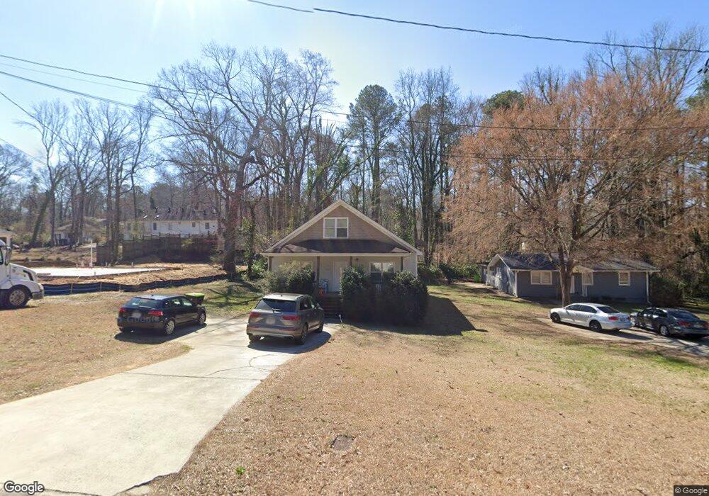
791 Britt Rd SW Mableton, GA 30126
Estimated Value: $288,000 - $384,000
3
Beds
3
Baths
1,714
Sq Ft
$192/Sq Ft
Est. Value
About This Home
This home is located at 791 Britt Rd SW, Mableton, GA 30126 and is currently estimated at $329,629, approximately $192 per square foot. 791 Britt Rd SW is a home located in Cobb County with nearby schools including Bryant Elementary School, Lindley Middle School, and Pebblebrook High School.
Ownership History
Date
Name
Owned For
Owner Type
Purchase Details
Closed on
Aug 2, 2024
Sold by
Braswell Ashley L and Mullen Richard
Bought by
Mullen Richard
Current Estimated Value
Purchase Details
Closed on
Jun 6, 2017
Sold by
Braswell Ashley
Bought by
Bank Of America
Purchase Details
Closed on
Jul 7, 2015
Sold by
Hud & Housing Of Urban Dev
Bought by
Mtg Electronic Registration Sy and O Carl Mcrae Exec C
Create a Home Valuation Report for This Property
The Home Valuation Report is an in-depth analysis detailing your home's value as well as a comparison with similar homes in the area
Home Values in the Area
Average Home Value in this Area
Purchase History
| Date | Buyer | Sale Price | Title Company |
|---|---|---|---|
| Mullen Richard | -- | None Listed On Document | |
| Bank Of America | $45,600 | -- | |
| Mtg Electronic Registration Sy | -- | -- |
Source: Public Records
Tax History Compared to Growth
Tax History
| Year | Tax Paid | Tax Assessment Tax Assessment Total Assessment is a certain percentage of the fair market value that is determined by local assessors to be the total taxable value of land and additions on the property. | Land | Improvement |
|---|---|---|---|---|
| 2025 | $3,416 | $113,372 | $30,020 | $83,352 |
| 2024 | $3,418 | $113,372 | $30,020 | $83,352 |
| 2023 | $2,949 | $97,812 | $30,020 | $67,792 |
| 2022 | $2,269 | $74,760 | $18,960 | $55,800 |
| 2021 | $1,973 | $65,020 | $16,432 | $48,588 |
| 2020 | $1,858 | $61,228 | $12,640 | $48,588 |
| 2019 | $1,858 | $61,228 | $12,640 | $48,588 |
| 2018 | $1,583 | $52,168 | $7,268 | $44,900 |
| 2017 | $1,104 | $38,416 | $4,740 | $33,676 |
| 2016 | $1,104 | $38,416 | $4,740 | $33,676 |
| 2015 | $1,151 | $39,080 | $3,160 | $35,920 |
| 2014 | $1,019 | $34,312 | $0 | $0 |
Source: Public Records
Map
Nearby Homes
- 760 W Starling Dr SW
- 767 Kenneth Ln SW
- 846 Orris Ln SW
- 6281 Denny Ln SW
- 6266 Britt Rd SW
- 377 Waterbluff Dr SW
- 373 Waterbluff Dr SW
- 369 Waterbluff Dr SW
- 368 Waterbluff Dr SW
- Magnolia Plan at The Overlook at Factory Shoals - Georgian Series
- Axley Plan at The Overlook at Factory Shoals - Georgian Series
- Chatsworth Plan at The Overlook at Factory Shoals - Georgian Series
- 365 Waterbluff Dr SW
- 6302 Mount Pisgah Ln
- 364 Waterbluff Dr SW
- 1086 S Gordon Rd
- 537 Elizabeth Ln SW
- 496 Elizabeth Ln SW
- 760 Wade Farm Dr
- 1202 Pisgah Rd SW
- 795 Britt Rd SW
- 0 Britt Rd Unit 3154077
- 0 Britt Rd Unit 20011772
- 0 Britt Rd Unit 7583015
- 797 Britt Rd
- 761 Britt Rd SW
- 0 Gardner Ct Unit Lot 6 8979157
- 6520 Gardner Ct Unit 5
- 6520 Gardner Ct
- 890 Britt Rd SW
- 6540 Gardner Ct
- 782 Britt Rd SW
- 6531 Gardner Ct
- 757 Britt Rd SW
- 799 Britt Rd SW
- 6435 Jane Dr SW Unit 3
- 800 Gardner St
- 754 Britt Rd SW
- 6541 Gardner Ct
- 790 Gardner St