Estimated Value: $207,981 - $641,000
--
Bed
--
Bath
1,350
Sq Ft
$383/Sq Ft
Est. Value
About This Home
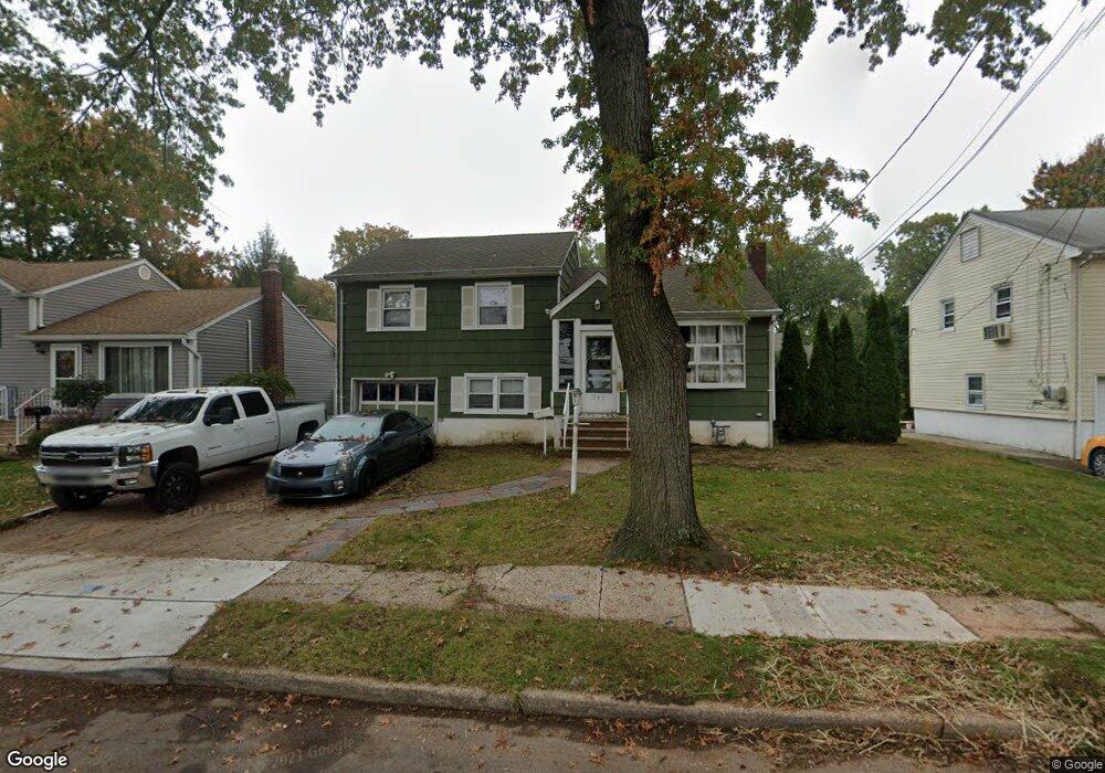
This home is located at 791 Nixon Rd, Union, NJ 07083 and is currently estimated at $516,495, approximately $382 per square foot. 791 Nixon Rd is a home located in Union County with nearby schools including Livingston Elementary School and Union High School.
Ownership History
Date
Name
Owned For
Owner Type
Purchase Details
Closed on
Feb 22, 2021
Sold by
Maenza Michael and Maenza Patricia J
Bought by
Maenza Michael
Current Estimated Value
Home Financials for this Owner
Home Financials are based on the most recent Mortgage that was taken out on this home.
Original Mortgage
$263,000
Interest Rate
3%
Mortgage Type
New Conventional
Purchase Details
Closed on
Apr 28, 1989
Bought by
Maenza Michael
Create a Home Valuation Report for This Property
The Home Valuation Report is an in-depth analysis detailing your home's value as well as a comparison with similar homes in the area
Home Values in the Area
Average Home Value in this Area
Purchase History
| Date | Buyer | Sale Price | Title Company |
|---|---|---|---|
| Maenza Michael | -- | Eagle Title Agency Llc | |
| Maenza Michael | -- | None Listed On Document | |
| Maenza Michael | $171,000 | -- |
Source: Public Records
Mortgage History
| Date | Status | Borrower | Loan Amount |
|---|---|---|---|
| Previous Owner | Maenza Michael | $263,000 |
Source: Public Records
Tax History Compared to Growth
Tax History
| Year | Tax Paid | Tax Assessment Tax Assessment Total Assessment is a certain percentage of the fair market value that is determined by local assessors to be the total taxable value of land and additions on the property. | Land | Improvement |
|---|---|---|---|---|
| 2025 | $10,416 | $46,600 | $21,300 | $25,300 |
| 2024 | $10,098 | $46,600 | $21,300 | $25,300 |
| 2023 | $10,098 | $46,600 | $21,300 | $25,300 |
| 2022 | $9,747 | $46,600 | $21,300 | $25,300 |
| 2021 | $9,511 | $46,600 | $21,300 | $25,300 |
| 2020 | $9,321 | $46,600 | $21,300 | $25,300 |
| 2019 | $9,196 | $46,600 | $21,300 | $25,300 |
| 2018 | $9,039 | $46,600 | $21,300 | $25,300 |
| 2017 | $8,905 | $46,600 | $21,300 | $25,300 |
| 2016 | $8,688 | $46,600 | $21,300 | $25,300 |
| 2015 | $8,544 | $46,600 | $21,300 | $25,300 |
| 2014 | $8,353 | $46,600 | $21,300 | $25,300 |
Source: Public Records
Map
Nearby Homes
- 795 Colonial Arms Rd
- 875 Salem Rd
- 717 Winchester Ave
- 328 Minute Arms Rd
- 1084 Woodland Ave
- 790 Green Ln Unit A1
- 365 Broadwell Ave
- 969 Arnet Ave
- 1370 Beverly Rd
- 1031 Lowden Ave
- 578 Winchester Ave
- 819 Greenwich Ln
- 169 Valley View Rd
- 536 Lehigh Ave
- 275 Clermont Terrace
- 309 Palisade Rd Unit 323
- 403 Foxwood Rd
- 1040 Cranbrook Rd
- 631 Golf Terrace
- 341 Trotting Rd
- 795 Nixon Rd
- 787 Nixon Rd
- 790 Colonial Arms Rd
- 801 Nixon Rd
- 786 Colonial Arms Rd
- 794 Colonial Arms Rd
- 783 Nixon Rd
- 782 Colonial Arms Rd
- 800 Colonial Arms Rd
- 788 Nixon Rd
- 792 Nixon Rd
- 805 Nixon Rd
- 796 Nixon Rd
- 786 Nixon Rd
- 779 Nixon Rd
- 778 Colonial Arms Rd
- 804 Colonial Arms Rd
- 800 Nixon Rd
- 782 Nixon Rd
- 809 Nixon Rd