Estimated Value: $146,000 - $187,000
--
Bed
2
Baths
1,360
Sq Ft
$121/Sq Ft
Est. Value
About This Home
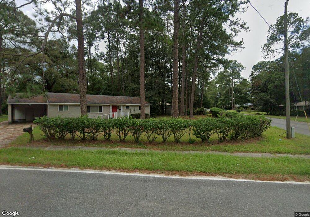
This home is located at 791 S 6th St, Jesup, GA 31545 and is currently estimated at $164,458, approximately $120 per square foot. 791 S 6th St is a home located in Wayne County with nearby schools including Martha Rawls Smith Elementary School, Arthur Williams Middle School, and Wayne County High School.
Ownership History
Date
Name
Owned For
Owner Type
Purchase Details
Closed on
May 14, 2007
Sold by
Rinehart George William
Bought by
Bettner Patty
Current Estimated Value
Home Financials for this Owner
Home Financials are based on the most recent Mortgage that was taken out on this home.
Original Mortgage
$80,800
Outstanding Balance
$49,148
Interest Rate
6.17%
Mortgage Type
New Conventional
Estimated Equity
$115,310
Purchase Details
Closed on
May 1, 2001
Bought by
Rinehart Ii George William and Rinehart Lorett
Purchase Details
Closed on
Nov 1, 1967
Create a Home Valuation Report for This Property
The Home Valuation Report is an in-depth analysis detailing your home's value as well as a comparison with similar homes in the area
Home Values in the Area
Average Home Value in this Area
Purchase History
| Date | Buyer | Sale Price | Title Company |
|---|---|---|---|
| Bettner Patty | $101,000 | -- | |
| Rinehart Ii George William | $62,500 | -- | |
| -- | -- | -- |
Source: Public Records
Mortgage History
| Date | Status | Borrower | Loan Amount |
|---|---|---|---|
| Open | Bettner Patty | $80,800 |
Source: Public Records
Tax History Compared to Growth
Tax History
| Year | Tax Paid | Tax Assessment Tax Assessment Total Assessment is a certain percentage of the fair market value that is determined by local assessors to be the total taxable value of land and additions on the property. | Land | Improvement |
|---|---|---|---|---|
| 2024 | $1,457 | $51,975 | $5,106 | $46,869 |
| 2023 | $1,280 | $36,182 | $5,059 | $31,123 |
| 2022 | $982 | $36,182 | $5,059 | $31,123 |
| 2021 | $1,051 | $36,182 | $5,059 | $31,123 |
| 2020 | $1,088 | $36,182 | $5,059 | $31,123 |
| 2019 | $1,120 | $36,182 | $5,059 | $31,123 |
| 2018 | $1,120 | $36,182 | $5,059 | $31,123 |
| 2017 | $964 | $36,182 | $5,059 | $31,123 |
| 2016 | $933 | $36,182 | $5,059 | $31,123 |
| 2014 | $936 | $36,182 | $5,059 | $31,123 |
| 2013 | -- | $36,182 | $5,059 | $31,123 |
Source: Public Records
Map
Nearby Homes