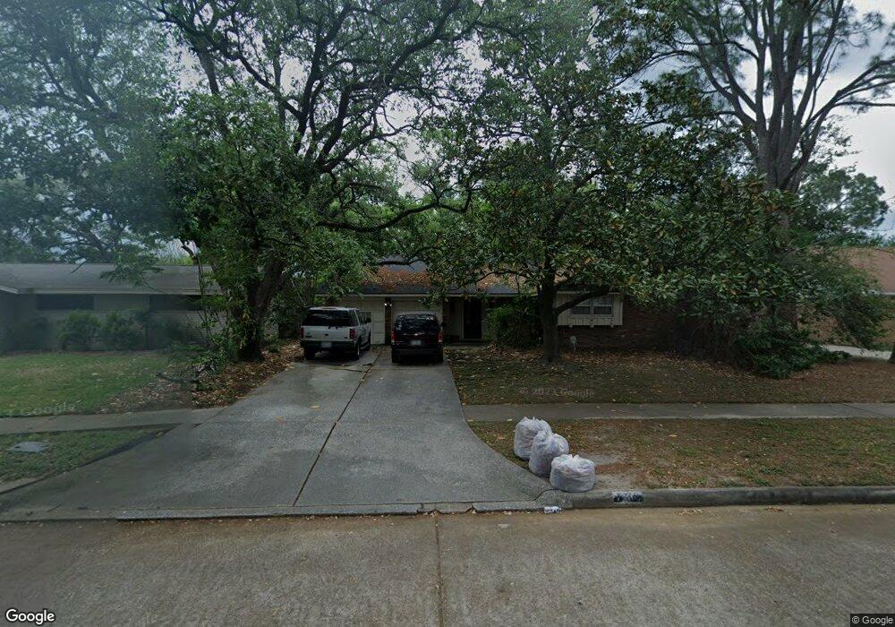
7910 Mobud Dr Houston, TX 77036
Sharpstown NeighborhoodEstimated Value: $301,000 - $349,000
4
Beds
2
Baths
1,834
Sq Ft
$173/Sq Ft
Est. Value
About This Home
This home is located at 7910 Mobud Dr, Houston, TX 77036 and is currently estimated at $317,172, approximately $172 per square foot. 7910 Mobud Dr is a home located in Harris County with nearby schools including Neff Elementary School, Sugar Grove Academy, and Sharpstown High School.
Ownership History
Date
Name
Owned For
Owner Type
Purchase Details
Closed on
Mar 22, 2005
Sold by
Omar Olga O
Bought by
Omar Timur A
Current Estimated Value
Purchase Details
Closed on
Nov 24, 2003
Sold by
Rosborough John P and Rosborough Mary A
Bought by
Omar Olga O
Home Financials for this Owner
Home Financials are based on the most recent Mortgage that was taken out on this home.
Original Mortgage
$128,250
Outstanding Balance
$59,705
Interest Rate
6.06%
Mortgage Type
Purchase Money Mortgage
Estimated Equity
$257,467
Create a Home Valuation Report for This Property
The Home Valuation Report is an in-depth analysis detailing your home's value as well as a comparison with similar homes in the area
Home Values in the Area
Average Home Value in this Area
Purchase History
| Date | Buyer | Sale Price | Title Company |
|---|---|---|---|
| Omar Timur A | -- | -- | |
| Omar Olga O | -- | Chicago Title Fb |
Source: Public Records
Mortgage History
| Date | Status | Borrower | Loan Amount |
|---|---|---|---|
| Open | Omar Olga O | $128,250 |
Source: Public Records
Tax History Compared to Growth
Tax History
| Year | Tax Paid | Tax Assessment Tax Assessment Total Assessment is a certain percentage of the fair market value that is determined by local assessors to be the total taxable value of land and additions on the property. | Land | Improvement |
|---|---|---|---|---|
| 2025 | $3,601 | $283,618 | $135,122 | $148,496 |
| 2024 | $3,601 | $271,714 | $97,588 | $174,126 |
| 2023 | $3,601 | $271,714 | $97,588 | $174,126 |
| 2022 | $5,027 | $244,619 | $60,054 | $184,565 |
| 2021 | $4,668 | $200,265 | $60,054 | $140,211 |
| 2020 | $5,180 | $207,054 | $60,054 | $147,000 |
| 2019 | $5,291 | $202,674 | $45,041 | $157,633 |
| 2018 | $3,636 | $197,409 | $45,041 | $152,368 |
| 2017 | $4,590 | $192,884 | $45,041 | $147,843 |
| 2016 | $4,173 | $185,441 | $45,041 | $140,400 |
| 2015 | $2,553 | $166,833 | $45,041 | $121,792 |
| 2014 | $2,553 | $144,356 | $45,041 | $99,315 |
Source: Public Records
Map
Nearby Homes
- 7819 Bellaire Blvd
- 8019 Sharpview Dr
- 8314 Edgemoor Dr
- 7419 Barberton Dr
- 6602 Harbor Town Dr Unit 1207
- 6602 Harbor Town Dr Unit 1202
- 6500 Harbor Town Dr Unit 3208
- 6500 Harbor Town Dr Unit 2808
- 6500 Harbor Town Dr Unit 3204
- 6500 Harbor Town Dr Unit 3408
- 6500 Harbor Town Dr Unit 2902
- 8515 Edgemoor Dr
- 8223 Golf Green Cir
- 6403 Fondren Rd Unit D25
- 8527 Edgemoor Dr
- 8530 Roos Rd
- 8119 Concho St
- 7302 Burning Tree Dr
- 8218 Hazen St
- 7302 Redding Rd
- 7914 Mobud Dr
- 7906 Mobud Dr
- 7911 Edgemoor Dr
- 7907 Edgemoor Dr
- 7915 Edgemoor Dr
- 7918 Mobud Dr
- 7902 Mobud Dr
- 7911 Mobud Dr
- 7919 Edgemoor Dr
- 7903 Edgemoor Dr
- 7907 Mobud Dr
- 7915 Mobud Dr
- 8002 Mobud Dr
- 7903 Mobud Dr
- 7919 Mobud Dr
- 8003 Edgemoor Dr
- 7910 Edgemoor Dr
- 8003 Mobud Dr
- 7910 Neff St
- 7906 Edgemoor Dr