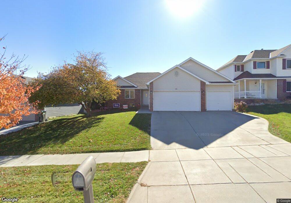
7911 Red Oak Rd Lincoln, NE 68516
Family Acres NeighborhoodEstimated Value: $381,000 - $418,000
3
Beds
2
Baths
1,545
Sq Ft
$261/Sq Ft
Est. Value
About This Home
This home is located at 7911 Red Oak Rd, Lincoln, NE 68516 and is currently estimated at $403,253, approximately $261 per square foot. 7911 Red Oak Rd is a home located in Lancaster County with nearby schools including Maxey Elementary School, Lux Middle School, and Lincoln East High School.
Ownership History
Date
Name
Owned For
Owner Type
Purchase Details
Closed on
May 11, 2017
Sold by
Brunsman Robert J and Brunsman Bethany A
Bought by
Brunsman Bethany A
Current Estimated Value
Purchase Details
Closed on
Apr 16, 2013
Sold by
Brunsman Robert J and Brunsman Bethany A
Bought by
City Of Lincoln
Purchase Details
Closed on
Jul 31, 2000
Sold by
New Century Homes Inc
Bought by
Brunsman Robert J and Brunsman Bethany A
Home Financials for this Owner
Home Financials are based on the most recent Mortgage that was taken out on this home.
Original Mortgage
$139,600
Interest Rate
8.15%
Purchase Details
Closed on
Nov 2, 1999
Sold by
Schmidt Carl R and Schmidt Vicki A
Bought by
New Century Homes Inc
Home Financials for this Owner
Home Financials are based on the most recent Mortgage that was taken out on this home.
Original Mortgage
$148,800
Interest Rate
7.77%
Mortgage Type
Construction
Create a Home Valuation Report for This Property
The Home Valuation Report is an in-depth analysis detailing your home's value as well as a comparison with similar homes in the area
Home Values in the Area
Average Home Value in this Area
Purchase History
| Date | Buyer | Sale Price | Title Company |
|---|---|---|---|
| Brunsman Bethany A | -- | None Available | |
| City Of Lincoln | $2,204 | None Available | |
| Brunsman Robert J | $175,000 | -- | |
| New Century Homes Inc | -- | -- |
Source: Public Records
Mortgage History
| Date | Status | Borrower | Loan Amount |
|---|---|---|---|
| Previous Owner | Brunsman Robert J | $139,600 | |
| Previous Owner | New Century Homes Inc | $148,800 |
Source: Public Records
Tax History Compared to Growth
Tax History
| Year | Tax Paid | Tax Assessment Tax Assessment Total Assessment is a certain percentage of the fair market value that is determined by local assessors to be the total taxable value of land and additions on the property. | Land | Improvement |
|---|---|---|---|---|
| 2025 | $5,124 | $388,700 | $61,200 | $327,500 |
| 2024 | $5,124 | $367,100 | $61,200 | $305,900 |
| 2023 | $5,836 | $348,200 | $61,200 | $287,000 |
| 2022 | $5,618 | $281,900 | $54,000 | $227,900 |
| 2021 | $5,315 | $281,900 | $54,000 | $227,900 |
| 2020 | $5,014 | $262,400 | $54,000 | $208,400 |
| 2019 | $5,014 | $262,400 | $54,000 | $208,400 |
| 2018 | $4,609 | $240,100 | $54,000 | $186,100 |
| 2017 | $4,651 | $240,100 | $54,000 | $186,100 |
| 2016 | $4,420 | $227,000 | $40,500 | $186,500 |
| 2015 | $4,390 | $227,000 | $40,500 | $186,500 |
| 2014 | $3,841 | $197,500 | $40,500 | $157,000 |
| 2013 | -- | $197,500 | $40,500 | $157,000 |
Source: Public Records
Map
Nearby Homes
- 5614 S 80th St
- 5624 Barrington Cir
- 5431 S 79th St
- 10111 S 78th St
- 7501 Karl Dr
- 8101 Cheney Ridge Rd
- 7501 Stevens Ridge Rd
- 5233 S 71st St
- 5241 Troon Dr
- 4840 S 77th St
- 5441 S 88th St
- 7814 Phares Dr
- 7739 Phares Dr
- 8439 Birkett Dr
- 5335 Troon Dr
- 8610 Oakmont Dr
- 8440 Birkett Dr
- 6948 Kings Ct
- 4911 S 76th St
- 5811 S 88th St
- 7921 Red Oak Rd
- 7901 Red Oak Rd
- 7931 Red Oak Rd
- 7867 Red Oak Rd
- 7920 Red Oak Rd
- 7900 Red Oak Rd
- 7857 Red Oak Rd
- 5655 S 80th St
- 7930 Red Oak Rd
- 7866 Red Oak Rd
- 7920 Creek View Dr
- 7910 Creek View Dr
- 7858 Red Oak Rd
- 5641 S 80th St
- 7849 Red Oak Rd
- 7940 Creek View Dr
- 7841 Barrington Place
- 7900 Creek View Dr
- 7833 Barrington Place
- 7849 Barrington Place