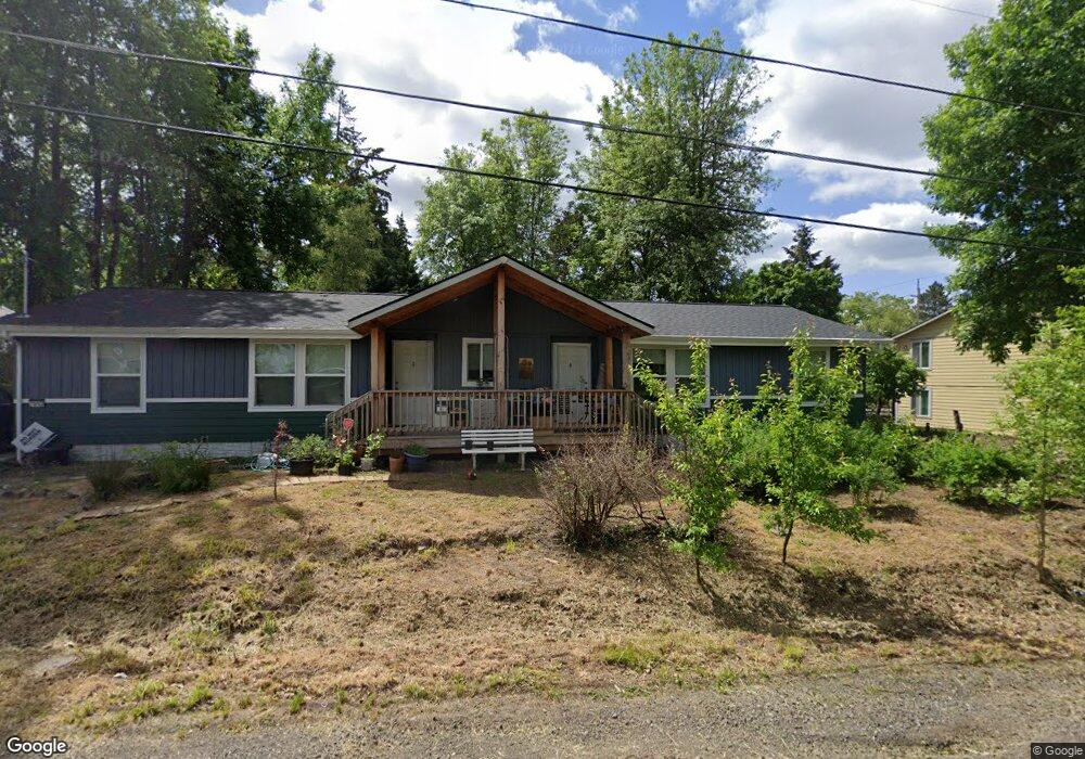
7912 SW Cedarcrest St Portland, OR 97223
Estimated Value: $422,000 - $632,000
3
Beds
1
Bath
1,356
Sq Ft
$370/Sq Ft
Est. Value
About This Home
This home is located at 7912 SW Cedarcrest St, Portland, OR 97223 and is currently estimated at $502,214, approximately $370 per square foot. 7912 SW Cedarcrest St is a home located in Washington County with nearby schools including Metzger Elementary School, Thomas R. Fowler Middle School, and Tigard High School.
Ownership History
Date
Name
Owned For
Owner Type
Purchase Details
Closed on
Dec 23, 1996
Sold by
Pritchett William C and Pritchett Janet M
Bought by
Hunt William G
Current Estimated Value
Home Financials for this Owner
Home Financials are based on the most recent Mortgage that was taken out on this home.
Original Mortgage
$370,000
Interest Rate
7.53%
Mortgage Type
Purchase Money Mortgage
Create a Home Valuation Report for This Property
The Home Valuation Report is an in-depth analysis detailing your home's value as well as a comparison with similar homes in the area
Home Values in the Area
Average Home Value in this Area
Purchase History
| Date | Buyer | Sale Price | Title Company |
|---|---|---|---|
| Hunt William G | -- | Fidelity National Title Co |
Source: Public Records
Mortgage History
| Date | Status | Borrower | Loan Amount |
|---|---|---|---|
| Closed | Hunt William G | $370,000 |
Source: Public Records
Tax History Compared to Growth
Tax History
| Year | Tax Paid | Tax Assessment Tax Assessment Total Assessment is a certain percentage of the fair market value that is determined by local assessors to be the total taxable value of land and additions on the property. | Land | Improvement |
|---|---|---|---|---|
| 2026 | $3,139 | $201,170 | -- | -- |
| 2025 | $3,139 | $195,320 | -- | -- |
| 2024 | $3,032 | $189,640 | -- | -- |
| 2023 | $3,032 | $184,120 | $0 | $0 |
| 2022 | $2,908 | $184,120 | $0 | $0 |
| 2021 | $2,613 | $159,600 | $0 | $0 |
| 2020 | $2,536 | $154,960 | $0 | $0 |
| 2019 | $2,482 | $150,450 | $0 | $0 |
| 2018 | $2,370 | $146,070 | $0 | $0 |
| 2017 | $2,283 | $141,820 | $0 | $0 |
| 2016 | $2,173 | $137,690 | $0 | $0 |
| 2015 | $2,091 | $133,680 | $0 | $0 |
| 2014 | $2,026 | $129,790 | $0 | $0 |
Source: Public Records
Map
Nearby Homes
- 7849 SW Birch St
- 8925 SW 80th Ave
- 7480 SW Taylors Ferry Rd
- 7830 SW Hemlock St
- 7080 SW Taylors Ferry Rd
- 8770 SW 71st Place
- 7375 SW Ashdale Dr
- 9335 SW 69th Ave
- 10022 SW 72nd Ave
- 10010 SW Hall Blvd Unit 5
- 7402 SW Locust St
- 6985 SW Florence Ln
- 10125 SW 72nd Ave
- 7705 SW Alden St
- 8815 SW Oleson Rd
- 9825 SW Ventura Ct
- 9560 SW 91st Ave Unit 3
- 9556 SW 91st Ave Unit 2
- 9576 SW 91st Ave Unit 7
- 9552 SW 91st Ave Unit 1
- 7900 SW Cedarcrest St
- 7906 SW Cedarcrest St
- 7864 SW Cedarcrest St
- 7915 SW Cedarcrest St
- 9280 SW 80th Ave
- 7909 SW Cedarcrest St
- 7823 SW Cedarcrest St
- 7820 SW Cedarcrest St
- 9400 SW 80th Ave
- 7911 SW Cedarcrest St
- 9250 SW 80th Ave
- 7814 SW Cedarcrest St
- 9345 SW 80th Ave
- 7817 SW Cedarcrest St
- 7823 SW Chestnut St
- 8000 SW Cedarcrest St
- 8000 SW Cedarcrest St Unit 1
- 7800 SW Cedarcrest St
- 7855 SW Chestnut St
- 9275 SW 80th Ave