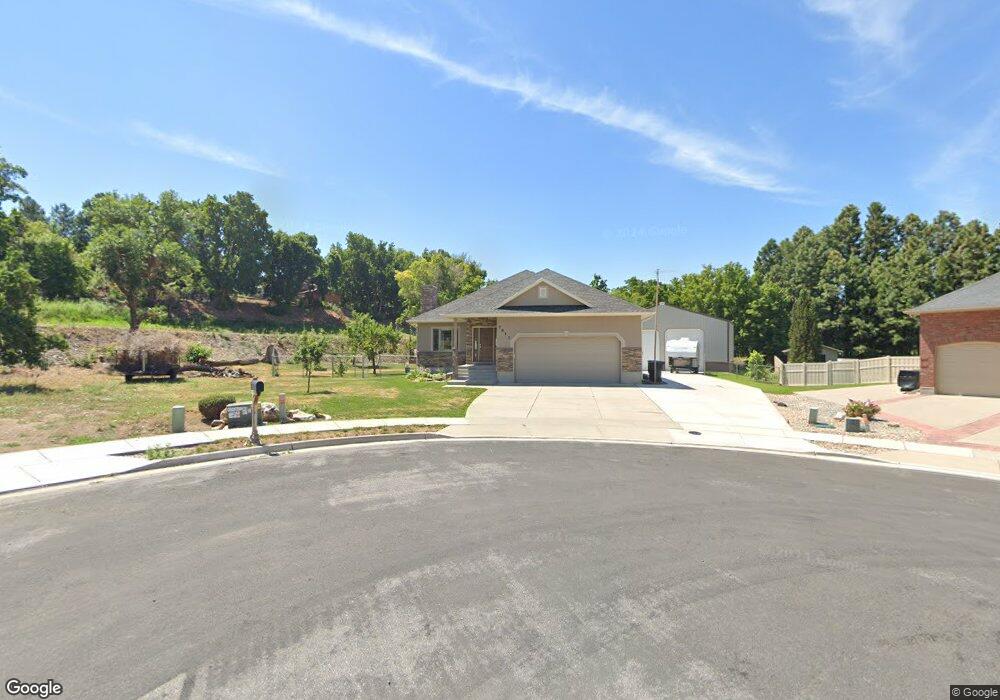
7913 S 2600 E Unit .49 South Weber, UT 84405
Estimated Value: $576,000 - $652,315
3
Beds
2
Baths
1,754
Sq Ft
$355/Sq Ft
Est. Value
About This Home
This home is located at 7913 S 2600 E Unit .49, South Weber, UT 84405 and is currently estimated at $622,079, approximately $354 per square foot. 7913 S 2600 E Unit .49 is a home with nearby schools including South Weber Elementary School, Sunset Junior High School, and Northridge High School.
Ownership History
Date
Name
Owned For
Owner Type
Purchase Details
Closed on
Apr 22, 2025
Sold by
Maw Keith M and Maw Alyson W
Bought by
Maw Family Living Trust and Maw
Current Estimated Value
Purchase Details
Closed on
Apr 19, 2006
Sold by
Simmons W Scott and Simmons Blynn
Bought by
Maw Keith M and Maw Alyson W
Home Financials for this Owner
Home Financials are based on the most recent Mortgage that was taken out on this home.
Original Mortgage
$121,500
Interest Rate
6.35%
Mortgage Type
Purchase Money Mortgage
Create a Home Valuation Report for This Property
The Home Valuation Report is an in-depth analysis detailing your home's value as well as a comparison with similar homes in the area
Home Values in the Area
Average Home Value in this Area
Purchase History
| Date | Buyer | Sale Price | Title Company |
|---|---|---|---|
| Maw Family Living Trust | -- | None Listed On Document | |
| Maw Family Living Trust | -- | None Listed On Document | |
| Maw Keith M | -- | Bonneville Title Company |
Source: Public Records
Mortgage History
| Date | Status | Borrower | Loan Amount |
|---|---|---|---|
| Previous Owner | Maw Keith M | $121,500 |
Source: Public Records
Tax History Compared to Growth
Tax History
| Year | Tax Paid | Tax Assessment Tax Assessment Total Assessment is a certain percentage of the fair market value that is determined by local assessors to be the total taxable value of land and additions on the property. | Land | Improvement |
|---|---|---|---|---|
| 2025 | $3,636 | $323,400 | $142,922 | $180,478 |
| 2024 | $3,382 | $308,000 | $118,800 | $189,200 |
| 2023 | $3,363 | $560,000 | $191,193 | $368,807 |
| 2022 | $3,285 | $331,650 | $103,518 | $228,132 |
| 2021 | $2,809 | $433,000 | $150,794 | $282,206 |
| 2020 | $2,571 | $386,000 | $138,981 | $247,019 |
| 2019 | $2,558 | $375,000 | $128,941 | $246,059 |
| 2018 | $2,284 | $352,000 | $116,400 | $235,600 |
| 2016 | $1,999 | $160,930 | $51,038 | $109,892 |
| 2015 | $2,060 | $156,915 | $51,038 | $105,877 |
| 2014 | $1,980 | $145,476 | $58,665 | $86,811 |
| 2013 | -- | $132,240 | $47,857 | $84,383 |
Source: Public Records
Map
Nearby Homes
- 303 S 2700 E
- 305 S 2700 E Unit 305
- 2681 E Sunshine Ct
- 8149 S 2425 E
- 2368 E 8300 S
- 2256 E 8240 S
- 3785 N 2675 E
- 3624 N 2775 E
- 3606 N 2775 E
- 2002 Deer Run Dr
- 3680 N 2300 E
- 3532 N Layton Ridge Dr
- 1962 E 7550 S
- 2277 E 3225 N
- 2255 E 3225 N
- 3302 N 2175 E
- 2553 E 6550 S
- 7496 S 1740 E
- 7212 S Harolds Way
- 2008 E Redtail Way
- 7913 S 2600 E
- 7913 S 2600 E Unit 7
- 7907 S 2600 E
- 7907 S 2600 E Unit 6
- 7894 S 2600 E
- 2569 E 7870 S
- 2583 E 7870 S
- 7883 S 2600 E
- 7920 S 2530 E
- 2610 Deer Run Dr
- 2622 Deer Run Dr
- 2600 Deer Run Dr
- 7932 S 2530 E
- 2636 Deer Run Dr
- 7908 S 2530 E
- 2646 Deer Run Dr
- 2557 E 7870 S Unit 8
- 2557 E 7870 S
- 7893 S 2530 E
- 2568 Deer Run Dr