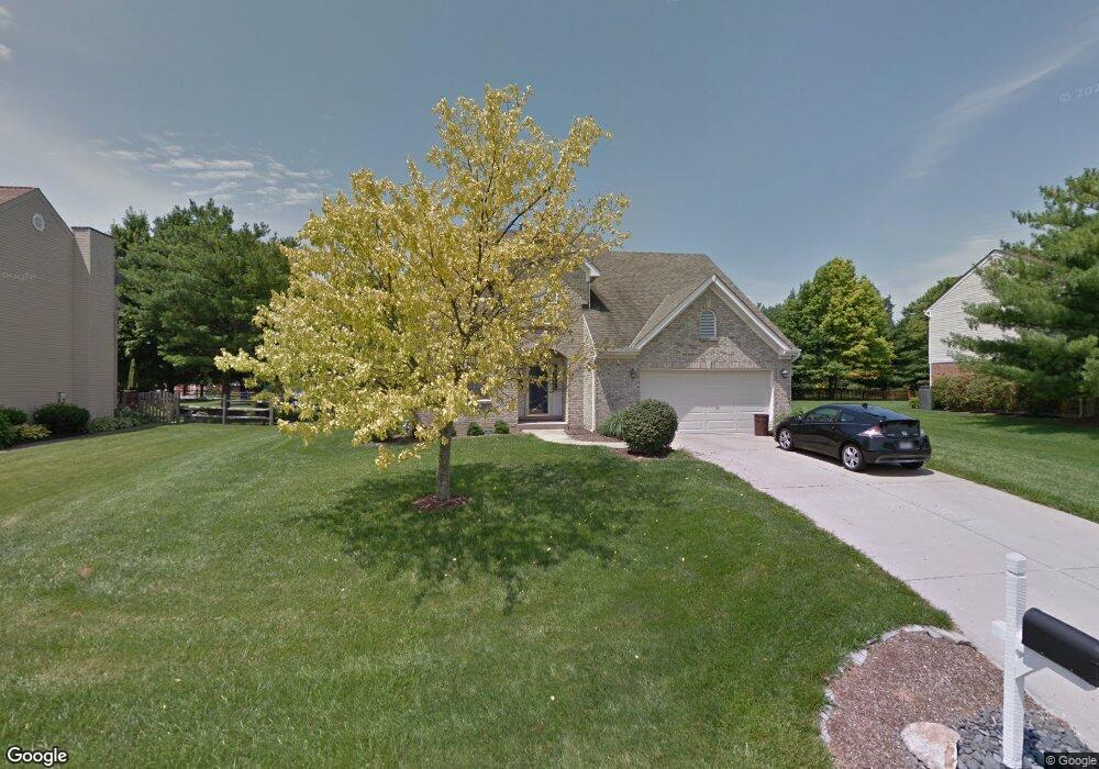
7915 Tylers Way West Chester, OH 45069
West Chester Township NeighborhoodEstimated Value: $432,000 - $475,000
4
Beds
3
Baths
2,316
Sq Ft
$196/Sq Ft
Est. Value
About This Home
This home is located at 7915 Tylers Way, West Chester, OH 45069 and is currently estimated at $453,676, approximately $195 per square foot. 7915 Tylers Way is a home located in Butler County with nearby schools including Hopewell Early Childhood School, Woodland Elementary School, and Hopewell Junior School.
Ownership History
Date
Name
Owned For
Owner Type
Purchase Details
Closed on
Jun 17, 1997
Sold by
Turner Randall G
Bought by
Bruck Donald P and Bruck Joyce
Current Estimated Value
Home Financials for this Owner
Home Financials are based on the most recent Mortgage that was taken out on this home.
Original Mortgage
$132,000
Interest Rate
8.13%
Mortgage Type
Balloon
Purchase Details
Closed on
Dec 12, 1994
Sold by
Williamsburg Properties
Bought by
Turner Randall G and Turner Sheila
Home Financials for this Owner
Home Financials are based on the most recent Mortgage that was taken out on this home.
Original Mortgage
$103,000
Interest Rate
7.5%
Mortgage Type
New Conventional
Purchase Details
Closed on
Jan 12, 1994
Create a Home Valuation Report for This Property
The Home Valuation Report is an in-depth analysis detailing your home's value as well as a comparison with similar homes in the area
Home Values in the Area
Average Home Value in this Area
Purchase History
| Date | Buyer | Sale Price | Title Company |
|---|---|---|---|
| Bruck Donald P | $165,000 | -- | |
| Turner Randall G | $143,000 | -- | |
| -- | $150,000 | -- |
Source: Public Records
Mortgage History
| Date | Status | Borrower | Loan Amount |
|---|---|---|---|
| Closed | Bruck Donald P | $132,000 | |
| Previous Owner | Turner Randall G | $103,000 |
Source: Public Records
Tax History Compared to Growth
Tax History
| Year | Tax Paid | Tax Assessment Tax Assessment Total Assessment is a certain percentage of the fair market value that is determined by local assessors to be the total taxable value of land and additions on the property. | Land | Improvement |
|---|---|---|---|---|
| 2024 | $5,711 | $117,380 | $15,620 | $101,760 |
| 2023 | $6,062 | $117,700 | $15,620 | $102,080 |
| 2022 | $5,171 | $85,400 | $15,620 | $69,780 |
| 2021 | $4,596 | $82,080 | $15,620 | $66,460 |
| 2020 | $5,060 | $82,080 | $15,620 | $66,460 |
| 2019 | $8,017 | $72,550 | $15,050 | $57,500 |
| 2018 | $4,103 | $72,550 | $15,050 | $57,500 |
| 2017 | $4,320 | $72,550 | $15,050 | $57,500 |
| 2016 | $4,084 | $66,870 | $15,050 | $51,820 |
| 2015 | $4,067 | $66,870 | $15,050 | $51,820 |
| 2014 | $4,297 | $66,870 | $15,050 | $51,820 |
| 2013 | $4,297 | $66,510 | $15,740 | $50,770 |
Source: Public Records
Map
Nearby Homes
- 7986 Tylers Way
- 6955 Grand Oaks Ct
- 921 Leslie Ct
- 873 Tradewind Dr
- 947 Olympia Dr
- 6070 Fireside Dr Unit 45
- 8430 Meadowlark Ct
- 6134 Nicholas Way
- 6142 Nicholas Way
- 6138 Nicholas Way
- 6387 Coverage Ct
- 6369 Coverage Ct
- 6403 Coverage Ct
- 6357 Coverage Ct
- 6383 Coverage Ct
- 6407 Coverage Ct
- 6375 Coverage Ct
- 6365 Coverage Ct
- 6361 Coverage Ct
- 6379 Coverage Ct
- 7925 Tylers Way
- 7905 Tylers Way
- 7918 W Gate Park
- 7935 Tylers Way
- 7908 W Gate Park
- 7895 Tylers Way
- 7906 Tylers Way
- 7928 W Gate Park
- 7896 Tylers Way
- 7945 Tylers Way
- 7916 Tylers Way
- 7926 Tylers Way
- 7938 W Gate Park
- 8205 Chestnut Hill Ct
- 7885 Tylers Way
- 7936 Tylers Way
- 7905 W Gate Park
- 8209 Chestnut Hill Ct
- 7905 W Gate Park
- 7955 Tylers Way