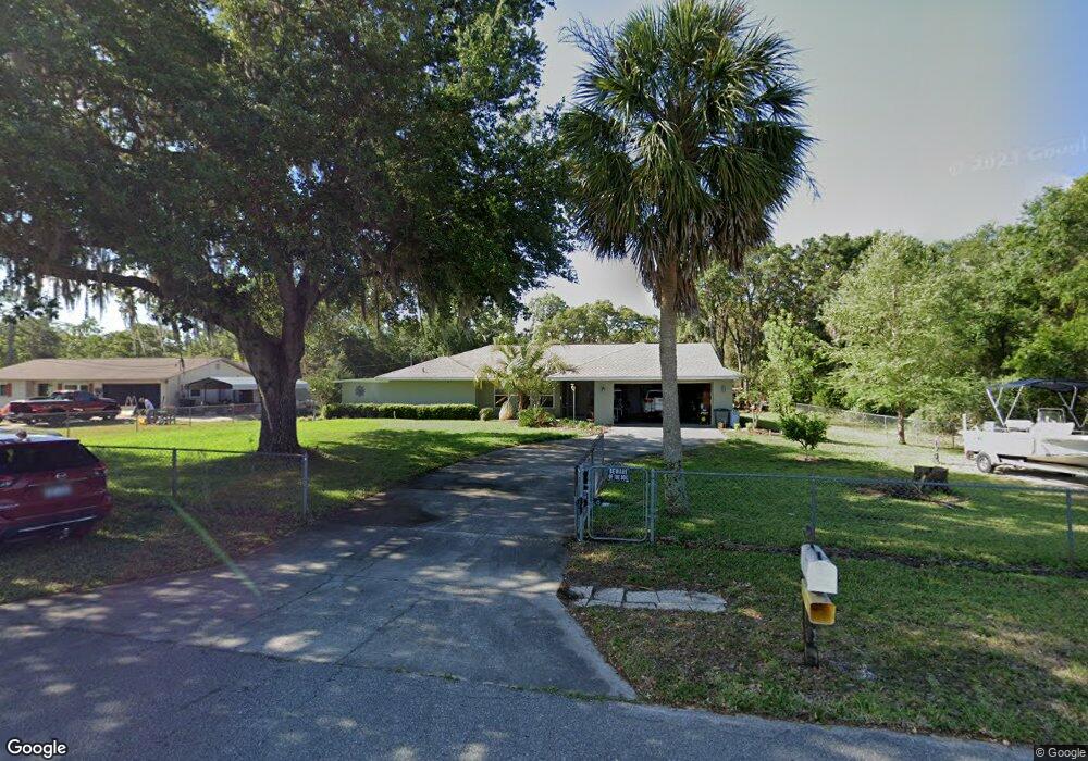
7918 W Flight Path Ct Crystal River, FL 34429
Estimated Value: $348,477 - $395,000
2
Beds
3
Baths
2,060
Sq Ft
$179/Sq Ft
Est. Value
About This Home
This home is located at 7918 W Flight Path Ct, Crystal River, FL 34429 and is currently estimated at $369,119, approximately $179 per square foot. 7918 W Flight Path Ct is a home located in Citrus County with nearby schools including Rock Crusher Elementary School, Crystal River High School, and Crystal River Middle School.
Ownership History
Date
Name
Owned For
Owner Type
Purchase Details
Closed on
Jun 2, 2020
Sold by
Smith Timothy E and Smith Judith A
Bought by
Smith Timothy E and Smith Judith A
Current Estimated Value
Purchase Details
Closed on
Feb 14, 2000
Sold by
Sentz Kendall C and Sentz Wanda L
Bought by
Smith Timothy E and Smith Judith A
Purchase Details
Closed on
Jul 1, 1995
Bought by
Smith Timothy E and Smith Judith A
Purchase Details
Closed on
Apr 1, 1984
Bought by
Smith Timothy E and Smith Judith A
Create a Home Valuation Report for This Property
The Home Valuation Report is an in-depth analysis detailing your home's value as well as a comparison with similar homes in the area
Home Values in the Area
Average Home Value in this Area
Purchase History
| Date | Buyer | Sale Price | Title Company |
|---|---|---|---|
| Smith Timothy E | -- | Attorney | |
| Smith Timothy E | $101,000 | Land Title Ins Citrus Cnty I | |
| Smith Timothy E | $85,500 | -- | |
| Smith Timothy E | $9,000 | -- |
Source: Public Records
Tax History Compared to Growth
Tax History
| Year | Tax Paid | Tax Assessment Tax Assessment Total Assessment is a certain percentage of the fair market value that is determined by local assessors to be the total taxable value of land and additions on the property. | Land | Improvement |
|---|---|---|---|---|
| 2024 | $1,473 | $127,276 | -- | -- |
| 2023 | $1,473 | $123,569 | $0 | $0 |
| 2022 | $1,383 | $119,970 | $0 | $0 |
| 2021 | $1,329 | $116,476 | $0 | $0 |
| 2020 | $1,225 | $179,890 | $9,510 | $170,380 |
| 2019 | $1,205 | $165,030 | $9,510 | $155,520 |
| 2018 | $1,175 | $125,273 | $10,440 | $114,833 |
| 2017 | $1,157 | $107,925 | $10,350 | $97,575 |
| 2016 | $1,166 | $105,705 | $12,260 | $93,445 |
| 2015 | $1,178 | $104,970 | $12,230 | $92,740 |
| 2014 | $1,249 | $106,940 | $13,490 | $93,450 |
Source: Public Records
Map
Nearby Homes
- 836 N Golf Course Dr Unit 7
- 836 N Golf Course Dr
- 603 N Golf Course Dr
- 7509 W 7 Rivers Dr
- 765 N Rhyme Point
- 7640 W Golf Club St
- 7527 W Golf Club St
- 868 N Rhyme Point
- 964 N Song Point
- 7420 W Golf Club St
- 7027 W 7 Rivers Dr
- 1146 N Jorie Terrace
- 1267 N Jorie Terrace
- 8181 W Tracy
- 8569 W Admiral Byrd Ln
- 1179 N Tessa Terrace
- 130 S Suncoast Blvd Unit 54
- 130 S Suncoast Blvd Unit M36
- 130 S Suncoast Blvd Unit M11
- 7894 W Flight Path Ct
- 7870 W Flight Path Ct
- 7947 W Venable St
- 7911 W Hillside View Ct
- 7848 W Flight Path Ct
- 7824 W Flight Path Ct
- 7847 W Seven Rivers Dr
- 138 N Golf Course Dr
- 7733 W Seven Rivers Dr
- 123 N Golf Course Dr
- 7844 W Venable St
- 133 N Golf Course Dr
- 7635 W Seven Rivers Dr
- 7630 W 7 Rivers Dr
- 7609 W Jim Ln
- 7608 W Jim Ln
- 7600 W Jim Ln
- 523 N Golf Course Dr
- 7599 W Seven Rivers Dr
- 7589 W Fairview Ct