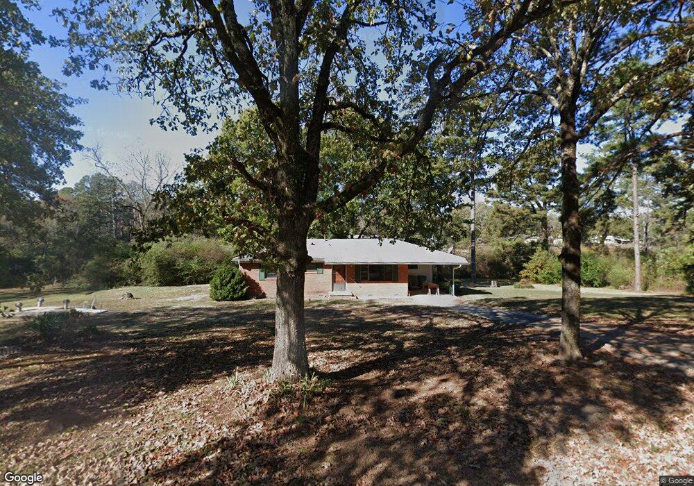
7919 Circle r Rd North Little Rock, AR 72118
Estimated Value: $107,169 - $141,000
--
Bed
1
Bath
1,133
Sq Ft
$111/Sq Ft
Est. Value
About This Home
This home is located at 7919 Circle r Rd, North Little Rock, AR 72118 and is currently estimated at $126,292, approximately $111 per square foot. 7919 Circle r Rd is a home located in Pulaski County with nearby schools including Oak Grove Elementary School, Maumelle Middle School, and Maumelle High School.
Ownership History
Date
Name
Owned For
Owner Type
Purchase Details
Closed on
Feb 17, 2015
Sold by
Herzog John J and Herzog Jennifer
Bought by
J H Enterprises Llc
Current Estimated Value
Home Financials for this Owner
Home Financials are based on the most recent Mortgage that was taken out on this home.
Original Mortgage
$48,000
Interest Rate
3.78%
Mortgage Type
New Conventional
Purchase Details
Closed on
Oct 30, 2001
Sold by
Henson Barbara Price and Henson William R
Bought by
Herzog John J
Home Financials for this Owner
Home Financials are based on the most recent Mortgage that was taken out on this home.
Original Mortgage
$74,908
Interest Rate
6.71%
Mortgage Type
FHA
Create a Home Valuation Report for This Property
The Home Valuation Report is an in-depth analysis detailing your home's value as well as a comparison with similar homes in the area
Home Values in the Area
Average Home Value in this Area
Purchase History
| Date | Buyer | Sale Price | Title Company |
|---|---|---|---|
| J H Enterprises Llc | -- | Standard Abstract & Title Co | |
| Herzog John J | -- | American Abstract & Title Co | |
| Herzog John J | $76,000 | American Abstract & Title Co |
Source: Public Records
Mortgage History
| Date | Status | Borrower | Loan Amount |
|---|---|---|---|
| Closed | J H Enterprises Llc | $48,000 | |
| Previous Owner | Herzog John J | $74,908 |
Source: Public Records
Tax History Compared to Growth
Tax History
| Year | Tax Paid | Tax Assessment Tax Assessment Total Assessment is a certain percentage of the fair market value that is determined by local assessors to be the total taxable value of land and additions on the property. | Land | Improvement |
|---|---|---|---|---|
| 2025 | $1,083 | $21,731 | $4,394 | $17,337 |
| 2024 | $929 | $21,731 | $4,394 | $17,337 |
| 2023 | $929 | $21,731 | $4,394 | $17,337 |
| 2022 | $1,001 | $21,731 | $4,394 | $17,337 |
| 2021 | $899 | $15,240 | $1,690 | $13,550 |
| 2020 | $899 | $15,240 | $1,690 | $13,550 |
| 2019 | $774 | $15,240 | $1,690 | $13,550 |
| 2018 | $774 | $15,240 | $1,690 | $13,550 |
| 2017 | $774 | $15,240 | $1,690 | $13,550 |
| 2016 | $1,138 | $22,400 | $5,070 | $17,330 |
| 2015 | $728 | $14,340 | $5,070 | $9,270 |
| 2014 | $728 | $12,140 | $5,070 | $7,070 |
Source: Public Records
Map
Nearby Homes
- 5503 Taril Ln
- 7923 Macarthur Dr
- 8016 Highway 365
- 5901 Kelly Rd
- 00 Trapp Rd
- 5119 Vaughn Rd
- 0 Macarthur Unit 25004179
- 4901 Vaughn Rd
- 30 Silver Ridge Cove
- 7213 Westwind Dr
- 29 Prospect Trail
- 0 Westwind Dr Unit 25030537
- 5517 McMurtrey Dr
- 5314 McMurtrey Dr
- 6824 Drew Ln
- 95 Prospect Trail
- 7417 Service Rd
- 0 Rivermist Pointe Dr Unit 23019601
- 7423 Service Rd
- 00 Interstate 40
- 0 Circle r Rd
- 8006 Circle r Rd
- 7914 Circle r Rd
- 8009 Circle r Rd
- 7905 Circle r Rd
- 8010 Circle r Rd
- 6711 Kelly Rd
- 7821 Circle r Rd
- 6921 Kelly Rd
- 00 Circle r Rd
- 6522 Kelly Rd
- 6925 Kelly Rd
- 6904 Kelly Rd
- 6706 Kelly Rd
- 6623 Kelly Rd
- 8123 Abb Davis Rd
- 6918 Kelly Rd
- 7001 Kelly Rd
- 6700 Kelly Rd
- 8119 Abb Davis Rd