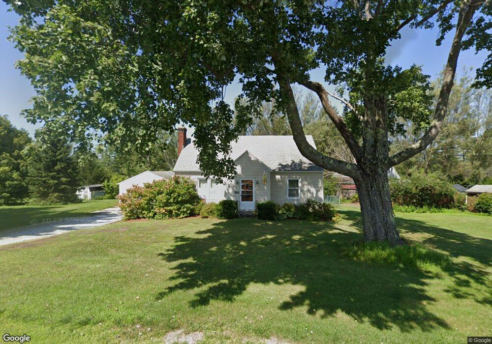
792 Barker Rd Pittsfield, MA 01201
Estimated Value: $291,782 - $330,000
4
Beds
2
Baths
1,346
Sq Ft
$230/Sq Ft
Est. Value
About This Home
This home is located at 792 Barker Rd, Pittsfield, MA 01201 and is currently estimated at $310,196, approximately $230 per square foot. 792 Barker Rd is a home located in Berkshire County with nearby schools including Stearns Elementary School, John T. Reid Middle School, and Taconic High School.
Ownership History
Date
Name
Owned For
Owner Type
Purchase Details
Closed on
Sep 6, 2012
Sold by
Manzolini Jeremy W and Manzolini Jody L
Bought by
Kurowski Laura J
Current Estimated Value
Home Financials for this Owner
Home Financials are based on the most recent Mortgage that was taken out on this home.
Original Mortgage
$148,410
Outstanding Balance
$101,715
Interest Rate
3.52%
Mortgage Type
New Conventional
Estimated Equity
$208,481
Purchase Details
Closed on
May 21, 2001
Sold by
Manzolini Eunice C and Horton Helen V
Bought by
Manzolini Jeremy W and Manzolini Jody L
Home Financials for this Owner
Home Financials are based on the most recent Mortgage that was taken out on this home.
Original Mortgage
$74,400
Interest Rate
7.03%
Mortgage Type
Purchase Money Mortgage
Create a Home Valuation Report for This Property
The Home Valuation Report is an in-depth analysis detailing your home's value as well as a comparison with similar homes in the area
Home Values in the Area
Average Home Value in this Area
Purchase History
| Date | Buyer | Sale Price | Title Company |
|---|---|---|---|
| Kurowski Laura J | $153,000 | -- | |
| Manzolini Jeremy W | $80,000 | -- | |
| Manzolini Jeremy W | $80,000 | -- |
Source: Public Records
Mortgage History
| Date | Status | Borrower | Loan Amount |
|---|---|---|---|
| Open | Kurowski Laura J | $148,410 | |
| Closed | Kurowski Laura J | $148,410 | |
| Previous Owner | Manzolini Jeremy W | $74,400 |
Source: Public Records
Tax History
| Year | Tax Paid | Tax Assessment Tax Assessment Total Assessment is a certain percentage of the fair market value that is determined by local assessors to be the total taxable value of land and additions on the property. | Land | Improvement |
|---|---|---|---|---|
| 2025 | $3,999 | $222,900 | $70,000 | $152,900 |
| 2024 | $3,832 | $207,700 | $70,000 | $137,700 |
| 2023 | $3,624 | $197,800 | $70,000 | $127,800 |
| 2022 | $3,354 | $180,700 | $70,000 | $110,700 |
| 2021 | $3,157 | $164,000 | $70,000 | $94,000 |
| 2020 | $2,915 | $147,900 | $57,000 | $90,900 |
| 2019 | $2,762 | $142,200 | $53,000 | $89,200 |
| 2018 | $2,807 | $140,300 | $53,000 | $87,300 |
| 2017 | $2,638 | $134,400 | $50,000 | $84,400 |
| 2016 | $2,521 | $134,400 | $50,000 | $84,400 |
| 2015 | $2,427 | $134,400 | $50,000 | $84,400 |
Source: Public Records
Map
Nearby Homes
- 1 Clarkson Ave
- 42 Bryant St
- 103 Stearns Ave
- 0 Jones Ave
- 90 Jones Ave
- 551 Tamarack Rd
- 728 W Housatonic St
- 497 Gale Ave
- 25 Alpine Trail Unit 6-A
- 499 Gale Ave
- 33 Alpine Trail
- 103 Alpine Trail
- 158 Eleanor Rd
- 208 Jason St
- 145 Velma Ave
- 2 Amy Ct
- 2 Amy Ct Unit 2
- Lot 25 Old Farm Ln
- Lot #26 Old Farm Ln
- Lot 24 Old Farm Ln
Your Personal Tour Guide
Ask me questions while you tour the home.