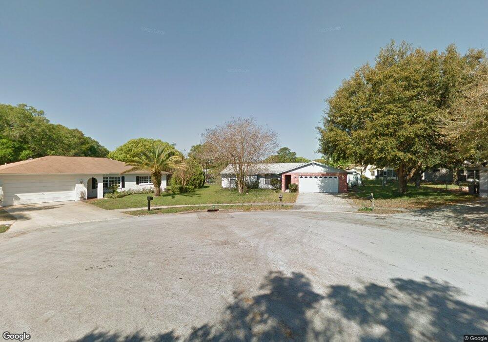
7921 Cameron Cay Ct New Port Richey, FL 34653
Estimated Value: $333,000 - $354,939
4
Beds
2
Baths
1,828
Sq Ft
$190/Sq Ft
Est. Value
About This Home
This home is located at 7921 Cameron Cay Ct, New Port Richey, FL 34653 and is currently estimated at $346,985, approximately $189 per square foot. 7921 Cameron Cay Ct is a home located in Pasco County with nearby schools including Calusa Elementary School, Chasco Middle School, and Gulf High School.
Ownership History
Date
Name
Owned For
Owner Type
Purchase Details
Closed on
May 13, 2010
Sold by
Latif Edmund
Bought by
Matos Miriam
Current Estimated Value
Home Financials for this Owner
Home Financials are based on the most recent Mortgage that was taken out on this home.
Original Mortgage
$123,339
Outstanding Balance
$82,710
Interest Rate
5.06%
Mortgage Type
FHA
Estimated Equity
$264,275
Create a Home Valuation Report for This Property
The Home Valuation Report is an in-depth analysis detailing your home's value as well as a comparison with similar homes in the area
Home Values in the Area
Average Home Value in this Area
Purchase History
| Date | Buyer | Sale Price | Title Company |
|---|---|---|---|
| Matos Miriam | $125,000 | Pappas Law & Title |
Source: Public Records
Mortgage History
| Date | Status | Borrower | Loan Amount |
|---|---|---|---|
| Open | Matos Miriam | $123,339 |
Source: Public Records
Tax History Compared to Growth
Tax History
| Year | Tax Paid | Tax Assessment Tax Assessment Total Assessment is a certain percentage of the fair market value that is determined by local assessors to be the total taxable value of land and additions on the property. | Land | Improvement |
|---|---|---|---|---|
| 2025 | $3,914 | $125,970 | -- | -- |
| 2024 | $3,914 | $122,420 | -- | -- |
| 2023 | $3,845 | $118,860 | $53,883 | $64,977 |
| 2022 | $3,745 | $115,400 | $0 | $0 |
| 2021 | $3,708 | $112,040 | $42,349 | $69,691 |
| 2020 | $3,681 | $110,500 | $22,781 | $87,719 |
| 2019 | $1,275 | $108,020 | $0 | $0 |
| 2018 | $1,244 | $106,009 | $0 | $0 |
| 2017 | $1,232 | $106,009 | $0 | $0 |
| 2016 | $1,146 | $101,693 | $0 | $0 |
| 2015 | $1,160 | $100,986 | $0 | $0 |
| 2014 | $1,123 | $103,654 | $20,981 | $82,673 |
Source: Public Records
Map
Nearby Homes
- 7924 Royal Stewart Dr
- 7925 Foxwood Dr
- 7841 Royal Stewart Dr
- 7835 Crosier Ct
- 7807 Summertree Ln
- 7518 Sequoia Dr
- 7504 Sequoia Dr
- 7525 Birdwood Ct
- 7826 Kinross Dr
- 7624 Summertree Ln
- 8010 Buttonball Ln
- 7449 Live Oak Ln
- 7628 Valley Ct Unit 6B
- 7612 Valley Ct
- 7706 Cherrytree Ln
- 7620 Cherrytree Ln
- 7812 Cherrytree Ln
- 8120 Buttonball Ln
- 8225 Arevee Dr Unit 819
- 8225 Arevee Dr Unit 334
- 7902 Royal Stewart Dr
- 7920 Cameron Cay Ct
- 7910 Royal Stewart Dr
- 7925 Cameron Cay Ct
- 7916 Royal Stewart Dr
- 7850 Royal Stewart Dr
- 7844 Royal Stewart Dr
- 7926 Cameron Cay Ct
- 7911 Foxwood Dr
- 7903 Foxwood Dr
- 7931 Cameron Cay Ct
- 7917 Foxwood Dr
- 7930 Royal Stewart Dr
- 7851 Foxwood Dr
- 7911 Royal Stewart Dr
- 7930 Cameron Cay Ct
- 7903 Royal Stewart Dr
- 7917 Royal Stewart Dr
- 7720 Crosier Ct
- 7836 Royal Stewart Dr