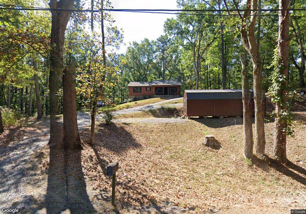
7921 Highway 53 W Jasper, GA 30143
Estimated Value: $189,000 - $390,000
--
Bed
2
Baths
1,344
Sq Ft
$214/Sq Ft
Est. Value
About This Home
This home is located at 7921 Highway 53 W, Jasper, GA 30143 and is currently estimated at $288,025, approximately $214 per square foot. 7921 Highway 53 W is a home located in Pickens County with nearby schools including Hill City Elementary School, Pickens County Middle School, and Pickens County High School.
Ownership History
Date
Name
Owned For
Owner Type
Purchase Details
Closed on
Mar 4, 2005
Sold by
Mullins Gregory
Bought by
Chastain Tammie S
Current Estimated Value
Home Financials for this Owner
Home Financials are based on the most recent Mortgage that was taken out on this home.
Original Mortgage
$76,000
Interest Rate
5.6%
Mortgage Type
New Conventional
Purchase Details
Closed on
Oct 4, 2002
Sold by
Mullins Gret L
Bought by
Mullins Gregory
Purchase Details
Closed on
Feb 18, 1988
Sold by
Thomason Eugene
Bought by
Mullins Greg L
Create a Home Valuation Report for This Property
The Home Valuation Report is an in-depth analysis detailing your home's value as well as a comparison with similar homes in the area
Home Values in the Area
Average Home Value in this Area
Purchase History
| Date | Buyer | Sale Price | Title Company |
|---|---|---|---|
| Chastain Tammie S | $95,000 | -- | |
| Mullins Gregory | -- | -- | |
| Mullins Greg L | $3,000 | -- |
Source: Public Records
Mortgage History
| Date | Status | Borrower | Loan Amount |
|---|---|---|---|
| Closed | Chastain Tammie S | $76,000 |
Source: Public Records
Tax History Compared to Growth
Tax History
| Year | Tax Paid | Tax Assessment Tax Assessment Total Assessment is a certain percentage of the fair market value that is determined by local assessors to be the total taxable value of land and additions on the property. | Land | Improvement |
|---|---|---|---|---|
| 2024 | $631 | $36,883 | $8,496 | $28,387 |
| 2023 | $648 | $36,883 | $8,496 | $28,387 |
| 2022 | $648 | $36,883 | $8,496 | $28,387 |
| 2021 | $695 | $36,883 | $8,496 | $28,387 |
| 2020 | $716 | $36,883 | $8,496 | $28,387 |
| 2019 | $732 | $36,883 | $8,496 | $28,387 |
| 2018 | $739 | $36,883 | $8,496 | $28,387 |
| 2017 | $751 | $36,883 | $8,496 | $28,387 |
| 2016 | $755 | $36,556 | $8,170 | $28,387 |
| 2015 | $738 | $36,556 | $8,170 | $28,387 |
| 2014 | $739 | $36,556 | $8,170 | $28,387 |
| 2013 | -- | $36,556 | $8,169 | $28,386 |
Source: Public Records
Map
Nearby Homes
- 344 Cain Trail
- 19 Thomason Farm Dr
- 110 Jerusalem Farms Dr
- 126 Jerusalem Farms Dr
- 310 Comet Ln
- Lot 1 Thompson Ln
- 0 Carver Mill Rd Unit 7670227
- 0 Carver Mill Rd Unit 7670211
- 6472 Highway 53
- 200 Willow Ln
- 681 Mullinax Rd
- 616 Gibson Trail
- 629 Georgia 136 Connector
- Lot 4 Jerusalem Church Rd
- 88 Hill City Trail
- 2075 Jerusalem Church Rd
- 701 Tatum Rd
- 280 Matthews Rd
- 69 Blakes Ln
- 8697 Georgia 136
- 7 Arrowhead Way
- 7950 Highway 53 W
- 129 Arrowhead Way
- 35 Cain Trail
- 0 Cain Trail Unit 5342659
- 000 Cain Trail
- 8032 Highway 53 W
- 7759 Highway 53 W
- 7611 Highway 53 W
- 2634 Arrowhead
- 8090 Highway 53 W
- 182 Arrowhead Way
- 129 Travis Ln
- 8187 Highway 53 W
- 219 Arrowhead Way
- 7730 Highway 53 W
- 8190 Highway 53 W
- 271 Cain Trail
- 281 Cain Trail
- 0 Hwy 53 Lots 4 & 5 W Unit 7068836