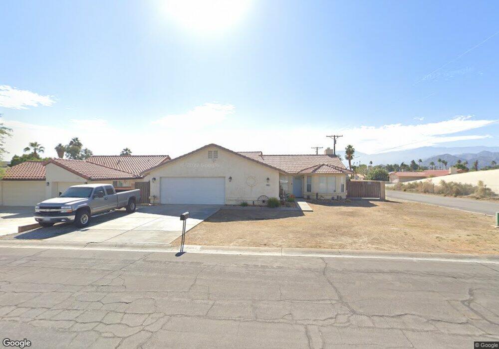
79251 Spalding Dr Bermuda Dunes, CA 92203
Estimated Value: $500,000 - $582,000
About This Home
This home is located at 79251 Spalding Dr, Bermuda Dunes, CA 92203 and is currently estimated at $539,083, approximately $309 per square foot. 79251 Spalding Dr is a home located in Riverside County with nearby schools including James Monroe Elementary School, Colonel Mitchell Paige Middle School, and Palm Desert High School.
Ownership History
We collect this data history from publicly available records. To have your information removed, we recommend requesting removal directly through your county’s website.
Purchase Details
Home Financials for this Owner
Home Financials are based on the most recent Mortgage that was taken out on this home.Purchase Details
Purchase Details
Home Financials for this Owner
Home Financials are based on the most recent Mortgage that was taken out on this home.Purchase Details
Home Financials for this Owner
Home Financials are based on the most recent Mortgage that was taken out on this home.Purchase Details
Purchase Details
Home Financials for this Owner
Home Financials are based on the most recent Mortgage that was taken out on this home.Purchase Details
Home Financials for this Owner
Home Financials are based on the most recent Mortgage that was taken out on this home.Purchase Details
Home Financials for this Owner
Home Financials are based on the most recent Mortgage that was taken out on this home.Purchase Details
Home Financials for this Owner
Home Financials are based on the most recent Mortgage that was taken out on this home.Purchase Details
Home Financials for this Owner
Home Financials are based on the most recent Mortgage that was taken out on this home.Purchase Details
Home Financials for this Owner
Home Financials are based on the most recent Mortgage that was taken out on this home.Purchase Details
Home Financials for this Owner
Home Financials are based on the most recent Mortgage that was taken out on this home.Purchase Details
Home Financials for this Owner
Home Financials are based on the most recent Mortgage that was taken out on this home.Home Values in the Area
Average Home Value in this Area
Purchase History
We collect this data history from publicly available records. To have your information removed, we recommend requesting removal directly through your county’s website.
| Date | Buyer | Sale Price | Title Company |
|---|---|---|---|
| -- | First American Title Insurance | ||
| -- | Wfg National Title | ||
| -- | None Available | ||
| -- | None Available | ||
| $190,000 | Ticor Title Company | ||
| $206,125 | Landsafe Title | ||
| -- | Southland Title Inland Empir | ||
| $339,000 | Southland Title Inland Empir | ||
| -- | -- | ||
| -- | Lawyers Title Company | ||
| $169,500 | Orange Coast Title | ||
| -- | Commonwealth Land Title Co | ||
| -- | Orange Coast Title | ||
| $28,000 | Orange Coast Title |
Mortgage History
We collect this data history from publicly available records. To have your information removed, we recommend requesting removal directly through your county’s website.
| Date | Status | Borrower | Loan Amount |
|---|---|---|---|
| Open | $205,000 | ||
| Previous Owner | $164,195 | ||
| Previous Owner | $186,558 | ||
| Previous Owner | $271,200 | ||
| Previous Owner | $232,750 | ||
| Previous Owner | $201,000 | ||
| Previous Owner | $164,648 | ||
| Previous Owner | $95,000 |
Tax History
We collect this data history from publicly available records. To have your information removed, we recommend requesting removal directly through your county’s website.
| Year | Tax Paid | Tax Assessment Tax Assessment Total Assessment is a certain percentage of the fair market value that is determined by local assessors to be the total taxable value of land and additions on the property. | Land | Improvement |
|---|---|---|---|---|
| 2025 | $2,886 | $244,657 | $61,158 | $183,499 |
| 2023 | $2,886 | $235,158 | $58,784 | $176,374 |
| 2022 | $2,771 | $230,548 | $57,632 | $172,916 |
| 2021 | $2,716 | $226,028 | $56,502 | $169,526 |
| 2020 | $2,664 | $223,711 | $55,923 | $167,788 |
| 2019 | $2,610 | $219,326 | $54,827 | $164,499 |
| 2018 | $2,558 | $215,026 | $53,754 | $161,272 |
| 2017 | $2,502 | $210,810 | $52,700 | $158,110 |
| 2016 | $2,438 | $206,677 | $51,667 | $155,010 |
| 2015 | $2,444 | $203,575 | $50,892 | $152,683 |
| 2014 | $2,401 | $199,589 | $49,896 | $149,693 |
Map
- 79271 Spalding Dr
- 41868 Volare Ct
- 41855 Volare Ct
- 41879 Volare Ct
- 41796 Volare Ct
- 41372 Gaslight Ave
- 79060 Lake Club Dr
- 41252 Gaslight Ave
- 79421 Avenue 42
- 79135 Avenue 41
- 79040 Cliff St
- 41563 Pedro Buff Dr
- 42518 Capri Dr
- 42567 Bellagio Dr
- 78901 Runaway Bay Dr
- 78650 Avenue 42 Unit 1602
- 78650 Avenue 42 Unit 811
- 78650 Avenue 42 Unit 1901
- 78650 Avenue 42 Unit 1515
- 78650 Avenue 42 Unit 207
- 79261 Spalding Dr
- 41740 Hopewell Ave
- 41760 Hopewell Ave
- 79250 Spalding Dr
- 79260 Spalding Dr
- 79281 Spalding Dr
- 41761 Hopewell Ave
- 79270 Spalding Dr
- 41780 Hopewell Ave
- 0 Hopewell Unit SB15122971
- 0 Hopewell Unit 219117354DA
- 0 Hopewell Unit 21433127DA
- 0 Hopewell Unit 21375100DA
- 79280 Spalding Dr
- 41781 Hopewell Ave
- 79291 Spalding Dr
- 79294 Aruba Ct
- 41820 Volare Ct
- 79270 Port Royal Ave
- 41650 Hopewell Ave
Ask me questions while you tour the home.