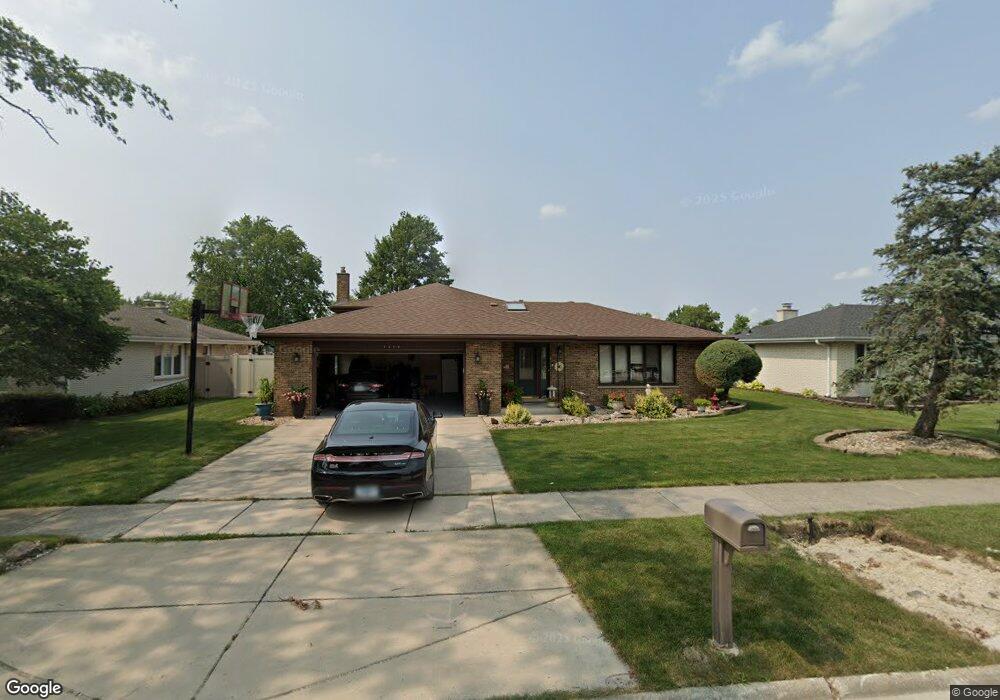
7928 Palm Ct Orland Park, IL 60462
Silver Lake South NeighborhoodEstimated Value: $423,000 - $467,000
4
Beds
4
Baths
1,853
Sq Ft
$237/Sq Ft
Est. Value
About This Home
This home is located at 7928 Palm Ct, Orland Park, IL 60462 and is currently estimated at $439,206, approximately $237 per square foot. 7928 Palm Ct is a home located in Cook County with nearby schools including Arnold W Kruse Education Center, Central Middle School, and Victor J Andrew High School.
Ownership History
Date
Name
Owned For
Owner Type
Purchase Details
Closed on
Sep 17, 2002
Sold by
Tammaro Michael
Bought by
Prairie Bank & Trust Company and Trust #02-111
Current Estimated Value
Purchase Details
Closed on
Apr 18, 2002
Sold by
Tammaro James W and Tammaro Nancy A
Bought by
Tammaro Michael
Home Financials for this Owner
Home Financials are based on the most recent Mortgage that was taken out on this home.
Original Mortgage
$191,250
Interest Rate
7.13%
Create a Home Valuation Report for This Property
The Home Valuation Report is an in-depth analysis detailing your home's value as well as a comparison with similar homes in the area
Home Values in the Area
Average Home Value in this Area
Purchase History
| Date | Buyer | Sale Price | Title Company |
|---|---|---|---|
| Prairie Bank & Trust Company | -- | -- | |
| Tammaro Michael | -- | -- |
Source: Public Records
Mortgage History
| Date | Status | Borrower | Loan Amount |
|---|---|---|---|
| Previous Owner | Tammaro Michael | $191,250 |
Source: Public Records
Tax History Compared to Growth
Tax History
| Year | Tax Paid | Tax Assessment Tax Assessment Total Assessment is a certain percentage of the fair market value that is determined by local assessors to be the total taxable value of land and additions on the property. | Land | Improvement |
|---|---|---|---|---|
| 2024 | $8,599 | $35,414 | $7,026 | $28,388 |
| 2023 | $6,288 | $35,414 | $7,026 | $28,388 |
| 2022 | $6,288 | $23,788 | $6,183 | $17,605 |
| 2021 | $6,219 | $23,786 | $6,182 | $17,604 |
| 2020 | $6,329 | $23,786 | $6,182 | $17,604 |
| 2019 | $6,312 | $24,224 | $5,620 | $18,604 |
| 2018 | $5,746 | $24,224 | $5,620 | $18,604 |
| 2017 | $5,520 | $24,224 | $5,620 | $18,604 |
| 2016 | $7,365 | $25,167 | $5,058 | $20,109 |
| 2015 | $7,201 | $25,167 | $5,058 | $20,109 |
| 2014 | $6,915 | $25,167 | $5,058 | $20,109 |
| 2013 | $6,524 | $25,107 | $5,058 | $20,049 |
Source: Public Records
Map
Nearby Homes
- 15229 Bunker Dr
- 7922 Sycamore Dr
- 7712 Sequoia Ct
- 7825 Braeloch Ct
- 15024 S 81st Ave
- 15543 Brassie Dr
- 8215 Saint Andrews Dr
- 15426 S 82nd Ave
- 7617 Sycamore Dr
- 7991 Forestview Dr
- 7842 Sea Pines Rd
- 14939 S 81st Ct
- 15346 Heather Ct
- 7820 Forestview Dr
- 15337 Heather Ct
- 7747 Cashew Dr
- 15624 Sunset Ridge Dr
- 15713 Brassie Ct Unit 1S
- 15349 Catalina Dr Unit 6
- 15702 Deerfield Ct Unit 2S
- 7936 Palm Ct
- 7920 Palm Ct
- 7944 Palm Ct
- 7927 W Ponderosa Ct
- 7935 W Ponderosa Ct
- 7919 W Ponderosa Ct
- 7945 W Ponderosa Ct
- 7943 W Ponderosa Ct
- 7919 Palm Ct
- 7927 Palm Ct
- 7911 Palm Ct
- 7950 Palm Ct
- 7935 Palm Ct
- 15265 Primrose Ln
- 15305 Primrose Ln
- 15259 Primrose Ln
- 7949 W Ponderosa Ct
- 15313 Primrose Ln
- 7943 Palm Ct
- 15251 Primrose Ln