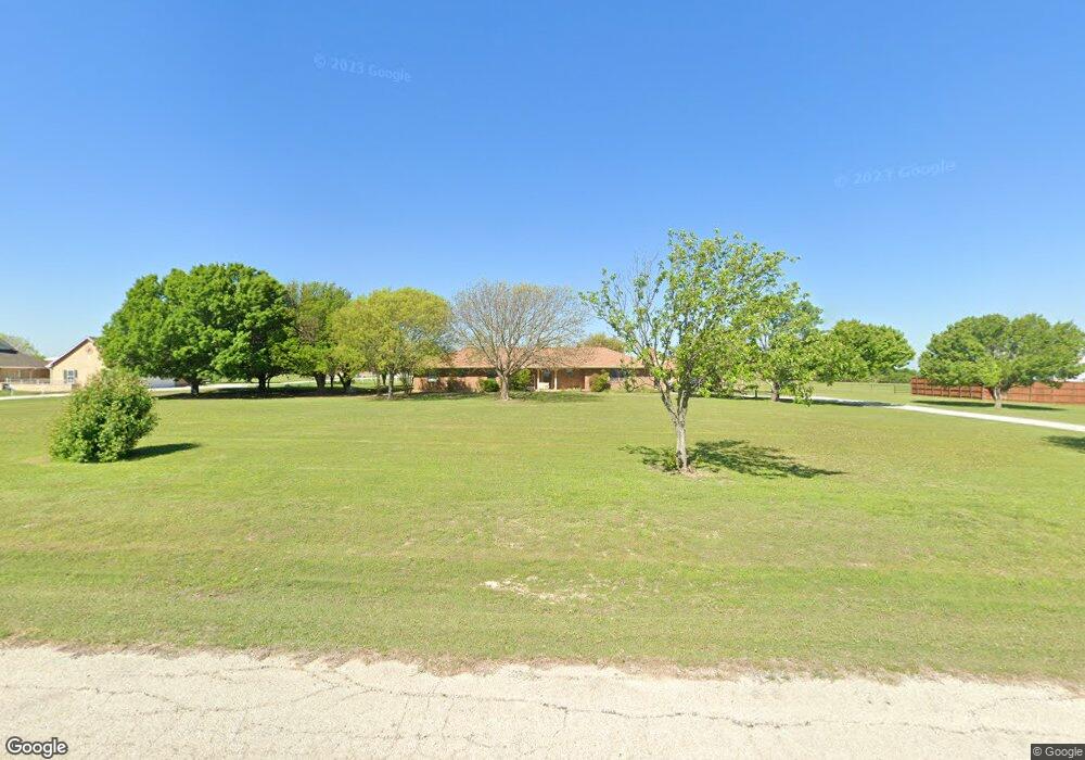
7929 Airfield Dr Sanger, TX 76266
Estimated Value: $384,000 - $674,000
3
Beds
2
Baths
2,076
Sq Ft
$259/Sq Ft
Est. Value
About This Home
This home is located at 7929 Airfield Dr, Sanger, TX 76266 and is currently estimated at $538,669, approximately $259 per square foot. 7929 Airfield Dr is a home located in Denton County with nearby schools including Chisholm Trail Elementary School, Clear Creek Intermediate School, and Sanger Sixth Grade Campus.
Ownership History
Date
Name
Owned For
Owner Type
Purchase Details
Closed on
Jun 21, 2000
Sold by
Brolsma John and Brolsma Lorraine
Bought by
Grandey Michael and Grandey Betty
Current Estimated Value
Home Financials for this Owner
Home Financials are based on the most recent Mortgage that was taken out on this home.
Original Mortgage
$91,000
Interest Rate
8.5%
Mortgage Type
Purchase Money Mortgage
Create a Home Valuation Report for This Property
The Home Valuation Report is an in-depth analysis detailing your home's value as well as a comparison with similar homes in the area
Home Values in the Area
Average Home Value in this Area
Purchase History
| Date | Buyer | Sale Price | Title Company |
|---|---|---|---|
| Grandey Michael | -- | -- |
Source: Public Records
Mortgage History
| Date | Status | Borrower | Loan Amount |
|---|---|---|---|
| Closed | Grandey Michael | $91,000 |
Source: Public Records
Tax History Compared to Growth
Tax History
| Year | Tax Paid | Tax Assessment Tax Assessment Total Assessment is a certain percentage of the fair market value that is determined by local assessors to be the total taxable value of land and additions on the property. | Land | Improvement |
|---|---|---|---|---|
| 2025 | $1,046 | $572,394 | $188,799 | $409,275 |
| 2024 | $7,063 | $520,358 | $0 | $0 |
| 2023 | $1,052 | $473,053 | $188,799 | $458,685 |
| 2022 | $7,349 | $443,096 | $183,568 | $303,094 |
| 2021 | $5,295 | $363,341 | $101,728 | $261,613 |
| 2020 | $5,291 | $336,785 | $101,728 | $247,272 |
| 2019 | $4,908 | $299,907 | $101,728 | $238,272 |
| 2018 | $4,176 | $253,254 | $60,544 | $192,710 |
| 2017 | $4,237 | $255,163 | $60,544 | $197,670 |
| 2016 | $3,685 | $221,936 | $45,056 | $176,880 |
| 2015 | $2,993 | $213,000 | $45,056 | $167,944 |
| 2013 | -- | $213,000 | $45,056 | $167,944 |
Source: Public Records
Map
Nearby Homes
- 6807 Sam Bass Rd
- 6552 Private Rd 6601
- TBD Michael Rd
- 6044 Mango Dr
- 6033 Mango Dr
- 8875 Fm 2450
- 6048 Mango Dr
- 6400 Ridgerock Dr
- 14158 Crest View Rd
- 6221 Deer Run Rd
- 6568 Michael Rd
- . Fm 2450 & Indian Trail
- 6501 Indian Trail
- TBD Fm 2164
- TBD Switzer Rd
- TBD Gregory Rd
- 7384 Rector Rd
- 7236 Davidson Rd
- 6713 Mustang Trail
- 5990 Farm To Market 455 W
- 7915 Airfield Dr
- 7993 Airfield Dr
- 8096 Airfield Dr
- 8018 Airfield Dr
- 8045 Airfield Dr
- 7911 Airfield Dr
- 8156 Airfield Dr
- 7837 Airfield Dr
- 6201 Sam Bass Rd
- 6265 Sam Bass Rd
- 7922 Airfield Dr
- 13543 Airfield Dr
- 5343 Down Wind Ln
- 7870 Airfield Dr
- 13535 Airfield Dr
- 5336 Down Wind Ln
- 7 Sam Bass Rd
- 6 Sam Bass Rd
- 5 Sam Bass Rd
- 4 Sam Bass Rd