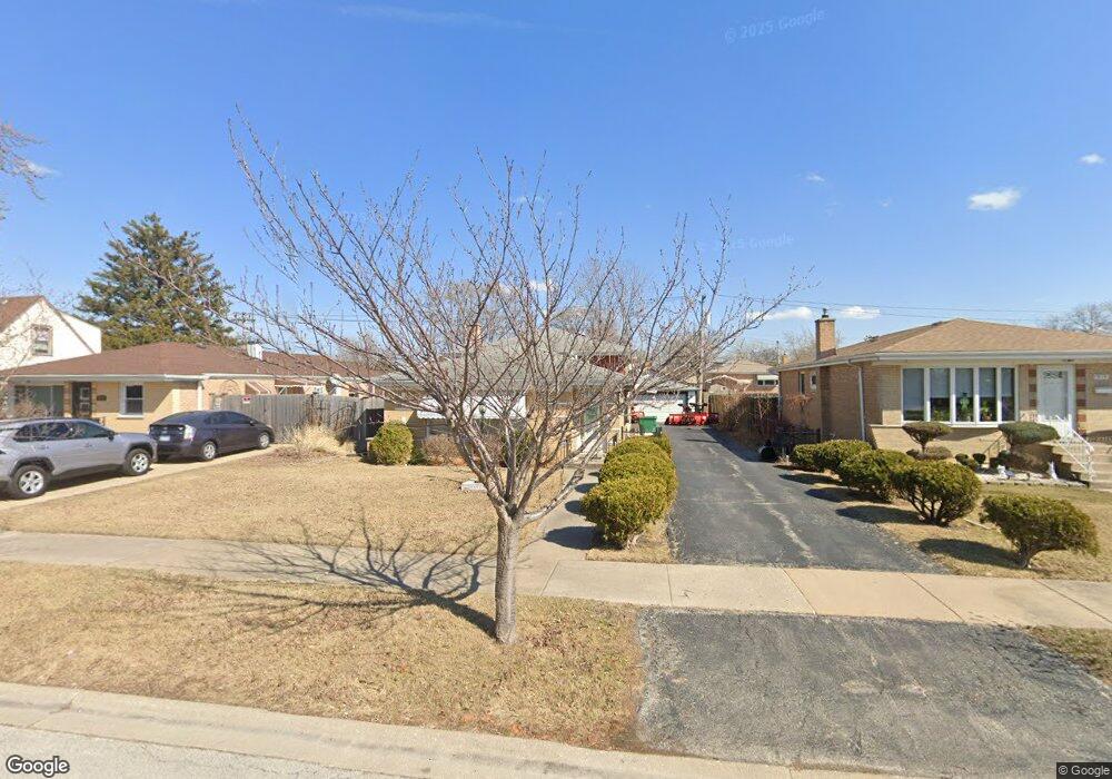
7929 Austin Ave Burbank, IL 60459
Estimated Value: $302,000 - $370,000
3
Beds
2
Baths
1,222
Sq Ft
$277/Sq Ft
Est. Value
About This Home
This home is located at 7929 Austin Ave, Burbank, IL 60459 and is currently estimated at $338,466, approximately $276 per square foot. 7929 Austin Ave is a home located in Cook County with nearby schools including Edward J Tobin Elementary School, Reavis High School, and St Albert the Great Catholic School.
Ownership History
Date
Name
Owned For
Owner Type
Purchase Details
Closed on
Sep 26, 2017
Sold by
Nicklason Sharon M
Bought by
Nicklason Sharon M and The Sharon M Nicklason Trust
Current Estimated Value
Home Financials for this Owner
Home Financials are based on the most recent Mortgage that was taken out on this home.
Original Mortgage
$30,000
Interest Rate
3.86%
Mortgage Type
Unknown
Create a Home Valuation Report for This Property
The Home Valuation Report is an in-depth analysis detailing your home's value as well as a comparison with similar homes in the area
Home Values in the Area
Average Home Value in this Area
Purchase History
| Date | Buyer | Sale Price | Title Company |
|---|---|---|---|
| Nicklason Sharon M | -- | Attorney |
Source: Public Records
Mortgage History
| Date | Status | Borrower | Loan Amount |
|---|---|---|---|
| Closed | Nicklason Sharon M | $30,000 |
Source: Public Records
Tax History Compared to Growth
Tax History
| Year | Tax Paid | Tax Assessment Tax Assessment Total Assessment is a certain percentage of the fair market value that is determined by local assessors to be the total taxable value of land and additions on the property. | Land | Improvement |
|---|---|---|---|---|
| 2024 | $1,947 | $25,000 | $3,978 | $21,022 |
| 2023 | $2,496 | $25,000 | $3,978 | $21,022 |
| 2022 | $2,496 | $19,907 | $3,501 | $16,406 |
| 2021 | $2,326 | $19,905 | $3,500 | $16,405 |
| 2020 | $2,090 | $19,905 | $3,500 | $16,405 |
| 2019 | $2,325 | $19,396 | $3,182 | $16,214 |
| 2018 | $2,263 | $19,396 | $3,182 | $16,214 |
| 2017 | $2,150 | $19,396 | $3,182 | $16,214 |
| 2016 | $3,133 | $13,837 | $2,705 | $11,132 |
| 2015 | $3,168 | $13,837 | $2,705 | $11,132 |
| 2014 | $3,104 | $13,837 | $2,705 | $11,132 |
| 2013 | $3,161 | $15,023 | $2,705 | $12,318 |
Source: Public Records
Map
Nearby Homes
- 6040 W 79th St
- 7851 Moody Ave
- 6127 W 79th Place
- 7840 Monitor Ave
- 7836 Monitor Ave
- 5830 W 81st St
- 7740 Monitor Ave
- 8146 Austin Ave
- 7718 Meade Ave
- 7840 Massasoit Ave
- 7723 Melvina Ave
- 6241 W 80th St
- 6139 W 81st Place
- 7921 Mobile Ave
- 7734 Melvina Ave
- 7711 Melvina Ave
- 7814 Major Ave
- 8244 Austin Ave
- 5938 W 83rd St
- 8125 Mobile Ave
- 7927 Austin Ave
- 7935 Austin Ave
- 7935 Austin Ave
- 7919 Austin Ave
- 7941 Austin Ave
- 7922 Mason Ave
- 7918 Mason Ave
- 7926 Mason Ave
- 7915 Austin Ave
- 7945 Austin Ave
- 7916 Mason Ave
- 7936 Mason Ave
- 7928 Austin Ave
- 7930 Austin Ave
- 7920 Austin Ave
- 7912 Mason Ave
- 7962 Mason Ave
- 7934 Austin Ave
- 7938 Austin Ave
- 7966 Mason Ave