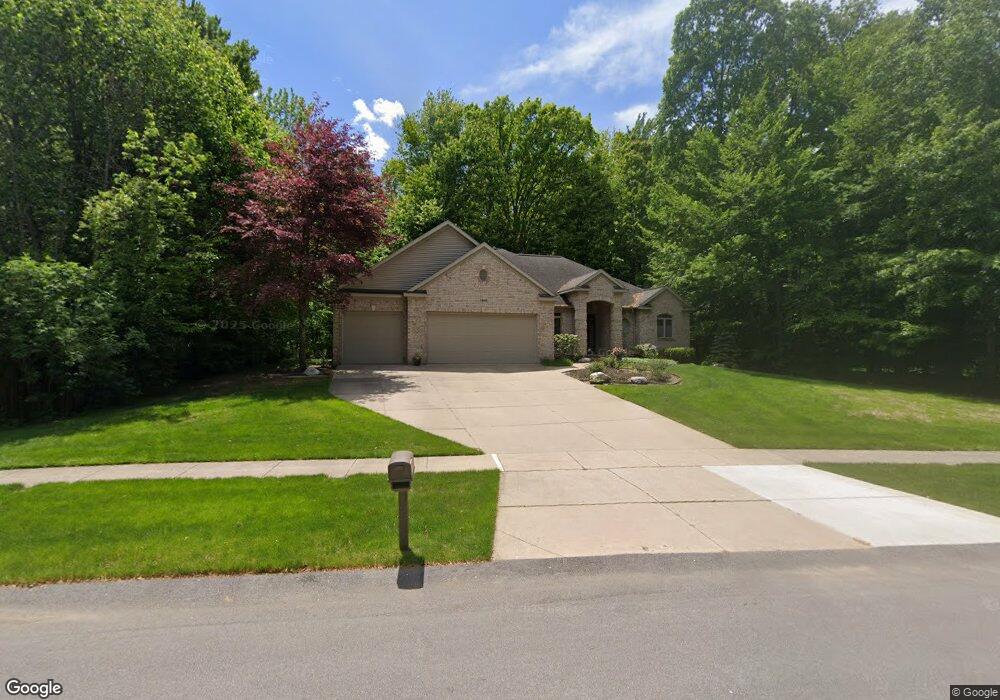
7929 Byron Station Ct SW Byron Center, MI 49315
Estimated Value: $645,009 - $763,000
3
Beds
3
Baths
1,853
Sq Ft
$373/Sq Ft
Est. Value
About This Home
This home is located at 7929 Byron Station Ct SW, Byron Center, MI 49315 and is currently estimated at $691,502, approximately $373 per square foot. 7929 Byron Station Ct SW is a home located in Kent County with nearby schools including Brown Elementary School, Robert L. Nickels Intermediate School, and Byron Center West Middle School.
Ownership History
Date
Name
Owned For
Owner Type
Purchase Details
Closed on
Aug 19, 2016
Sold by
Oetman David and Oetman Arlene
Bought by
Oetman David A and Oetman Arlene A
Current Estimated Value
Purchase Details
Closed on
Dec 20, 2005
Sold by
Land Terri and Terri Land Declaration Of Trus
Bought by
Meringa Robert K
Home Financials for this Owner
Home Financials are based on the most recent Mortgage that was taken out on this home.
Original Mortgage
$420,000
Outstanding Balance
$225,132
Interest Rate
6.62%
Mortgage Type
Construction
Estimated Equity
$466,370
Create a Home Valuation Report for This Property
The Home Valuation Report is an in-depth analysis detailing your home's value as well as a comparison with similar homes in the area
Home Values in the Area
Average Home Value in this Area
Purchase History
| Date | Buyer | Sale Price | Title Company |
|---|---|---|---|
| Oetman David A | -- | Attorney | |
| Meringa Robert K | $112,500 | -- |
Source: Public Records
Mortgage History
| Date | Status | Borrower | Loan Amount |
|---|---|---|---|
| Open | Meringa Robert K | $420,000 |
Source: Public Records
Tax History Compared to Growth
Tax History
| Year | Tax Paid | Tax Assessment Tax Assessment Total Assessment is a certain percentage of the fair market value that is determined by local assessors to be the total taxable value of land and additions on the property. | Land | Improvement |
|---|---|---|---|---|
| 2025 | $4,149 | $306,800 | $0 | $0 |
| 2024 | $4,149 | $287,500 | $0 | $0 |
| 2023 | $3,968 | $235,100 | $0 | $0 |
| 2022 | $5,530 | $214,200 | $0 | $0 |
| 2021 | $5,382 | $210,700 | $0 | $0 |
| 2020 | $3,652 | $195,100 | $0 | $0 |
| 2019 | $5,252 | $194,700 | $0 | $0 |
| 2018 | $5,144 | $187,500 | $36,800 | $150,700 |
| 2017 | $5,010 | $175,700 | $0 | $0 |
| 2016 | $4,825 | $171,600 | $0 | $0 |
| 2015 | $4,743 | $171,600 | $0 | $0 |
| 2013 | -- | $152,400 | $0 | $0 |
Source: Public Records
Map
Nearby Homes
- 8138 Boardwalk Dr SW
- 8090 Country Rail Ct SW
- 8393 Woodhaven Dr SW Unit 1
- 2740 Woodhaven Ct SW Unit 2
- 670 84th St SW
- 8330 Rockledge Way SW Unit 92
- 8030 Lionel Dr
- 1942 Creekside Dr SW
- 1912 Creekside Dr SW
- 8581 Troy St SW
- 8541 Woodhaven Dr SW
- 1828 Gloryfield Dr
- 8564 Elkwood Dr SW
- 2581 Ravines Trail Dr SW
- 2569 Ravines Trail Dr SW
- 2567 Ravines Trail Dr SW
- 2553 Ravines Trail Dr SW
- The Preston Plan at Alden Grove
- The Marley Plan at Alden Grove
- The Grayson Plan at Alden Grove
- 7943 Byron Station Ct SW
- 7921 Byron Station Ct SW
- 7932 Byron Station Ct SW
- 7920 Byron Station Ct SW
- 7955 Byron Station Ct SW
- 2606 Byron Station Dr SW
- 7950 Byron Station Ct SW
- 2589 Byron Station Dr SW
- 2605 Byron Station Dr SW
- 7969 Byron Station Ct SW
- 2618 Byron Station Dr SW
- 8140 Country Rail Dr SW
- 7968 Byron Station Ct SW
- 2585 Byron Station Dr SW Unit APP
- 2621 Byron Station Dr SW
- 7985 Byron Station Ct SW
- 2528 Byron Station Dr SW
- 2650 Byron Station Dr SW
- 7984 Byron Station Ct SW
- 8158 Country Rail Dr SW