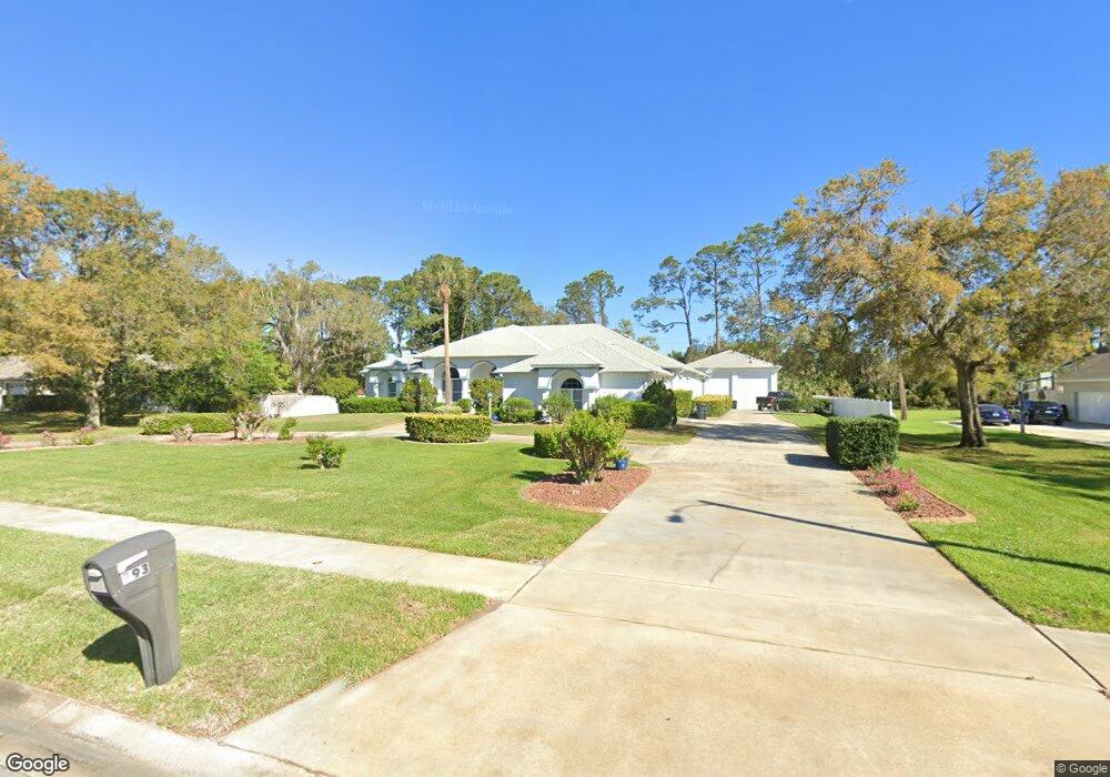
793 Pheasant Run Ct Port Orange, FL 32127
Port Orange West NeighborhoodEstimated Value: $778,000 - $941,000
3
Beds
3
Baths
3,721
Sq Ft
$229/Sq Ft
Est. Value
About This Home
This home is located at 793 Pheasant Run Ct, Port Orange, FL 32127 and is currently estimated at $851,638, approximately $228 per square foot. 793 Pheasant Run Ct is a home located in Volusia County with nearby schools including Spruce Creek Elementary School, Creekside Middle School, and Spruce Creek High School.
Ownership History
Date
Name
Owned For
Owner Type
Purchase Details
Closed on
Apr 21, 2025
Sold by
Gray Christopher and Gray Christine
Bought by
Christopher A Gray And Christine S Gray Joint and Gray
Current Estimated Value
Purchase Details
Closed on
Jan 25, 1999
Sold by
City Port Orange
Bought by
Gray Christopher and Gray Christine
Purchase Details
Closed on
Jul 30, 1998
Sold by
Rajkumar Devanand and Rajkumar Bibi Z
Bought by
Gray Christopher and Gray Christine
Purchase Details
Closed on
Jul 14, 1995
Sold by
Clark Douglas J
Bought by
Rajkumar Devanand and Rajkumar Bibi Z
Create a Home Valuation Report for This Property
The Home Valuation Report is an in-depth analysis detailing your home's value as well as a comparison with similar homes in the area
Home Values in the Area
Average Home Value in this Area
Purchase History
| Date | Buyer | Sale Price | Title Company |
|---|---|---|---|
| Christopher A Gray And Christine S Gray Joint | $100 | None Listed On Document | |
| Christopher A Gray And Christine S Gray Joint | $100 | None Listed On Document | |
| Gray Christopher | -- | -- | |
| Gray Christopher | $67,500 | -- | |
| Rajkumar Devanand | $51,000 | -- |
Source: Public Records
Tax History Compared to Growth
Tax History
| Year | Tax Paid | Tax Assessment Tax Assessment Total Assessment is a certain percentage of the fair market value that is determined by local assessors to be the total taxable value of land and additions on the property. | Land | Improvement |
|---|---|---|---|---|
| 2025 | $5,866 | $392,003 | -- | -- |
| 2024 | $5,866 | $380,957 | -- | -- |
| 2023 | $5,866 | $369,861 | $0 | $0 |
| 2022 | $5,695 | $359,088 | $0 | $0 |
| 2021 | $5,845 | $348,629 | $0 | $0 |
| 2020 | $5,694 | $343,816 | $0 | $0 |
| 2019 | $5,511 | $336,086 | $0 | $0 |
| 2018 | $5,525 | $329,819 | $0 | $0 |
| 2017 | $5,559 | $323,035 | $0 | $0 |
| 2016 | $5,613 | $316,391 | $0 | $0 |
| 2015 | $5,791 | $314,192 | $0 | $0 |
| 2014 | $5,820 | $311,698 | $0 | $0 |
Source: Public Records
Map
Nearby Homes
- 732 English Oaks Dr
- 5808 Westport Dr
- 747 Taylor Rd
- 722 English Oaks Dr
- 720 English Oaks Dr
- 725 English Oaks Dr
- 783 Highgarden Dr
- 739 English Oaks Dr
- 840 Pine Forest Trail W
- 740 English Oaks Dr
- 936 Countryside Blvd W
- 804 Wildwood Cir
- 823 Bayridge Ln
- 981 Countryside Blvd W
- 5800 Spruce Creek Woods Dr
- 204 Devon St
- 360 Bent Oak Dr
- 644 Hamlet Dr
- 601 English Oaks Dr
- 364 Bent Oak Dr
- 791 Pheasant Run Ct
- 795 Pheasant Run Ct
- 811 Pheasant Dr
- 789 Pheasant Run Ct
- 797 Pheasant Run Ct
- 983 Smokerise Blvd
- 792 Pheasant Run Ct
- 985 Smokerise Blvd
- 979 Smokerise Blvd
- 794 Pheasant Run Ct
- 790 Pheasant Run Ct
- 799 Pheasant Run Ct
- 977 Smokerise Blvd
- 987 Smokerise Blvd
- 787 Pheasant Run Ct
- 796 Pheasant Run Ct
- 989 Smokerise Blvd
- 975 Smokerise Blvd
- 788 Pheasant Run Ct
- 984 Smokerise Blvd