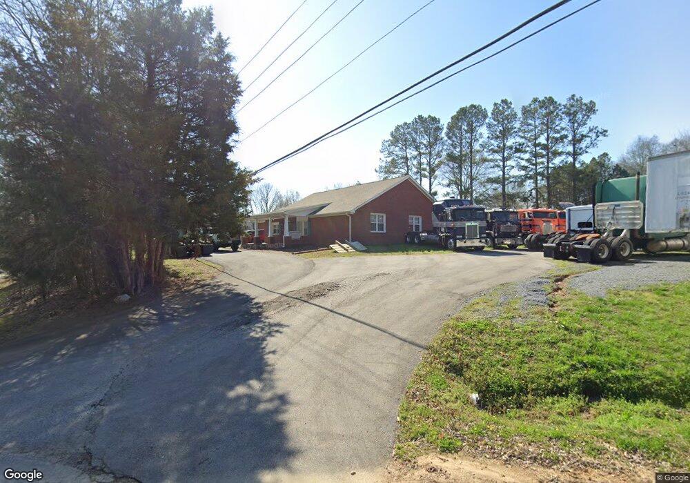
793 Prior Station Rd Cedartown, GA 30125
Estimated Value: $252,000 - $286,000
3
Beds
2
Baths
1,910
Sq Ft
$142/Sq Ft
Est. Value
About This Home
This home is located at 793 Prior Station Rd, Cedartown, GA 30125 and is currently estimated at $271,971, approximately $142 per square foot. 793 Prior Station Rd is a home located in Polk County with nearby schools including Cedar Christian School.
Ownership History
Date
Name
Owned For
Owner Type
Purchase Details
Closed on
Oct 3, 2019
Sold by
Hoag Cathy Diane
Bought by
Pretty James Michael
Current Estimated Value
Purchase Details
Closed on
Oct 2, 2019
Sold by
Pretty Diane S
Bought by
Pretty James Michael and Hoag Cathy Diane
Purchase Details
Closed on
Aug 9, 2004
Sold by
Pretty Diane S*Executrix Under The Last
Bought by
Pretty Diane S
Purchase Details
Closed on
Jul 9, 2004
Sold by
Shelley Hall H
Bought by
Pretty Diane S *Executrix
Purchase Details
Closed on
Feb 9, 1978
Bought by
Shelley Hall H
Create a Home Valuation Report for This Property
The Home Valuation Report is an in-depth analysis detailing your home's value as well as a comparison with similar homes in the area
Home Values in the Area
Average Home Value in this Area
Purchase History
| Date | Buyer | Sale Price | Title Company |
|---|---|---|---|
| Pretty James Michael | -- | -- | |
| Pretty James Michael | -- | -- | |
| Pretty James Michael | -- | -- | |
| Pretty Diane S | -- | -- | |
| Pretty Diane S *Executrix | -- | -- | |
| Shelley Hall H | -- | -- |
Source: Public Records
Tax History Compared to Growth
Tax History
| Year | Tax Paid | Tax Assessment Tax Assessment Total Assessment is a certain percentage of the fair market value that is determined by local assessors to be the total taxable value of land and additions on the property. | Land | Improvement |
|---|---|---|---|---|
| 2024 | $1,848 | $88,386 | $3,210 | $85,176 |
| 2023 | $1,440 | $60,690 | $3,210 | $57,480 |
| 2022 | $1,250 | $52,684 | $2,140 | $50,544 |
| 2021 | $1,267 | $52,684 | $2,140 | $50,544 |
| 2020 | $1,269 | $52,684 | $2,140 | $50,544 |
| 2019 | $1,149 | $56,114 | $2,140 | $53,974 |
| 2018 | $1,077 | $52,405 | $2,140 | $50,265 |
| 2017 | $1,059 | $52,405 | $2,140 | $50,265 |
| 2016 | $1,110 | $54,282 | $4,018 | $50,265 |
| 2015 | $1,119 | $54,556 | $4,018 | $50,538 |
| 2014 | $1,125 | $54,556 | $4,018 | $50,538 |
Source: Public Records
Map
Nearby Homes
- 119 New Harmony Rd
- 255 Reynolds Rd
- 0 Mountain Home Rd Unit 1020-C 10351948
- 0 Mountain Home Rd Unit 1020-B 10351940
- 0 Mountain Home Rd Unit 1020-A 10351930
- 151 Friendship Rd
- 35 Harris Loop
- 382 5th St
- 293 4th St
- 516 Branch St
- 512 Branch St
- 508 Branch St
- 1849 Prior Station Rd Unit 76 ACRES
- 1849 Prior Station Rd
- 0 Cornelius Rd Unit 7646589
- 309 Walnut St
- 605 W Girard Ave
- 2460 Hidden Creek Rd
- 427 Wissahickon Ave
- 0 Emmet Rd
- 24 Reynolds Rd
- 19 Reynolds Rd
- 825 Prior Station Rd
- 44 Reynolds Rd
- 41 Emmet Rd
- 43 Reynolds Rd
- 741 Prior Station Rd
- 58 Reynolds Rd
- 727 Prior Station Rd
- 85 Emmet Rd
- 864 Prior Station Rd
- 78 Reynolds Rd
- 852 Prior Station Rd
- 868 Prior Station Rd
- 102 Emmet Rd
- 97 Emmet Rd
- 660 Prior Station Rd
- 894 Prior Station Rd
- 77 Mountain Home Rd