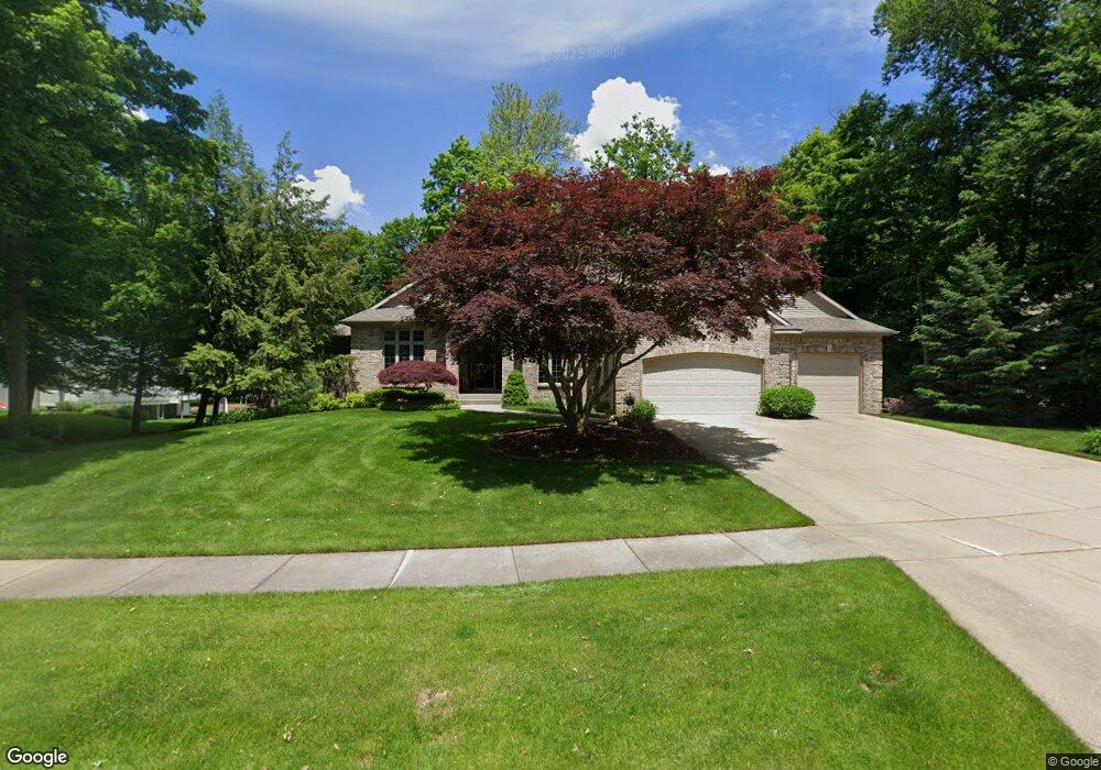
7932 Byron Station Ct SW Byron Center, MI 49315
Estimated Value: $808,984 - $875,000
--
Bed
1
Bath
2,404
Sq Ft
$351/Sq Ft
Est. Value
About This Home
This home is located at 7932 Byron Station Ct SW, Byron Center, MI 49315 and is currently estimated at $843,246, approximately $350 per square foot. 7932 Byron Station Ct SW is a home located in Kent County with nearby schools including Brown Elementary School, Robert L. Nickels Intermediate School, and Byron Center West Middle School.
Ownership History
Date
Name
Owned For
Owner Type
Purchase Details
Closed on
Sep 4, 2002
Sold by
Bonnie L Bainbridge Trust
Bought by
Newhouse Timothy and Newhouse Kristan
Current Estimated Value
Home Financials for this Owner
Home Financials are based on the most recent Mortgage that was taken out on this home.
Original Mortgage
$408,000
Outstanding Balance
$172,424
Interest Rate
6.4%
Mortgage Type
Purchase Money Mortgage
Estimated Equity
$670,822
Create a Home Valuation Report for This Property
The Home Valuation Report is an in-depth analysis detailing your home's value as well as a comparison with similar homes in the area
Home Values in the Area
Average Home Value in this Area
Purchase History
| Date | Buyer | Sale Price | Title Company |
|---|---|---|---|
| Newhouse Timothy | $510,000 | -- |
Source: Public Records
Mortgage History
| Date | Status | Borrower | Loan Amount |
|---|---|---|---|
| Open | Newhouse Timothy | $408,000 |
Source: Public Records
Tax History Compared to Growth
Tax History
| Year | Tax Paid | Tax Assessment Tax Assessment Total Assessment is a certain percentage of the fair market value that is determined by local assessors to be the total taxable value of land and additions on the property. | Land | Improvement |
|---|---|---|---|---|
| 2025 | $5,382 | $402,500 | $0 | $0 |
| 2024 | $5,382 | $377,300 | $0 | $0 |
| 2023 | $5,147 | $306,800 | $0 | $0 |
| 2022 | $7,173 | $278,500 | $0 | $0 |
| 2021 | $6,981 | $274,000 | $0 | $0 |
| 2020 | $4,737 | $257,100 | $0 | $0 |
| 2019 | $6,673 | $256,900 | $0 | $0 |
| 2018 | $6,673 | $244,700 | $36,800 | $207,900 |
| 2017 | $6,498 | $228,800 | $0 | $0 |
| 2016 | $6,259 | $224,000 | $0 | $0 |
| 2015 | $6,152 | $224,000 | $0 | $0 |
| 2013 | -- | $197,700 | $0 | $0 |
Source: Public Records
Map
Nearby Homes
- 8138 Boardwalk Dr SW
- 8090 Country Rail Ct SW
- 8393 Woodhaven Dr SW Unit 1
- 2740 Woodhaven Ct SW Unit 2
- 8330 Rockledge Way SW Unit 92
- 670 84th St SW
- 8030 Lionel Dr
- 8581 Troy St SW
- 1942 Creekside Dr SW
- 1912 Creekside Dr SW
- 8541 Woodhaven Dr SW
- 8564 Elkwood Dr SW
- 1828 Gloryfield Dr
- 2581 Ravines Trail Dr SW
- 2569 Ravines Trail Dr SW
- 2567 Ravines Trail Dr SW
- 2553 Ravines Trail Dr SW
- 3183 Railway Dr SW
- 8549 Eldora Dr SW
- 3152 84th St SW
- 7920 Byron Station Ct SW
- 7943 Byron Station Ct SW
- 7950 Byron Station Ct SW
- 7929 Byron Station Ct SW
- 7955 Byron Station Ct SW
- 7921 Byron Station Ct SW
- 7968 Byron Station Ct SW
- 2585 Byron Station Dr SW Unit APP
- 7969 Byron Station Ct SW
- 2589 Byron Station Dr SW
- 2528 Byron Station Dr SW
- 2606 Byron Station Dr SW
- 7984 Byron Station Ct SW
- 2605 Byron Station Dr SW
- 7985 Byron Station Ct SW
- 2520 Byron Station Dr SW
- 2621 Byron Station Dr SW
- 2618 Byron Station Dr SW
- 2512 Byron Station Dr SW
- 7865 Railside Dr SW