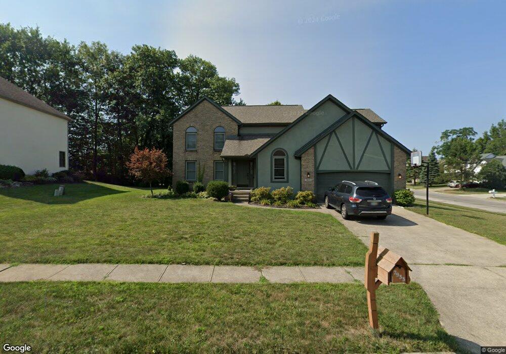
7933 Campton Ct Reynoldsburg, OH 43068
Estimated Value: $359,000 - $452,000
4
Beds
3
Baths
2,552
Sq Ft
$161/Sq Ft
Est. Value
About This Home
This home is located at 7933 Campton Ct, Reynoldsburg, OH 43068 and is currently estimated at $411,604, approximately $161 per square foot. 7933 Campton Ct is a home located in Franklin County with nearby schools including Slate Ridge Elementary School, Hannah J Ashton Middle School, and Baldwin Road Junior High School.
Ownership History
Date
Name
Owned For
Owner Type
Purchase Details
Closed on
Dec 6, 2011
Sold by
Fannie Mae
Bought by
Idom Jeffrey and Idom Alice
Current Estimated Value
Purchase Details
Closed on
Apr 25, 2011
Sold by
Chamblin Gregory S and Chamblin Mary E
Bought by
Federal National Mortgage Association
Purchase Details
Closed on
Apr 13, 1995
Sold by
Donley Inc
Bought by
Chamblin Gregory S and Chamblin Mary E
Home Financials for this Owner
Home Financials are based on the most recent Mortgage that was taken out on this home.
Original Mortgage
$174,900
Interest Rate
7.75%
Mortgage Type
New Conventional
Purchase Details
Closed on
May 11, 1994
Create a Home Valuation Report for This Property
The Home Valuation Report is an in-depth analysis detailing your home's value as well as a comparison with similar homes in the area
Home Values in the Area
Average Home Value in this Area
Purchase History
| Date | Buyer | Sale Price | Title Company |
|---|---|---|---|
| Idom Jeffrey | $120,000 | Bxallodial Bo | |
| Federal National Mortgage Association | $186,605 | Allodial | |
| Chamblin Gregory S | $184,900 | -- | |
| -- | -- | -- |
Source: Public Records
Mortgage History
| Date | Status | Borrower | Loan Amount |
|---|---|---|---|
| Previous Owner | Chamblin Gregory S | $174,900 |
Source: Public Records
Tax History Compared to Growth
Tax History
| Year | Tax Paid | Tax Assessment Tax Assessment Total Assessment is a certain percentage of the fair market value that is determined by local assessors to be the total taxable value of land and additions on the property. | Land | Improvement |
|---|---|---|---|---|
| 2024 | $6,568 | $128,280 | $31,500 | $96,780 |
| 2023 | $6,268 | $128,275 | $31,500 | $96,775 |
| 2022 | $6,291 | $97,410 | $18,060 | $79,350 |
| 2021 | $6,316 | $97,410 | $18,060 | $79,350 |
| 2020 | $6,444 | $97,410 | $18,060 | $79,350 |
| 2019 | $5,957 | $81,620 | $15,050 | $66,570 |
| 2018 | $5,928 | $81,620 | $15,050 | $66,570 |
| 2017 | $6,022 | $81,620 | $15,050 | $66,570 |
| 2016 | $6,088 | $74,590 | $14,910 | $59,680 |
| 2015 | $5,899 | $74,590 | $14,910 | $59,680 |
| 2014 | $5,926 | $74,590 | $14,910 | $59,680 |
| 2013 | $2,883 | $74,585 | $14,910 | $59,675 |
Source: Public Records
Map
Nearby Homes
- 1890 Lockmere Ct
- 7780 Featherleaf Ct
- 7933 Meadowlark Ln S Unit 7933
- 2098 Stone Valley Place
- 1849 Drugan Ct SW
- 1788 Leighton Dr
- 7832 Country Brook Ln
- 7607 Palmer Rd SW
- 1744 Graham Rd
- 10039 Taylor Rd SW
- 7961 Oak Valley Rd
- 0 Oak Valley Rd Unit 5148458
- 0 Oak Valley Rd Unit Lot 4, 1.088 ac.
- 1569 Marabar Dr
- 1545 Alar Ave
- 214 Estates Ln
- 210 Estates Ln
- 7682 E Main St
- 258 Baron Ct
- 8055 Eliot Dr
- 7949 Campton Ct
- 2086 Wagontrail Dr
- 2092 Wagontrail Dr
- 2102 Wagontrail Dr
- 2041 Farmsbury Dr
- 2011 Farmsbury Dr
- 7940 Campton Ct
- 7961 Campton Ct
- 2081 Farmsbury Dr
- 7952 Campton Ct
- 2001 Farmsbury Dr
- 2112 Wagontrail Dr
- 2091 Farmsbury Dr
- 2087 Wagontrail Dr
- 2093 Wagontrail Dr
- 7966 Campton Ct
- 7977 Campton Ct
- 1975 Haverton Dr
- 2122 Wagontrail Dr
- 1990 Farmsbury Dr