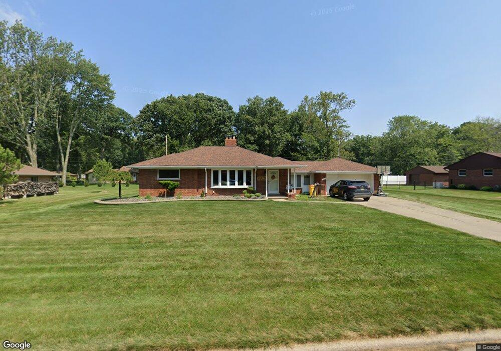
7934 Coventry Ave Grosse Ile, MI 48138
Estimated Value: $297,831 - $377,000
3
Beds
3
Baths
1,800
Sq Ft
$186/Sq Ft
Est. Value
About This Home
This home is located at 7934 Coventry Ave, Grosse Ile, MI 48138 and is currently estimated at $335,208, approximately $186 per square foot. 7934 Coventry Ave is a home located in Wayne County with nearby schools including St. Cyprian Elementary School.
Ownership History
Date
Name
Owned For
Owner Type
Purchase Details
Closed on
Nov 20, 2018
Sold by
Siewniak Matthew and Siewniak Dawn M
Bought by
Siewniak Matthew T and Siewniak Dawn M
Current Estimated Value
Purchase Details
Closed on
Apr 16, 2018
Sold by
Siewink Matthew
Bought by
Sieniawk Matthew
Purchase Details
Closed on
Nov 1, 2013
Sold by
Martini Judithlee
Bought by
Siewniak Matthew
Purchase Details
Closed on
Jul 10, 2009
Sold by
Pray Carol A and The Don D & Carol A Pray Revoc
Bought by
Martini Judithlee
Create a Home Valuation Report for This Property
The Home Valuation Report is an in-depth analysis detailing your home's value as well as a comparison with similar homes in the area
Home Values in the Area
Average Home Value in this Area
Purchase History
| Date | Buyer | Sale Price | Title Company |
|---|---|---|---|
| Siewniak Matthew T | -- | None Available | |
| Sieniawk Matthew | -- | None Available | |
| Siewniak Matthew | $170,000 | First American Title Ins Co | |
| Martini Judithlee | $170,000 | Michigan Title Insurance Age |
Source: Public Records
Tax History
| Year | Tax Paid | Tax Assessment Tax Assessment Total Assessment is a certain percentage of the fair market value that is determined by local assessors to be the total taxable value of land and additions on the property. | Land | Improvement |
|---|---|---|---|---|
| 2025 | $1,568 | $138,600 | $0 | $0 |
| 2024 | $1,526 | $128,600 | $0 | $0 |
| 2023 | $1,746 | $117,900 | $0 | $0 |
| 2022 | $4,063 | $108,300 | $0 | $0 |
| 2021 | $3,887 | $106,800 | $0 | $0 |
| 2019 | $3,855 | $93,300 | $0 | $0 |
| 2018 | $1,658 | $92,100 | $0 | $0 |
| 2017 | $4,281 | $89,000 | $0 | $0 |
| 2016 | $3,788 | $88,700 | $0 | $0 |
| 2015 | $8,067 | $81,900 | $0 | $0 |
| 2013 | $8,000 | $81,400 | $0 | $0 |
| 2012 | $1,691 | $78,900 | $28,000 | $50,900 |
Source: Public Records
Map
Nearby Homes
- 7949 Church Rd
- 21527 Parke Ln
- 8258 Concord Rd
- 21599 Parke Ln
- 21774 E River Rd
- 20766 Hcl Jackson
- 21071 Thorofare Rd
- 21524 Thorofare Rd
- 22220 E River Rd
- 7761 Stout Ave
- 7806 Island Blvd
- 9355 Highland Dr
- 9447 Whitall Ln
- 9281 Island Dr
- 19580 Parke Ln
- 0 West River Unit 20250008619
- 9000 Ferry Rd
- 00000 Magnolia Ln
- VACANT Oriole Ave
- Lot 2 Bridge
- 7958 Coventry Ave
- 7935 Bournemouth Ave
- 7959 Bournemouth Ave
- 7911 Bournemouth Ave
- 7937 Coventry Ave
- 7915 Coventry Ave
- 7982 Coventry Ave
- 7961 Coventry Ave
- 7983 Bournemouth Ave
- 7782 Coventry Ave
- 000 Parke Ln Unit 12
- 000 Parke Ln
- 7985 Coventry Ave
- 7779 Bournemouth Ave
- 7932 Bournemouth Ave
- 7950 Church Rd
- 7954 Bournemouth Ave Unit Bldg-Unit
- 7954 Bournemouth Ave
- 8006 Coventry Ave
- 21490 Parke Ln
Your Personal Tour Guide
Ask me questions while you tour the home.