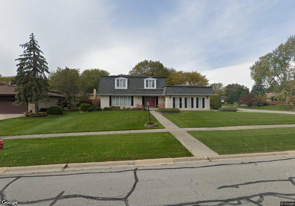
7934 Grant St Darien, IL 60561
Estimated Value: $469,814 - $561,000
Studio
1
Bath
2,254
Sq Ft
$229/Sq Ft
Est. Value
About This Home
This home is located at 7934 Grant St, Darien, IL 60561 and is currently estimated at $516,454, approximately $229 per square foot. 7934 Grant St is a home located in DuPage County with nearby schools including Concord Elementary School, Cass Jr High School, and Hinsdale South High School.
Ownership History
Date
Name
Owned For
Owner Type
Purchase Details
Closed on
Jun 27, 2002
Sold by
Gangichiodo Paul J and Gangichiodo Linda J
Bought by
Clark Michael W and Clark Merle E
Current Estimated Value
Home Financials for this Owner
Home Financials are based on the most recent Mortgage that was taken out on this home.
Original Mortgage
$248,000
Outstanding Balance
$106,770
Interest Rate
6.93%
Estimated Equity
$409,684
Create a Home Valuation Report for This Property
The Home Valuation Report is an in-depth analysis detailing your home's value as well as a comparison with similar homes in the area
Home Values in the Area
Average Home Value in this Area
Purchase History
| Date | Buyer | Sale Price | Title Company |
|---|---|---|---|
| Clark Michael W | $310,000 | First American Title |
Source: Public Records
Mortgage History
| Date | Status | Borrower | Loan Amount |
|---|---|---|---|
| Open | Clark Michael W | $248,000 | |
| Closed | Clark Michael W | $30,000 |
Source: Public Records
Tax History
| Year | Tax Paid | Tax Assessment Tax Assessment Total Assessment is a certain percentage of the fair market value that is determined by local assessors to be the total taxable value of land and additions on the property. | Land | Improvement |
|---|---|---|---|---|
| 2024 | $9,360 | $161,245 | $62,897 | $98,348 |
| 2023 | $8,935 | $148,230 | $57,820 | $90,410 |
| 2022 | $8,510 | $138,470 | $56,080 | $82,390 |
| 2021 | $7,895 | $136,890 | $55,440 | $81,450 |
| 2020 | $7,749 | $134,180 | $54,340 | $79,840 |
| 2019 | $7,437 | $128,750 | $52,140 | $76,610 |
| 2018 | $7,184 | $127,140 | $51,710 | $75,430 |
| 2017 | $7,004 | $122,340 | $49,760 | $72,580 |
| 2016 | $6,822 | $116,760 | $47,490 | $69,270 |
| 2015 | $6,664 | $109,850 | $44,680 | $65,170 |
| 2014 | $6,546 | $106,800 | $43,440 | $63,360 |
| 2013 | $6,406 | $107,800 | $43,240 | $64,560 |
Source: Public Records
Map
Nearby Homes
- 1204 Sleepy Hollow Ln
- 1501 Darien Lake Dr Unit A201
- 1390 Marco Ct
- 7802 Warwick Ave
- 1518 Pine View Ct
- 7706 Warwick Ave
- 17W435 Concord Place
- Lot 1, 2, 3, 4 & 5 Nantucket Dr
- 1447 Coventry Ct
- 7717 Rohrer Dr
- 8167 Ripple Ridge Unit 8167
- 8169 Ripple Ridge
- 8321 Ripple Ridge
- 709 79th St Unit 408
- 7800 Dorchester Ln
- 18W025 73rd St
- 7525 Nantucket Dr Unit 210
- 714 Walnut Dr Unit 405
- 714 Walnut Dr Unit 205
- 8334 Portsmouth Dr Unit C
- 7938 Grant St
- 7942 Grant St
- 7922 Grant St
- 7933 Grant St
- 1310 Sleepy Hollow Ln
- 7937 Grant St
- 7929 Grant St
- 7941 Grant St
- 7918 Grant St
- 7925 Grant St
- 1314 Sleepy Hollow Ln
- 7924 Grant St
- 7928 Grant St
- 7921 Grant St
- 7926 Grant St
- 1227 Ashbrook Ct
- 1318 Sleepy Hollow Ln
- 1210 Sleepy Hollow Ln
- 7914 Grant St
- 1212 Sleepy Hollow Ln
Your Personal Tour Guide
Ask me questions while you tour the home.