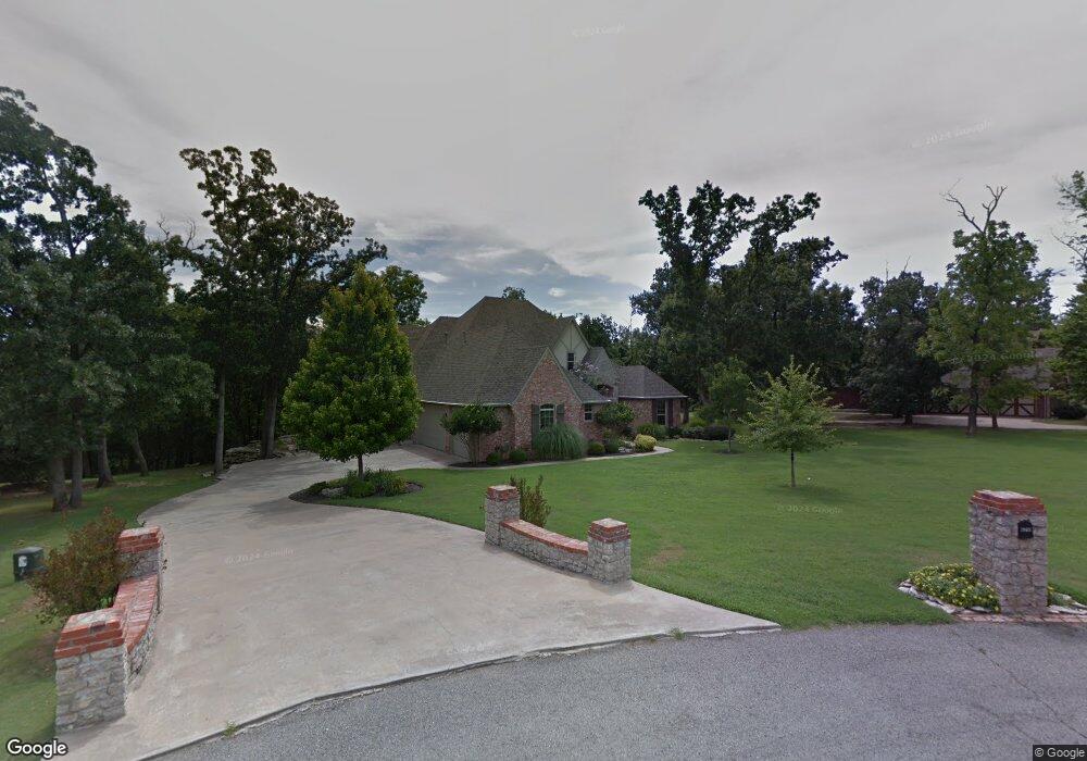
7936 N 192nd East Ave Owasso, OK 74055
Estimated Value: $482,493 - $591,000
4
Beds
3
Baths
2,744
Sq Ft
$202/Sq Ft
Est. Value
About This Home
This home is located at 7936 N 192nd East Ave, Owasso, OK 74055 and is currently estimated at $554,873, approximately $202 per square foot. 7936 N 192nd East Ave is a home located in Rogers County with nearby schools including Stone Canyon Elementary School, Owasso 6th Grade Center, and Owasso 8th Grade Center.
Ownership History
Date
Name
Owned For
Owner Type
Purchase Details
Closed on
Jul 13, 2019
Sold by
Bennett Marjorie A
Bought by
Bennett Marjorie A and Marjorie A Bennett Revocable Trust
Current Estimated Value
Purchase Details
Closed on
Apr 26, 2018
Sold by
Calvert Paul W and Calvert Norma L
Bought by
Bennett Marjorie A and Neighbors Danny
Home Financials for this Owner
Home Financials are based on the most recent Mortgage that was taken out on this home.
Original Mortgage
$356,250
Outstanding Balance
$306,440
Interest Rate
4.45%
Mortgage Type
New Conventional
Estimated Equity
$248,433
Create a Home Valuation Report for This Property
The Home Valuation Report is an in-depth analysis detailing your home's value as well as a comparison with similar homes in the area
Home Values in the Area
Average Home Value in this Area
Purchase History
| Date | Buyer | Sale Price | Title Company |
|---|---|---|---|
| Bennett Marjorie A | -- | None Available | |
| Bennett Marjorie A | $375,000 | Rogers County Abstract |
Source: Public Records
Mortgage History
| Date | Status | Borrower | Loan Amount |
|---|---|---|---|
| Open | Bennett Marjorie A | $356,250 |
Source: Public Records
Tax History Compared to Growth
Tax History
| Year | Tax Paid | Tax Assessment Tax Assessment Total Assessment is a certain percentage of the fair market value that is determined by local assessors to be the total taxable value of land and additions on the property. | Land | Improvement |
|---|---|---|---|---|
| 2025 | $5,323 | $47,376 | $8,192 | $39,184 |
| 2024 | $5,323 | $48,235 | $7,521 | $40,714 |
| 2023 | $5,323 | $45,938 | $10,725 | $35,213 |
| 2022 | $5,052 | $45,003 | $9,399 | $35,604 |
| 2021 | $4,868 | $43,848 | $9,399 | $34,449 |
| 2020 | $4,790 | $43,199 | $9,399 | $33,800 |
| 2019 | $4,613 | $41,579 | $9,399 | $32,180 |
| 2018 | $4,357 | $41,444 | $9,399 | $32,045 |
| 2017 | $4,365 | $41,156 | $9,379 | $31,777 |
| 2016 | $4,239 | $39,958 | $9,343 | $30,615 |
| 2015 | $4,157 | $38,793 | $9,265 | $29,528 |
| 2014 | $4,000 | $37,231 | $9,029 | $28,202 |
Source: Public Records
Map
Nearby Homes
- 18894 E 80th St N
- 17798 E Anthem Ridge Rd
- 19433 E 73rd Place N
- 7397 N 201st East Ave
- 18934 Chickadee Ct
- 7221 N 200th East Ave
- 7311 N 202nd East Ave
- 8219 N 175th East Ave
- 19425 E 69th St N
- 6940 N Garden Stone Ln
- 19460 E Boulder Dr
- 17401 E 78th St N
- 18533 E Crooked Oak Dr
- 17834 E 93rd St N
- 19108 E Twin Creeks Dr
- 6531 S Ridgeview Rd
- 18420 E Persimmon Ln
- 6431 S Ridgeview
- 6568 N Blue Sage Dr
- 19433 E Clear Brook Rd
- 7987 N 192nd East Ave
- 7935 N 192nd East Ave
- 7963 N 192nd East Ave
- 7984 N 192nd East Ave
- 7966 N 192nd East Ave
- 7952 N 192nd East Ave
- 7966 N 192nd East Ave
- 7934 N 192nd East Ave
- 19222 E 79th St N
- 7910 N 192nd East Ave
- 19270 E 79th St N
- 19134 E 79th St N
- 19082 E 79th St N
- 0 N 190th Ave Unit 1936015
- 18971 E 79th St N
- 18921 E 80th
- 18843 E 79th St N
- 18921 E 80th St N
- 18868 E 80th St N
- 7875 N 190th East Ave