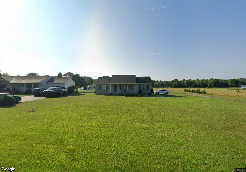
7937 White Lowe Rd Salisbury, MD 21801
North Salisbury NeighborhoodEstimated Value: $209,038 - $257,000
--
Bed
2
Baths
1,200
Sq Ft
$193/Sq Ft
Est. Value
About This Home
This home is located at 7937 White Lowe Rd, Salisbury, MD 21801 and is currently estimated at $232,010, approximately $193 per square foot. 7937 White Lowe Rd is a home located in Wicomico County with nearby schools including Westside Primary School, Westside Intermediate School, and Salisbury Middle School.
Ownership History
Date
Name
Owned For
Owner Type
Purchase Details
Closed on
Jun 1, 1990
Sold by
Landry Thomas P
Bought by
Cannon Billy T and Cannon Christine L
Current Estimated Value
Purchase Details
Closed on
May 16, 1989
Sold by
Ebelein John H and Ebelein Arlene P
Bought by
Landry Thomas P
Home Financials for this Owner
Home Financials are based on the most recent Mortgage that was taken out on this home.
Original Mortgage
$88,000
Interest Rate
10.93%
Purchase Details
Closed on
Jun 30, 1987
Sold by
Corman Chester D
Bought by
Ebelein John H and Ebelein Arlene P
Create a Home Valuation Report for This Property
The Home Valuation Report is an in-depth analysis detailing your home's value as well as a comparison with similar homes in the area
Home Values in the Area
Average Home Value in this Area
Purchase History
| Date | Buyer | Sale Price | Title Company |
|---|---|---|---|
| Cannon Billy T | $13,500 | -- | |
| Landry Thomas P | $108,000 | -- | |
| Ebelein John H | $5,000 | -- |
Source: Public Records
Mortgage History
| Date | Status | Borrower | Loan Amount |
|---|---|---|---|
| Previous Owner | Landry Thomas P | $88,000 |
Source: Public Records
Tax History Compared to Growth
Tax History
| Year | Tax Paid | Tax Assessment Tax Assessment Total Assessment is a certain percentage of the fair market value that is determined by local assessors to be the total taxable value of land and additions on the property. | Land | Improvement |
|---|---|---|---|---|
| 2025 | $1,526 | $163,467 | $0 | $0 |
| 2024 | $1,526 | $152,933 | $0 | $0 |
| 2023 | $1,468 | $142,400 | $41,900 | $100,500 |
| 2022 | $1,492 | $140,533 | $0 | $0 |
| 2021 | $1,478 | $138,667 | $0 | $0 |
| 2020 | $1,471 | $136,800 | $41,900 | $94,900 |
| 2019 | $1,449 | $132,733 | $0 | $0 |
| 2018 | $1,413 | $128,667 | $0 | $0 |
| 2017 | $1,371 | $124,600 | $0 | $0 |
| 2016 | -- | $124,233 | $0 | $0 |
| 2015 | $1,439 | $123,867 | $0 | $0 |
| 2014 | $1,439 | $123,500 | $0 | $0 |
Source: Public Records
Map
Nearby Homes
- 0 Stanton Ave
- 7453 Titleist Dr
- 7545 Titleist Dr
- 0 Milford Twilley Dr Unit MDWC2013476
- 0 Log Cabin Rd Unit MDWC2015458
- 0 Log Cabin Rd
- 28600 Naylor Mill Rd
- Lot B6 Westwood Dr
- Lot B7 Westwood Dr
- Lot D5 International Dr
- 27500 Edgewood Cir
- 27430 Log Cabin Rd
- Lot C2 International Dr
- 7877 Bennett Park Dr
- 1023 Marquis Ave
- 27135 E Lillian St
- 1816 Ocean Shore Dr
- 1707 West Rd
- 1817 Ocean Shore Ln
- 922 Marquis Ave
- 7949 White Lowe Rd
- 7959 White Lowe Rd
- 0 White Lowe Rd
- 0 Royalty Way
- 7969 White Lowe Rd
- 7900 Royality Way
- 7987 White Lowe Rd
- 0 Route 50 & White Lowe Rd Unit 1001559294
- 0 Route 50 & White Lowe Rd Unit MDWC105616
- 0 Route 50 & White Lowe Rd Unit MDWC101318
- 7997 White Lowe Rd
- 8005 White Lowe Rd
- 8011 White Lowe Rd
- 8025 White Lowe Rd
- 7824 Stanton Ave
- 8037 White Lowe Rd
- 7820 Stanton Ave
- 27905 Ocean Gateway
- 8070 White Lowe Rd
- 28092 Ocean Gateway