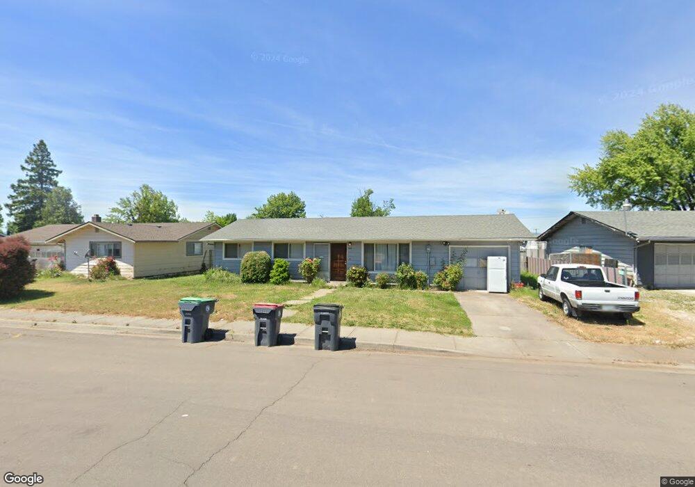
7939 Ajax St White City, OR 97503
Estimated Value: $277,000 - $335,000
3
Beds
1
Bath
1,216
Sq Ft
$261/Sq Ft
Est. Value
About This Home
This home is located at 7939 Ajax St, White City, OR 97503 and is currently estimated at $316,887, approximately $260 per square foot. 7939 Ajax St is a home located in Jackson County with nearby schools including Table Rock Elementary School, White Mountain Middle School, and Eagle Point Middle School.
Ownership History
Date
Name
Owned For
Owner Type
Purchase Details
Closed on
Dec 5, 2008
Sold by
Wells Fargo Bank Na
Bought by
Harper Robert and Hanson Amanda
Current Estimated Value
Home Financials for this Owner
Home Financials are based on the most recent Mortgage that was taken out on this home.
Original Mortgage
$105,112
Interest Rate
5.14%
Mortgage Type
FHA
Purchase Details
Closed on
Sep 6, 2008
Sold by
Lind Donna J and Lind George D
Bought by
Wells Fargo Bank Na and Option One Mortgage Loan Trust 2007-1 As
Purchase Details
Closed on
Mar 29, 2004
Sold by
Henagin Keith G
Bought by
Lind George D and Lind Donna J
Home Financials for this Owner
Home Financials are based on the most recent Mortgage that was taken out on this home.
Original Mortgage
$104,000
Interest Rate
6.65%
Mortgage Type
Purchase Money Mortgage
Create a Home Valuation Report for This Property
The Home Valuation Report is an in-depth analysis detailing your home's value as well as a comparison with similar homes in the area
Home Values in the Area
Average Home Value in this Area
Purchase History
| Date | Buyer | Sale Price | Title Company |
|---|---|---|---|
| Harper Robert | $102,000 | None Available | |
| Wells Fargo Bank Na | $114,750 | Fa | |
| Lind George D | $130,000 | Amerititle |
Source: Public Records
Mortgage History
| Date | Status | Borrower | Loan Amount |
|---|---|---|---|
| Previous Owner | Harper Robert | $105,112 | |
| Previous Owner | Lind George D | $104,000 | |
| Closed | Lind George D | $26,000 |
Source: Public Records
Tax History Compared to Growth
Tax History
| Year | Tax Paid | Tax Assessment Tax Assessment Total Assessment is a certain percentage of the fair market value that is determined by local assessors to be the total taxable value of land and additions on the property. | Land | Improvement |
|---|---|---|---|---|
| 2025 | $2,154 | $155,500 | $61,340 | $94,160 |
| 2024 | $2,154 | $150,980 | $59,560 | $91,420 |
| 2023 | $2,081 | $146,590 | $57,830 | $88,760 |
| 2022 | $2,024 | $146,590 | $57,830 | $88,760 |
| 2021 | $1,964 | $142,330 | $56,140 | $86,190 |
| 2020 | $2,084 | $138,190 | $54,500 | $83,690 |
| 2019 | $2,052 | $130,270 | $51,380 | $78,890 |
| 2018 | $2,003 | $126,480 | $49,880 | $76,600 |
| 2017 | $1,952 | $126,480 | $49,880 | $76,600 |
| 2016 | $1,906 | $119,230 | $47,020 | $72,210 |
| 2015 | $1,827 | $119,230 | $47,020 | $72,210 |
| 2014 | $1,779 | $112,390 | $44,320 | $68,070 |
Source: Public Records
Map
Nearby Homes
- 8219 Barbur St
- 8291 Division Rd
- 2548 Antelope Rd
- 3025 Ingalls Dr
- 2581 Terrmont St
- 3061 Village Cir
- 3026 Avenue G
- 2622 Falcon St Unit 25
- 2622 Falcon St Unit 78
- 2622 Falcon St Unit 29
- 2622 Falcon St Unit SPC 75
- 2854 Avenue A
- 2669 Falcon St
- 0 Avenue A
- 3131 Avenue A
- 2956 Agate Meadows Cir
- 8242 Kestrel Way
- 9674 SE Pavati Dr
- 9889 SE Pavati Dr
- 9697 SE Pavati Dr
- 7925 Ajax St
- 7945 Ajax St
- 7974 Division Rd
- 7966 Division Rd
- 7986 Division Rd
- 7911 Ajax St
- 7955 Ajax St
- 7956 Division Rd Unit 1
- 7994 Division Rd
- 7905 Ajax St
- 0 Division Rd
- 7967 Ajax St
- 7930 Ajax St
- 7918 Ajax St
- 7948 Division Rd
- 8008 Division Rd
- 7950 Ajax St
- 7895 Ajax St
- 7977 Ajax St
- 7973 Division Rd Unit 1