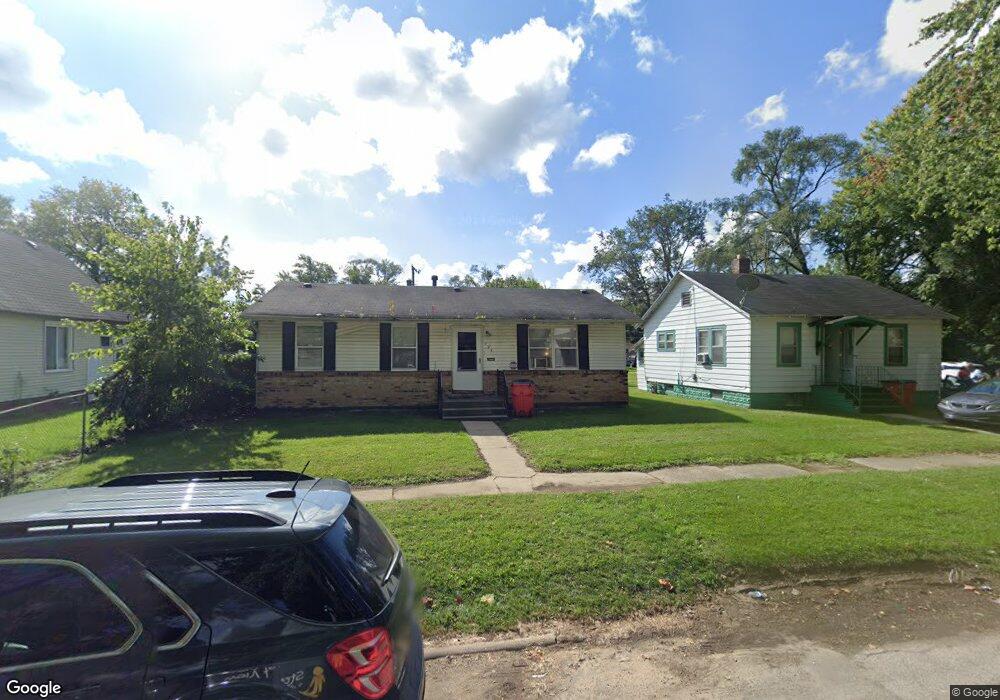
794 E Vineyard Ave Benton Harbor, MI 49022
Estimated Value: $87,000 - $108,000
3
Beds
1
Bath
988
Sq Ft
$100/Sq Ft
Est. Value
About This Home
This home is located at 794 E Vineyard Ave, Benton Harbor, MI 49022 and is currently estimated at $99,035, approximately $100 per square foot. 794 E Vineyard Ave is a home located in Berrien County with nearby schools including Fair Plain Middle School, Benton Harbor High School, and Benton Harbor Charter School Academy.
Ownership History
Date
Name
Owned For
Owner Type
Purchase Details
Closed on
Jun 17, 2024
Sold by
Tucker Stephen A
Bought by
Berrien County Treasurer
Current Estimated Value
Purchase Details
Closed on
Jun 14, 2024
Sold by
Tucker Stephen A
Bought by
Berrien County Treasurer
Purchase Details
Closed on
Jun 13, 2023
Sold by
Tucker Stephen A
Bought by
Berrien County Treasurer
Purchase Details
Closed on
Sep 14, 2022
Sold by
Virginia Williams
Bought by
Tucker Stephen A
Purchase Details
Closed on
Mar 28, 2008
Sold by
Golliday Leslie Andre and Golliday Pamela D
Bought by
Williams Virginia
Purchase Details
Closed on
Jan 11, 1996
Purchase Details
Closed on
Jan 10, 1996
Purchase Details
Closed on
Oct 9, 1991
Create a Home Valuation Report for This Property
The Home Valuation Report is an in-depth analysis detailing your home's value as well as a comparison with similar homes in the area
Home Values in the Area
Average Home Value in this Area
Purchase History
| Date | Buyer | Sale Price | Title Company |
|---|---|---|---|
| Berrien County Treasurer | -- | -- | |
| Berrien County Treasurer | -- | -- | |
| Berrien County Treasurer | -- | -- | |
| Tucker Stephen A | -- | -- | |
| Williams Virginia | $60,000 | Chicago Title Of Michigan | |
| -- | -- | -- | |
| -- | $1,000 | -- | |
| -- | -- | -- |
Source: Public Records
Tax History
| Year | Tax Paid | Tax Assessment Tax Assessment Total Assessment is a certain percentage of the fair market value that is determined by local assessors to be the total taxable value of land and additions on the property. | Land | Improvement |
|---|---|---|---|---|
| 2025 | $1,994 | $38,700 | $0 | $0 |
| 2024 | $1,539 | $34,100 | $0 | $0 |
| 2023 | $1,231 | $24,300 | $0 | $0 |
| 2022 | $595 | $17,600 | $0 | $0 |
| 2021 | $609 | $17,300 | $700 | $16,600 |
| 2020 | $602 | $17,600 | $0 | $0 |
| 2019 | $591 | $15,500 | $0 | $0 |
| 2018 | $577 | $15,300 | $0 | $0 |
| 2017 | $565 | $13,500 | $0 | $0 |
| 2016 | $554 | $13,600 | $0 | $0 |
| 2015 | $553 | $12,500 | $0 | $0 |
| 2014 | $591 | $15,200 | $0 | $0 |
Source: Public Records
Map
Nearby Homes
- 710 Buss Ave
- 810 Thresher Ave
- 696 Highland Ave
- 561 Heck Ct
- 992 Highland Ave
- 137 Cornelia St
- 770 Territorial Rd
- 627 E Main St
- 635 E Main St
- 378 Pipestone St
- 596 Superior St
- 363 Brunson Ave
- 490 Territorial Rd
- 730 Superior St
- 410 Division St
- 520 Broadway
- 380 N Mccord St
- 470 N Mccord St
- 381 N Hull Ave
- 758 Pearl St
- 780 E Vineyard Ave
- 798 E Vineyard Ave
- 802 E Vineyard Ave
- 772 E Vineyard Ave
- 787 E Vineyard Ave
- 781 Mcguigan Ave
- 795 E Vineyard Ave
- 797 Mcguigan Ave
- 814 E Vineyard Ave
- 803 E Vineyard Ave
- 771 E Vineyard Ave
- 773 Mcguigan Ave
- 785 Mcguigan Ave
- 754 E Vineyard Ave
- 765 Mcguigan Ave
- 818 E Vineyard Ave
- 805 Mcguigan Ave
- 811 Mcguigan Ave
- 805 E Vineyard Ave
- 765 E Vineyard Ave
Your Personal Tour Guide
Ask me questions while you tour the home.