Estimated Value: $459,000 - $790,749
2
Beds
2
Baths
1,912
Sq Ft
$327/Sq Ft
Est. Value
About This Home
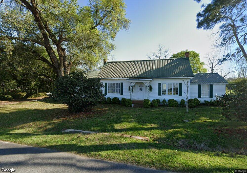
This home is located at 794 Joyner Rd, Cairo, GA 39828 and is currently estimated at $624,875, approximately $326 per square foot. 794 Joyner Rd is a home with nearby schools including Cairo High School.
Ownership History
Date
Name
Owned For
Owner Type
Purchase Details
Closed on
Oct 31, 2022
Sold by
Wood William Thomas
Bought by
Bennett Thomas Mathieu and Bennett Jessica Kate
Current Estimated Value
Purchase Details
Closed on
Nov 24, 2014
Sold by
Lundy W A Enterprises In
Bought by
Wood William Thomas
Purchase Details
Closed on
Sep 20, 2014
Sold by
W A Lundy Enterprises Inc
Bought by
Wood William Thomas
Purchase Details
Closed on
Jan 19, 1974
Bought by
Lundy W A Enterprises In
Create a Home Valuation Report for This Property
The Home Valuation Report is an in-depth analysis detailing your home's value as well as a comparison with similar homes in the area
Purchase History
| Date | Buyer | Sale Price | Title Company |
|---|---|---|---|
| Bennett Thomas Mathieu | -- | -- | |
| Wood William Thomas | -- | -- | |
| Wood William Thomas | -- | -- | |
| Lundy W A Enterprises In | -- | -- |
Source: Public Records
Tax History
| Year | Tax Paid | Tax Assessment Tax Assessment Total Assessment is a certain percentage of the fair market value that is determined by local assessors to be the total taxable value of land and additions on the property. | Land | Improvement |
|---|---|---|---|---|
| 2024 | $2,210 | $217,224 | $173,874 | $43,350 |
| 2023 | $1,326 | $83,523 | $71,143 | $12,380 |
| 2022 | $1,389 | $85,066 | $70,364 | $14,702 |
| 2021 | $1,368 | $85,066 | $70,364 | $14,702 |
| 2020 | $1,276 | $82,744 | $70,364 | $12,380 |
| 2019 | $1,252 | $82,744 | $70,364 | $12,380 |
| 2018 | $1,154 | $82,744 | $70,364 | $12,380 |
| 2017 | $1,078 | $82,744 | $70,364 | $12,380 |
| 2016 | $1,040 | $80,824 | $70,364 | $10,460 |
| 2015 | $951 | $80,824 | $70,364 | $10,460 |
| 2014 | -- | $80,824 | $70,364 | $10,460 |
| 2013 | -- | $85,510 | $75,875 | $9,635 |
Source: Public Records
Map
Nearby Homes
- 871 Joyner Rd
- 00, #11 Oak Bend Circle 4 33 Acres
- 433 Hall Rd
- 941 Joyner Rd
- 325-5 Hd Rd
- 325 Hd Rd
- 907 Joyner Rd
- #6 Oak Bend Subdivision
- Lot 11 Hall Rd
- L9 B1 Hall Rd
- #1 Oak Bend Subdivision
- 380 Hall Rd
- 1028 Joyner Rd
- 198 Oak Bend Dr
- #13 Oak Bend Subdivision
- #2 Oak Bend Subdivision
- 536 Joyner Rd
- 317 Hd Rd
- # 14 Oak Bend Subdivision
- 671 Hall Rd
Your Personal Tour Guide
Ask me questions while you tour the home.