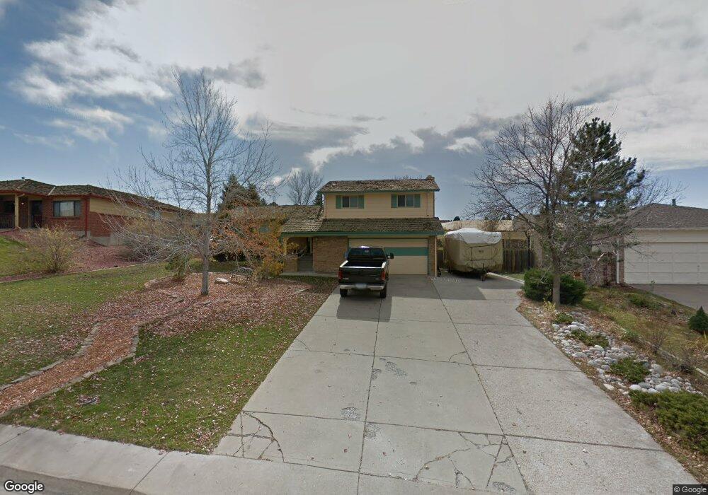
794 Mercury Cir Lone Tree, CO 80124
Estimated Value: $641,008 - $745,000
4
Beds
3
Baths
2,231
Sq Ft
$311/Sq Ft
Est. Value
About This Home
This home is located at 794 Mercury Cir, Lone Tree, CO 80124 and is currently estimated at $693,004, approximately $310 per square foot. 794 Mercury Cir is a home located in Douglas County with nearby schools including Acres Green Elementary School, Cresthill Middle School, and Highlands Ranch High School.
Ownership History
Date
Name
Owned For
Owner Type
Purchase Details
Closed on
Jun 27, 2022
Sold by
Stewart Iv Fred E and Stewart Karin R
Bought by
Wall Corey and Wall Janelle Irene
Current Estimated Value
Home Financials for this Owner
Home Financials are based on the most recent Mortgage that was taken out on this home.
Original Mortgage
$540,000
Outstanding Balance
$511,510
Interest Rate
5.25%
Mortgage Type
New Conventional
Estimated Equity
$181,494
Purchase Details
Closed on
Apr 5, 2021
Sold by
Stewart Fred E and Stewart Karin R
Bought by
Stewart Fred E and Stewart Karin R
Home Financials for this Owner
Home Financials are based on the most recent Mortgage that was taken out on this home.
Original Mortgage
$397,842
Interest Rate
3.05%
Mortgage Type
New Conventional
Purchase Details
Closed on
Jul 22, 2018
Sold by
Capper Benjamin H and Capper Kelsey
Bought by
Stewart Fred E and Stewart Karin R
Home Financials for this Owner
Home Financials are based on the most recent Mortgage that was taken out on this home.
Original Mortgage
$399,000
Interest Rate
4.6%
Mortgage Type
New Conventional
Purchase Details
Closed on
Sep 10, 2015
Sold by
Wolf Dwayne Alan
Bought by
Capper Benjamin H and Capper Kelsey
Home Financials for this Owner
Home Financials are based on the most recent Mortgage that was taken out on this home.
Original Mortgage
$319,900
Interest Rate
4.03%
Mortgage Type
New Conventional
Purchase Details
Closed on
Dec 3, 2004
Sold by
Wolf Barbara Kay
Bought by
Wolf Dwayne Alan
Purchase Details
Closed on
Feb 26, 1999
Sold by
Sondrol Daniel J and Sondrol Virginia L
Bought by
Wolf Dwayne A and Wolf Barbara K
Home Financials for this Owner
Home Financials are based on the most recent Mortgage that was taken out on this home.
Original Mortgage
$144,500
Interest Rate
6.73%
Purchase Details
Closed on
Dec 3, 1986
Sold by
Jacobs Richards P and Jacobs Christina E
Bought by
Lincoln Serv Corp
Purchase Details
Closed on
Sep 3, 1986
Sold by
Lincoln Serv Corp
Bought by
Us Dept Housing & Urban Dev
Purchase Details
Closed on
Jan 4, 1982
Sold by
G J Corporation
Bought by
Jacobs Richard P and Jacobs Christine E
Create a Home Valuation Report for This Property
The Home Valuation Report is an in-depth analysis detailing your home's value as well as a comparison with similar homes in the area
Home Values in the Area
Average Home Value in this Area
Purchase History
| Date | Buyer | Sale Price | Title Company |
|---|---|---|---|
| Wall Corey | $675,000 | None Listed On Document | |
| Stewart Fred E | -- | First Integrity Title | |
| Stewart Fred E | $420,000 | Fidelity National Title | |
| Capper Benjamin H | $349,900 | None Available | |
| Wolf Dwayne Alan | -- | -- | |
| Wolf Dwayne A | $174,500 | -- | |
| Lincoln Serv Corp | -- | -- | |
| Us Dept Housing & Urban Dev | -- | -- | |
| Jacobs Richard P | $83,000 | -- |
Source: Public Records
Mortgage History
| Date | Status | Borrower | Loan Amount |
|---|---|---|---|
| Open | Wall Corey | $540,000 | |
| Previous Owner | Stewart Fred E | $397,842 | |
| Previous Owner | Stewart Fred E | $399,000 | |
| Previous Owner | Capper Benjamin H | $319,900 | |
| Previous Owner | Wolf Dwayne A | $144,500 |
Source: Public Records
Tax History
| Year | Tax Paid | Tax Assessment Tax Assessment Total Assessment is a certain percentage of the fair market value that is determined by local assessors to be the total taxable value of land and additions on the property. | Land | Improvement |
|---|---|---|---|---|
| 2025 | $3,781 | $42,810 | $9,770 | $33,040 |
| 2024 | $3,781 | $44,890 | $10,740 | $34,150 |
| 2023 | $3,820 | $44,890 | $10,740 | $34,150 |
| 2022 | $2,912 | $32,700 | $9,120 | $23,580 |
| 2021 | $3,028 | $32,700 | $9,120 | $23,580 |
| 2020 | $2,919 | $32,290 | $9,490 | $22,800 |
| 2019 | $2,928 | $32,290 | $9,490 | $22,800 |
| 2018 | $2,286 | $27,000 | $8,120 | $18,880 |
| 2017 | $2,324 | $27,000 | $8,120 | $18,880 |
| 2016 | $1,897 | $21,590 | $6,260 | $15,330 |
| 2015 | $1,940 | $21,590 | $6,260 | $15,330 |
| 2014 | $1,761 | $18,350 | $4,780 | $13,570 |
Source: Public Records
Map
Nearby Homes
- 789 Mercury Cir
- 13226 Canopus Dr
- 6945 Mountain Brush Cir
- 9314 Wiltshire Dr
- 8852 Chestnut Hill Ln
- 8049 Sweet Water Rd
- 7191 Palisade Dr
- 7057 Chestnut Hill St
- 8159 Lodgepole Trail
- 6823 Edgewood Place
- 9466 Wiltshire Dr
- 9377 Newport Ln
- 9320 Miles Dr
- 7459 La Quinta Place
- 9390 Yale Ln
- 9631 Kemper Dr
- 9395 Princeton Cir
- 8666 Ainsdale Ct Unit 12B
- 181 Dianna Dr
- 9366 Cornell Cir
- 798 Mercury Cir
- 788 Mercury Cir
- 784 Mercury Cir
- 804 Mercury Cir
- 795 Mercury Cir
- 778 Mercury Cir
- 799 Mercury Cir
- 808 Mercury Cir
- 785 Mercury Cir
- 805 Mercury Cir
- 779 Mercury Cir
- 868 Hamal Dr
- 878 Hamal Dr
- 774 Mercury Cir
- 848 Hamal Dr
- 814 Mercury Cir
- 898 Hamal Dr
- 809 Mercury Cir
- 775 Mercury Cir
- 838 Hamal Dr
Your Personal Tour Guide
Ask me questions while you tour the home.