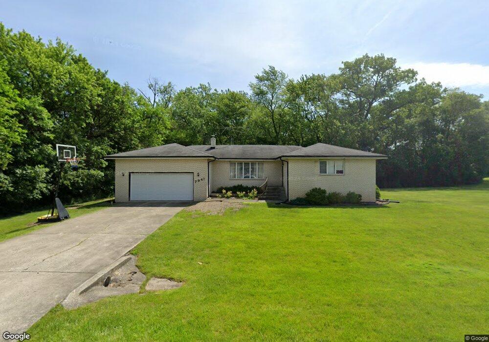
7941 Hawthorne St Dyer, IN 46311
Hartsdale NeighborhoodEstimated Value: $249,000 - $322,000
3
Beds
2
Baths
1,708
Sq Ft
$175/Sq Ft
Est. Value
About This Home
This home is located at 7941 Hawthorne St, Dyer, IN 46311 and is currently estimated at $299,387, approximately $175 per square foot. 7941 Hawthorne St is a home located in Lake County with nearby schools including James H. Watson Elementary School, Michael Grimmer Middle School, and Lake Central High School.
Ownership History
Date
Name
Owned For
Owner Type
Purchase Details
Closed on
Jun 26, 2023
Sold by
Zajac Mark
Bought by
Gorman Matthew C
Current Estimated Value
Home Financials for this Owner
Home Financials are based on the most recent Mortgage that was taken out on this home.
Original Mortgage
$144,000
Outstanding Balance
$140,302
Interest Rate
6.39%
Mortgage Type
Construction
Estimated Equity
$159,085
Purchase Details
Closed on
Jun 22, 2023
Sold by
Zajac Mark
Bought by
Gorman Matthew C
Home Financials for this Owner
Home Financials are based on the most recent Mortgage that was taken out on this home.
Original Mortgage
$144,000
Outstanding Balance
$140,302
Interest Rate
6.39%
Mortgage Type
Construction
Estimated Equity
$159,085
Create a Home Valuation Report for This Property
The Home Valuation Report is an in-depth analysis detailing your home's value as well as a comparison with similar homes in the area
Home Values in the Area
Average Home Value in this Area
Purchase History
| Date | Buyer | Sale Price | Title Company |
|---|---|---|---|
| Gorman Matthew C | $180,000 | None Listed On Document | |
| Gorman Matthew C | -- | None Listed On Document |
Source: Public Records
Mortgage History
| Date | Status | Borrower | Loan Amount |
|---|---|---|---|
| Open | Gorman Matthew C | $144,000 | |
| Closed | Gorman Matthew C | $144,000 |
Source: Public Records
Tax History Compared to Growth
Tax History
| Year | Tax Paid | Tax Assessment Tax Assessment Total Assessment is a certain percentage of the fair market value that is determined by local assessors to be the total taxable value of land and additions on the property. | Land | Improvement |
|---|---|---|---|---|
| 2024 | $3,904 | $214,100 | $64,600 | $149,500 |
| 2023 | $1,623 | $236,400 | $91,900 | $144,500 |
| 2022 | $1,733 | $225,400 | $91,900 | $133,500 |
| 2021 | $1,573 | $213,800 | $91,900 | $121,900 |
| 2020 | $1,615 | $213,700 | $68,800 | $144,900 |
| 2019 | $1,785 | $209,300 | $45,900 | $163,400 |
| 2018 | $1,749 | $204,700 | $45,900 | $158,800 |
| 2017 | $1,772 | $217,600 | $45,900 | $171,700 |
| 2016 | $1,706 | $214,700 | $44,100 | $170,600 |
| 2014 | $1,508 | $207,200 | $44,100 | $163,100 |
| 2013 | $1,459 | $201,400 | $44,100 | $157,300 |
Source: Public Records
Map
Nearby Homes
- 2530 Bennington Ave
- 8043 Northcote Ct
- 2438 Braeburn Place
- 8066 Northcote Ct
- 11433 Jonathan Dr
- 11435 Mcintosh Ln
- 8185 Hawthorne Dr
- 11825 Heron Lake Rd
- 8262 Heron Lake Rd
- 1444 Madelene Grace Ct
- 2213 June Dr
- 1442 Rhett Ct
- 11024 Lake Central Dr
- 716 Moraine Trace Unit 3
- 506 Concord Place
- 8607 Kelly Dr
- 2557 Howard Castle Dr
- 431 Hilbrich Dr
- 8269 Alexander St
- 12080 Wildwood Dr
- 7940 Hawthorne St
- 7946 Hawthorne St
- 7950 Hawthorne St
- 11840 79th Place
- 11804 79th Place
- 1131 Bemis Heights Ave
- 1125 Bemis Heights Ave
- 1137 Bemis Heights Ave
- 1143 Bemis Heights Ave
- 1119 Bemis Heights Ave
- 11800 79th Place
- 11905 79th Place
- 1149 Bemis Heights Ave
- 12000 79th Place
- 11813 79th Place
- 11809 79th Place
- 2541 Bennington Ave
- 11704 79th Place
- 1203 Bemis Heights Ave
- 11909 79th Place