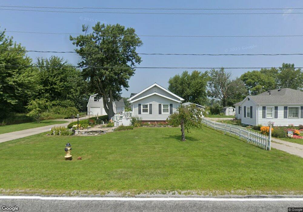
7947 Cedar Point Rd Oregon, OH 43616
Estimated Value: $209,535 - $291,000
2
Beds
2
Baths
1,444
Sq Ft
$171/Sq Ft
Est. Value
About This Home
This home is located at 7947 Cedar Point Rd, Oregon, OH 43616 and is currently estimated at $246,384, approximately $170 per square foot. 7947 Cedar Point Rd is a home located in Lucas County.
Ownership History
Date
Name
Owned For
Owner Type
Purchase Details
Closed on
Aug 7, 2015
Sold by
Murray James R and Oedy Patricia A
Bought by
Murray James R and Murray Patricia A Oedy
Current Estimated Value
Purchase Details
Closed on
Jun 11, 1996
Sold by
Hamilton Kathleen M
Bought by
Oedy Patricia A and Murray James R
Home Financials for this Owner
Home Financials are based on the most recent Mortgage that was taken out on this home.
Original Mortgage
$45,000
Interest Rate
7.97%
Mortgage Type
New Conventional
Purchase Details
Closed on
Jul 27, 1992
Sold by
Smith Charles R and Smith Laura J
Create a Home Valuation Report for This Property
The Home Valuation Report is an in-depth analysis detailing your home's value as well as a comparison with similar homes in the area
Purchase History
| Date | Buyer | Sale Price | Title Company |
|---|---|---|---|
| Murray James R | -- | None Available | |
| Oedy Patricia A | $60,000 | -- | |
| -- | $70,000 | -- |
Source: Public Records
Mortgage History
| Date | Status | Borrower | Loan Amount |
|---|---|---|---|
| Closed | Oedy Patricia A | $45,000 |
Source: Public Records
Tax History
| Year | Tax Paid | Tax Assessment Tax Assessment Total Assessment is a certain percentage of the fair market value that is determined by local assessors to be the total taxable value of land and additions on the property. | Land | Improvement |
|---|---|---|---|---|
| 2025 | -- | $79,870 | $13,475 | $66,395 |
| 2024 | $2,165 | $79,870 | $13,475 | $66,395 |
| 2023 | $3,588 | $54,565 | $3,850 | $50,715 |
| 2022 | $3,578 | $54,565 | $3,850 | $50,715 |
| 2021 | $3,598 | $54,565 | $3,850 | $50,715 |
| 2020 | $3,225 | $44,835 | $3,220 | $41,615 |
| 2019 | $3,076 | $44,835 | $3,220 | $41,615 |
| 2018 | $3,064 | $44,835 | $3,220 | $41,615 |
| 2017 | $2,852 | $39,270 | $980 | $38,290 |
| 2016 | $2,819 | $112,200 | $2,800 | $109,400 |
| 2015 | $2,802 | $112,200 | $2,800 | $109,400 |
| 2014 | $2,605 | $39,270 | $980 | $38,290 |
| 2013 | $2,605 | $39,270 | $980 | $38,290 |
Source: Public Records
Map
Nearby Homes
- 8246 Cedar Point Rd
- 1031 N Cousino Rd
- 9015 Seaman Rd
- 6028 Bayshore Rd
- 1944 Ashcroft Dr
- 7330 Jerusalem Rd
- 5914 Kacy Ln
- 5882 Kacy Ln
- 1561 N Stadium Rd
- 455 Cody
- 454 Cody Dr
- 5560 Eagles Landing Dr
- 5524 Eagles Landing Dr
- 5281 Eagles Landing Dr
- 5313 Eagles Landing Dr
- 5548 Eagles Landing Dr
- 5514 Eagles Landing Dr
- 5415 Seaman Rd
- 2046 Duchesse Dr
- 1536 N Wynn Rd
- 7951 Cedar Point Rd
- 8013 Cedar Point Rd
- 7910 Cedar Point Rd
- 8020 Cedar Point Rd
- 8056 Cedar Point Rd
- 7832 Cedar Point Rd
- 7816 Cedar Point Rd
- 8110 Cedar Point Rd
- 7812 Cedar Point Rd
- 1039 N Cousino Rd
- 1055 N Cousino Rd
- 1105 N Cousino Rd
- 7760 Cedar Point Rd
- 7731 Cedar Point Rd
- 1121 N Cousino Rd
- 8131 Cedar Point Rd
- 8128 Cedar Point Rd
- 7740 Cedar Point Rd
- 7701 Cedar Point Rd
- 8205 Cedar Point Rd
Your Personal Tour Guide
Ask me questions while you tour the home.