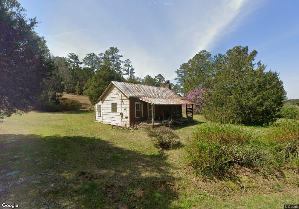
795 Lee Rd Cedartown, GA 30125
Estimated Value: $281,000 - $483,380
2
Beds
--
Bath
782
Sq Ft
$462/Sq Ft
Est. Value
About This Home
This home is located at 795 Lee Rd, Cedartown, GA 30125 and is currently estimated at $361,127, approximately $461 per square foot. 795 Lee Rd is a home located in Polk County.
Ownership History
Date
Name
Owned For
Owner Type
Purchase Details
Closed on
Sep 30, 2024
Sold by
Crawford Ronnie
Bought by
Crawford Jimmy Ray
Current Estimated Value
Purchase Details
Closed on
Sep 26, 2023
Sold by
Crawford William
Bought by
Crawford Ronnie and Crawford William Terry
Purchase Details
Closed on
Jan 19, 2018
Sold by
Crawford Johnny Ray
Bought by
Crawford Jimmy Ray
Purchase Details
Closed on
Oct 20, 2017
Sold by
Crawford Ollie Ray
Bought by
Crawford Johnny Ray and Crawford Jimmy Ray
Purchase Details
Closed on
Jun 7, 2010
Sold by
Crawford Freddie
Bought by
Crawford Johnny Ray
Purchase Details
Closed on
Jun 10, 1957
Bought by
Crawford Freddie
Create a Home Valuation Report for This Property
The Home Valuation Report is an in-depth analysis detailing your home's value as well as a comparison with similar homes in the area
Home Values in the Area
Average Home Value in this Area
Purchase History
| Date | Buyer | Sale Price | Title Company |
|---|---|---|---|
| Crawford Jimmy Ray | -- | -- | |
| Crawford Jimmy Ray | $90,000 | -- | |
| Crawford Ronnie | -- | -- | |
| Crawford Jimmy Ray | $42,000 | -- | |
| Crawford Johnny Ray | -- | -- | |
| Crawford Johnny Ray | -- | -- | |
| Crawford Freddie | -- | -- |
Source: Public Records
Tax History Compared to Growth
Tax History
| Year | Tax Paid | Tax Assessment Tax Assessment Total Assessment is a certain percentage of the fair market value that is determined by local assessors to be the total taxable value of land and additions on the property. | Land | Improvement |
|---|---|---|---|---|
| 2024 | $1,449 | $69,298 | $63,012 | $6,286 |
| 2023 | $1,597 | $67,294 | $63,012 | $4,282 |
| 2022 | $1,393 | $58,695 | $54,917 | $3,778 |
| 2021 | $1,411 | $58,695 | $54,917 | $3,778 |
| 2020 | $1,414 | $58,695 | $54,917 | $3,778 |
| 2019 | $1,595 | $59,384 | $54,964 | $4,420 |
| 2018 | $1,266 | $59,280 | $54,964 | $4,316 |
| 2017 | $1,246 | $59,280 | $54,964 | $4,316 |
| 2016 | $1,520 | $69,340 | $65,024 | $4,316 |
| 2015 | $1,527 | $69,436 | $65,024 | $4,412 |
| 2014 | $1,538 | $69,436 | $65,024 | $4,412 |
Source: Public Records
Map
Nearby Homes
- 176 Runyon Loop
- 0 Runyon Loop Unit 10606366
- 0 Runyon Loop Unit 7650113
- 1838 Antioch Rd
- 1912 Hightower Rd
- 160 Tate Rd
- 0 Everett Mtn Rd
- 0 Hightower Rd Unit 10584768
- 0 Hightower Rd Unit 7633002
- 0 Hightower Rd Unit 10584778
- 0 Hightower Rd Unit 7632982
- 4267 Buchanan Hwy
- 0 Youngs Farm Rd Unit 24829378
- 0 Buchanan Hwy Unit 10558945
- 102 acres Youngs Farm Rd
- 4550 Buchanan Hwy
- 258 Rainey Lake Rd
- 296 Winkle Rd
- 45 York Cir
- 0 Mckibben Rd Unit 7665027
- 732 Lee Rd
- 746 Wood Fall Rd
- 759 Wood Fall Rd
- 779 Wood Fall Rd
- 781 Wood Fall Rd
- 73 Fite Rd
- 220 Fite Rd
- 0A Fite Rd
- 791 Wood Fall Rd
- 454 Wood Fall Rd
- 290 Fite Rd
- 182 Fite Rd
- 142 Fite Rd
- 824 Wood Fall Rd
- 848 Wood Fall Rd
- 0 Fite Rd Unit 10202577
- 0 Fite Rd Unit 7274994
- 0 Fite Rd Unit 20054859
- 0 Fite Rd Unit 7292310
- 505 Wood Fall Rd