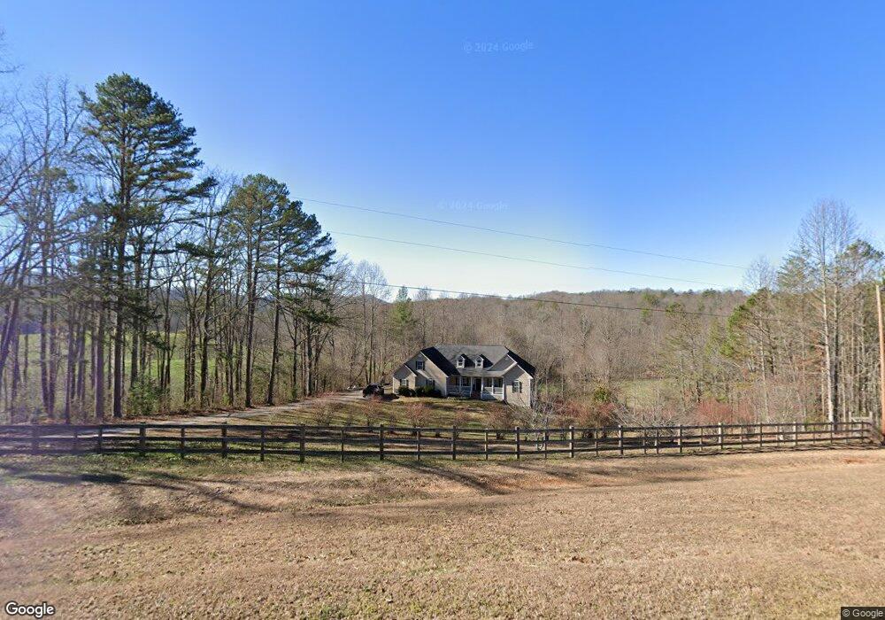
795 Lower Trackrock Rd Blairsville, GA 30512
Estimated Value: $602,000 - $646,000
4
Beds
3
Baths
2,667
Sq Ft
$235/Sq Ft
Est. Value
About This Home
This home is located at 795 Lower Trackrock Rd, Blairsville, GA 30512 and is currently estimated at $625,611, approximately $234 per square foot. 795 Lower Trackrock Rd is a home located in Union County with nearby schools including Union County Primary School, Union County Elementary School, and Union County Middle School.
Ownership History
Date
Name
Owned For
Owner Type
Purchase Details
Closed on
May 19, 2009
Sold by
Assad Stephany Garrett and Kay Stefany G
Bought by
Kay Stefany G
Current Estimated Value
Home Financials for this Owner
Home Financials are based on the most recent Mortgage that was taken out on this home.
Original Mortgage
$227,000
Outstanding Balance
$143,037
Interest Rate
4.8%
Mortgage Type
New Conventional
Estimated Equity
$482,574
Create a Home Valuation Report for This Property
The Home Valuation Report is an in-depth analysis detailing your home's value as well as a comparison with similar homes in the area
Home Values in the Area
Average Home Value in this Area
Purchase History
| Date | Buyer | Sale Price | Title Company |
|---|---|---|---|
| Kay Stefany G | -- | -- |
Source: Public Records
Mortgage History
| Date | Status | Borrower | Loan Amount |
|---|---|---|---|
| Open | Kay Stefany G | $227,000 |
Source: Public Records
Tax History Compared to Growth
Tax History
| Year | Tax Paid | Tax Assessment Tax Assessment Total Assessment is a certain percentage of the fair market value that is determined by local assessors to be the total taxable value of land and additions on the property. | Land | Improvement |
|---|---|---|---|---|
| 2024 | $2,937 | $248,680 | $25,320 | $223,360 |
| 2023 | $3,227 | $242,400 | $25,320 | $217,080 |
| 2022 | $2,517 | $189,040 | $23,440 | $165,600 |
| 2021 | $2,409 | $152,840 | $23,440 | $129,400 |
| 2020 | $2,032 | $107,418 | $19,397 | $88,021 |
| 2019 | $1,921 | $107,418 | $19,397 | $88,021 |
| 2018 | $1,887 | $107,418 | $19,397 | $88,021 |
| 2017 | $1,887 | $107,418 | $19,397 | $88,021 |
| 2016 | $1,888 | $107,418 | $19,397 | $88,021 |
| 2015 | $1,904 | $107,418 | $19,397 | $88,021 |
| 2013 | -- | $107,417 | $19,396 | $88,020 |
Source: Public Records
Map
Nearby Homes
- 33 Frontier Way Unit 13
- 33 Frontier Way
- Lot 13 Wilderness Ridge Sub
- 206 Timbergate Trail
- 160 Largen Rd
- L2&3 Crab Apple Rd
- 192 Misty Morning Dr
- 275 Everetts View
- 74 Timber Ln
- 75 Cloud Springs Ln
- 397 Everetts View
- 33 Dover Rd
- LL321 Turkey Trot
- 77 Alpine Way
- 0 Trackrock Gap Rd Unit 419584
- 0 Trackrock Gap Rd Unit 10554661
- 0 Trackrock Gap Rd Unit 412780
- 208 Rich Dr
- 16 Misty Mountain Ln
- 271 Burnt Ridge Rd
- 0 Lower Trackrock Rd Unit 8579995
- 0 Lower Trackrock Rd
- 850 Lower Trackrock Rd
- 926 Lower Trackrock Rd
- 36 Lee Way
- 36 Lee Way
- 250 Caylee Anne Dr
- LOT 3 Caylee Anne Dr
- 275 Caylee Anne Dr
- 646 Lower Trackrock Rd
- 82 Lee Way
- 0 Caylee Anne Dr Unit 20028781
- 136* Caylee Anne Dr
- Lot 16 Caylee Anne Dr
- 0 Caylee Anne Dr Unit 314751
- 0 Caylee Anne Dr Unit 8649404
- 0 Caylee Anne Dr Unit LOT 13 9043029
- Lot 13 Caylee Anne Dr Unit 13
- 3 Caylee Anne Dr
- 12 Caylee Anne Dr